Floodplains by Design—a collaborative and community driven approach for reimagining floodplains—is being used as a model for flood prevention and management across the U.S. and internationally, creating floodplains that work for people and nature

Earth Day was born out of a movement to improve the lives of people and nature, inspiring sweeping legislative action and investments. Today, federal infrastructure funding and WA Climate Commitment Act are a continuation of this movement, investments making a tangible impact locally. As an example, Washington’s historic funding of the Floodplains by Design program is contributing to nature-based floodplain management across the state to reduce flood risk, protect communities and protect salmon habitat. These state and federal dollars are just the start of local climate action that will improve the daily lives and the future of all Washingtonians.
Meet DeAnne Hamilton: Learn how the general manager of Tacoma’s KBTC Public Television and TNC in Washington trustee, uses the power of storytelling to engage people in conservation and create a better future for the next generation.
Nestled in the cliffs in Moses Coulee is an import desert water sources that every springs attracts thousands of Pacific Tree frogs. I came to Whisper Lake for a night concert. It was anything but quiet. The chorus of frogs was soothing, calming—the quintessential sound of spring.
The Cle Elum Wildlife Project is improving our understanding of how wildlife use and move through protected forest landscapes, providing us with an opportunity to test how forest management practices impact wildlife and building an evidence base for permanent protection.
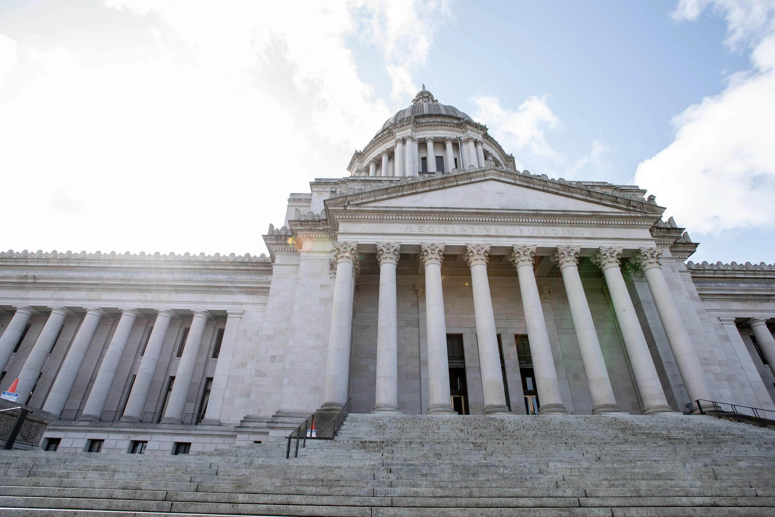
The 2023 Legislative Session in Olympia saw some major achievements for nature and people: investments in improving air quality, natural climate solutions, curbing greenhouse gas emissions, and better long-term resiliency planning. A big thanks to our staff who dedicated their efforts to our priorities.
They knew it was a long shot.
Yet Washington tribes, agricultural interests, environmental groups and local governments showed up in the state Capitol and spoke with one voice: The state, they told legislators, should invest $33 million to meet the needs of this diverse set of stakeholders. Their interests may vary, they noted, but they are connected by the floodplain where they live and work. Investing in a novel approach to collaboratively manage floodplains could protect communities and farms from flooding, sustain endangered salmon runs and create appealing places for people to enjoy the outdoors.
Lawmakers listened. In fact, they liked the idea so much that they allocated $44 million, a third more than requested. That 2013 funding launched the first suite of Floodplains by Design projects.
“We had all these different interests asking for the same thing,” said Bob Carey, The Nature Conservancy’s director of strategic partnerships. “That’s unique, and it opened some eyes. And getting more funds from the legislature than we requested? It’s unheard of!”
Since then, Floodplains by Design has won an additional $121 million in state funding for projects that have protected 38 communities and hundreds of residences, conserved 500 acres of farmland, and improved habitat for shellfish and salmon, among other benefits.
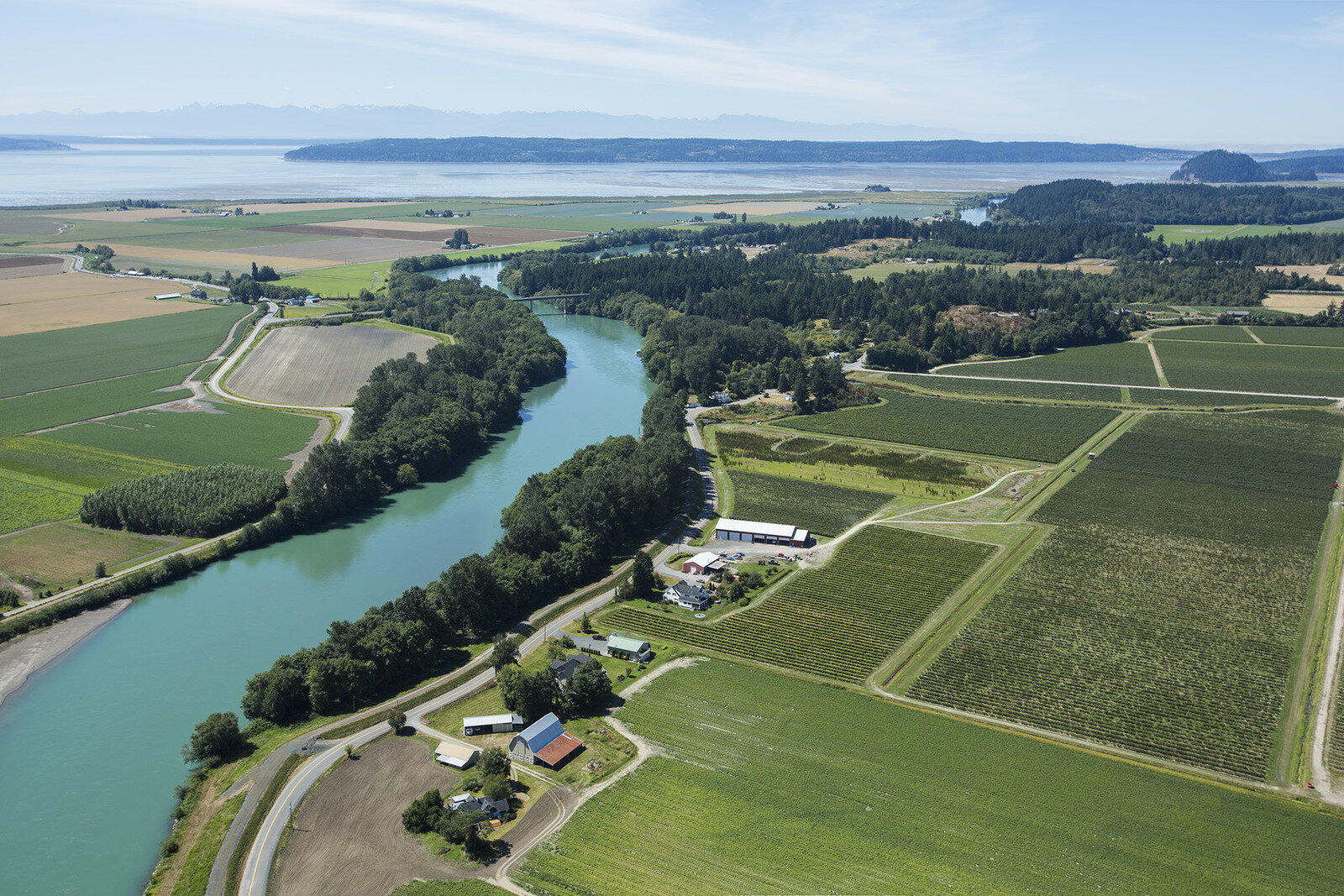
Aerial view of the Skagit River Delta where restoration projects have included Fisher Slough, Livingston Bay, and Fir Island Farm. Photo by Marlin Greene/One Earth Images.
“The way we manage our rivers has implications for farmers, tribes, conservationists, residents and civic leaders,” said Laura Blackmore, executive director of Puget Sound Partnership. “Floodplains by Design brings these interests together in a sophisticated and holistic approach that produces better outcomes for people and nature.”
That partnership-driven approach has become increasingly critical to the Conservancy’s success as we’ve scaled up our ambitions over 60 years. From our scrappy beginnings preserving important but often isolated parcels of land, we’ve evolved to focus on restoring healthy ecosystems that sustain both wildlife and human well-being. Today, we have set our sights on conservation throughout the Puget Sound watershed, from its robust floodplains to vibrant cities. But we can’t achieve results on that scale on our own, or even by working only with other conservation interests.
In much of our work, this calls for creative collaborations:
“We learn as we pioneer new approaches. Then we find the path of least resistance and greatest impact,” said Jessie Israel, our WA director of Puget Sound conservation. “The power of our partnerships fuels this innovation, and collaboration is the key to a healthy, thriving Puget Sound.”
Conservation through Collaboration
One of the very first Floodplains by Design projects demonstrates how communities rally around projects with multiple benefits for people and nature.
In the fall of 2014, the city of Orting had just set back its levees on the Puyallup River when the largest flood in decades hit. Only a few years earlier, another large flood had forced one the largest evacuations in state history. This time, the river had enough room to spread out and absorb the downpour. The town was spared.
“The benefits to people are obvious and immediate: safety, community well-being, economic security,” Orting Mayor Joachim Pestinger wrote in a 2015 op-ed in the Seattle Times.

Flooding risk is growing throughout Western Washington. This photo is from a 2015 flood in Snoqualmie, WA. Photo by The Nature Conservancy.
“Salmon also are taking advantage of their new 101 acres of habitat,” he wrote. “The wider channel provides opportunities for the river to meander and create complex habitat, with refuge for juvenile salmon in channels with lower velocity during peak flows. Birds and other animals enjoy the new wetlands, and people are taking advantage of new trails. While this project may not remove the risk of all future flooding, it is vastly improving our quality of life.”
That early success has blossomed into a much larger collaborative effort along the Puyallup River. This offshoot, called Floodplains for the Future, is a coalition of the county, cities, tribes, agricultural and environmental interests that are now implementing dozens of projects up and down the river corridor.
Being at the same table has allowed these groups to find common ground. A proposed flood mitigation project by the city of Sumner, for example, had been stymied because the Muckleshoot and Puyallup Tribes did not see their perspectives represented in the plan.
“City leaders pivoted... and sat down with tribes and others and figured out how they could address the very serious flood risks in ways tribes could support,” Carey said. “Now it’s a much more ambitious, multi-benefit project that people are excited about.” The project is underway, supported through Floodplains by Design funds.
This collaborative approach is much different — and harder — than what usually occurs, Carey said. Traditionally, groups have developed plans focused on a single purpose, for example, restoring salmon habitat. “But then when you go to implement,” Carey said, “the people affected by that project are like, ‘Wait, wait, wait; that’s not what I want to see there.’”

Floodplains by Design projects improve salmon habitat while also protecting Tribal and agricultural lands from floods. Photo by BLM.
That’s why successful ecosystem management requires “building trust and respect, and really listening to folks to understand what their needs are,” Carey said. “And then embracing those needs in the plan that you craft—in partnership with the other interests at the table.” While it may be harder to develop a plan that multiple interests support, collaboration can ultimately facilitate implementation while generating a much higher return on investment.
Today, Floodplains by Design has become a model for floodplain management around the world. With climate change driving increased flooding, innovative approaches like this are increasingly important. Carey and his colleagues have presented to Conservancy chapters and floodplain managers around the U.S., and in Canada, China and New Zealand. The language of multi-benefit solutions pioneered by the program now infuses conversations among floodplain managers, conservation organizations and state and federal agencies, Carey said.
Nature in an Urban Landscape
To have an impact on the scale of Puget Sound, we had to invest not only in its tributaries, but in the cities and towns that surround this iconic water body. Drawing on Floodplains by Design’s lessons in collaboration across sectors, we launched our Cities program in 2016.
"A thriving Puget Sound requires successes at the street and neighborhood level,” said Chris Hilton, the Conservancy’s urban partnerships director. “And it also requires the regional vision that the Conservancy brings, the ability to identify common problems and help communities generate solutions.”

A rain garden under the Aurora Bridge in Seattle’s Fremont neighborhood, where polluted stormwater will be naturally filtered before flowing into Lake Union. Photo by Hannah Letinich.
Our Cities program engages communities to make the Puget Sound’s urban landscapes more livable and climate resilient. In particular, our focus on stormwater pollution implements bioswales and raingardens to filter toxic runoff from busy streets and highways. As climate change increases rainfall in Puget Sound, the stormwater challenge is becoming increasingly urgent. Through a lens of equity and environmental justice, we also partner with local organizations to enhance the urban tree canopy, build rain gardens to purify polluted stormwater and increase access to nature in underserved neighborhoods.
Diverse interests, working together, have shown what’s possible.
In 2017, developer Mark Grey of Stephen C. Grey & Associates wanted to know how his project at the base of Seattle’s Aurora Bridge could help endangered salmon by filtering the toxic water running off the bridge and directly into Lake Union.
The bridge runoff “looked like a cup of coffee that’s been sitting around for five days, dark and sludgy,” Hilton said. Testing showed high levels of zinc, copper, lead and other pollutants that contribute to the decline of endangered salmon, orca and other wildlife.
The Conservancy collaborated with Grey, other nonprofits including Clean Lake Union and Salmon Safe, and state and local agencies to navigate a complex permitting process for swales and rain gardens that will eventually capture and clean more than 2 million gallons of bridge runoff annually.
Today, water flowing through first phase of the project, completed in 2018, is nearly clear, and pollutants have been reduced to safe levels. People living and working in the densely populated neighborhood can also enjoy the added green space, which helps boost activity levels and reduce stress. More gardens along the Burke Gilman trail will be complete in June, thanks in part to an additional $500,000 in state funding we helped secure.
In South Puget Sound, another project is not only cleaning stormwater runoff but also providing nutritious food and a connection to home.
In 2017, we began a partnership with World Relief Seattle to transform an unused church parking lot in Kent into a food garden where immigrants and refugees now grow produce that isn’t always accessible in their new surroundings. Cisterns provide most of the irrigation water, and rain gardens collect the remaining stormwater running off the hillside.
“The Kent Hillside Parking Plots projects demonstrates the value of community-led decision making and projects with multiple benefits for communities. The project is both a fantastic example of using nature to clean water, and it meets a true need identified and led by community.
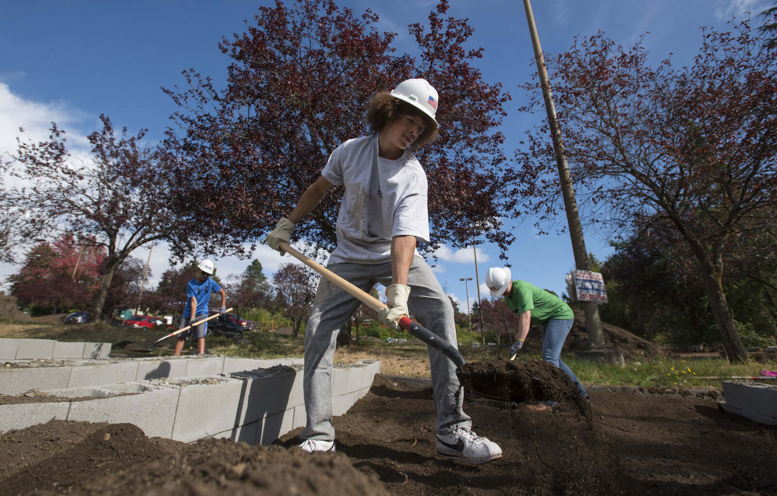
Volunteers came out to build a community garden in Kent, Washington. Photo by Hannah Letinich.
Moving Forward, Together
Looking ahead, our state faces enormous challenges from climate change. We are all facing this crisis together and, without strong interventions, the health of our forests and waters will continue to decline, and with them, human health and well-being.
Whether in cities, forests or floodplains, the Conservancy’s partnerships are making landscapes more climate resilient and helping communities mitigate changes that are already apparent, such as more intense wildfires and floods.
We’re also helping to build and sustain one of the largest and most diverse advocacy coalitions in state history. Through the 2018 ballot Initiative 1631 to boldy advance climate policy, we helped welcome many voices to the table. An inclusive approach is shifting the dialog around climate change, and environmental equity and social justice must be part of broad-scale solutions. Our combined voices created a powerful force that is here to stay.
Only diverse interests working together can achieve the large-scale change needed. With 60 years of practice building coalitions, the Conservancy is ready to lead in the fight for a sustainable future, says State Director Mike Stevens.
“There’s a lot of value in the Conservancy’s history of bringing different kinds of people together to work on common-sense solutions,” Stevens said. “We are in a position to work across political differences, across geographic differences, to build coalitions and generate solutions.”
Banner photo by Jeff Marsh.
Washington state’s innovative Floodplains by Design program is leading the way toward holistic river and floodplain management, bringing together all the benefits of investing in river restoration: communities protected from flooding, thriving farms, habitat for salmon and other wildlife, clean water, and recreational opportunities.
While constructed infrastructure—like dams, levees, seawalls, and breakwaters—will always play an important role, these approaches alone are no longer sufficient for a world where flood and storm events are becoming more frequent, extreme and costly. Plus, when flood control facilities fail – and they do – they fail big, often leading to catastrophic damages. Instead of working against nature, we must look to it as an essential partner in building resiliency for our communities and economies.
Just one acre of wetlands can hold about 1 million gallons of water—more than an Olympic-size swimming pool—reducing impacts on communities during floods. And for every $1 spent on restoring wetlands, more than $7 in direct flood-reduction benefit is achieved.
By Jenny Baker, Senior Restoration Manager
Photos by Jeanette Dorner; Alison Hart, Washington department of Fish and Wildlife
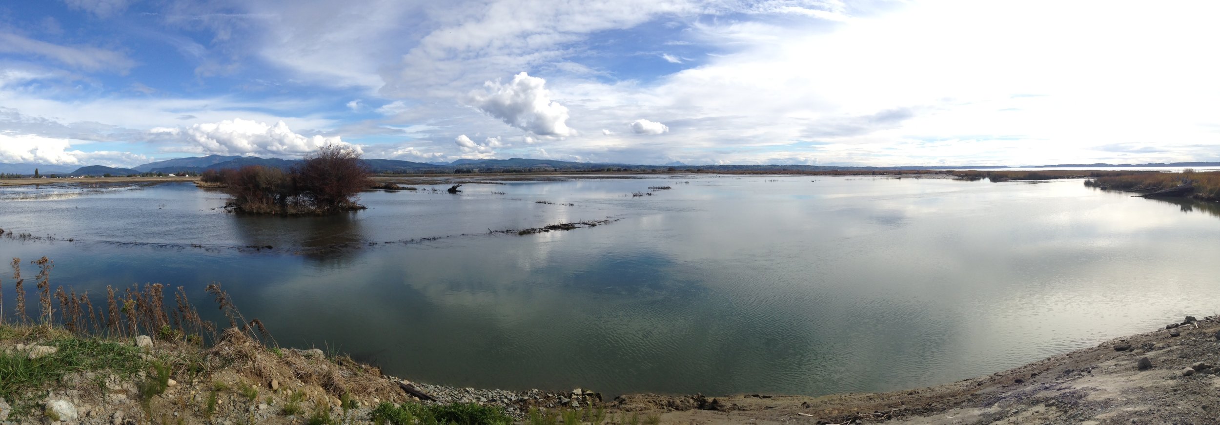
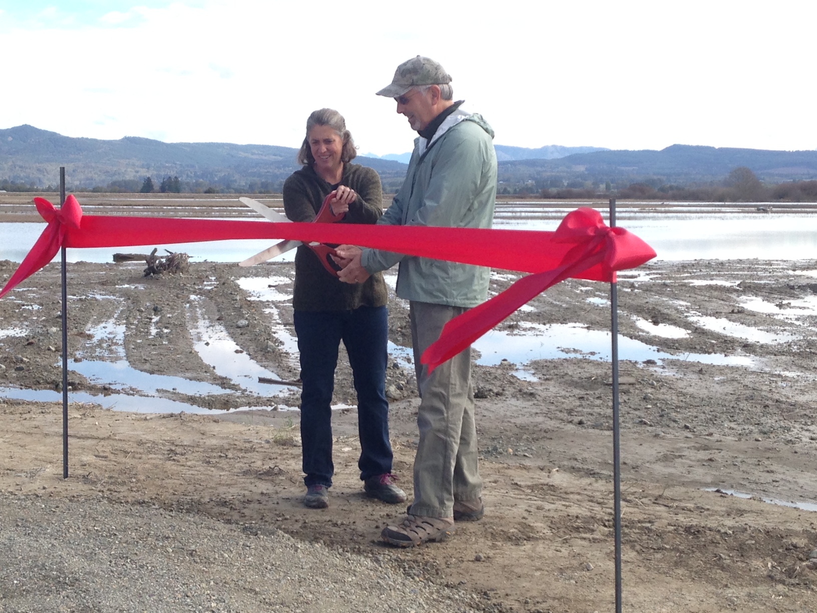
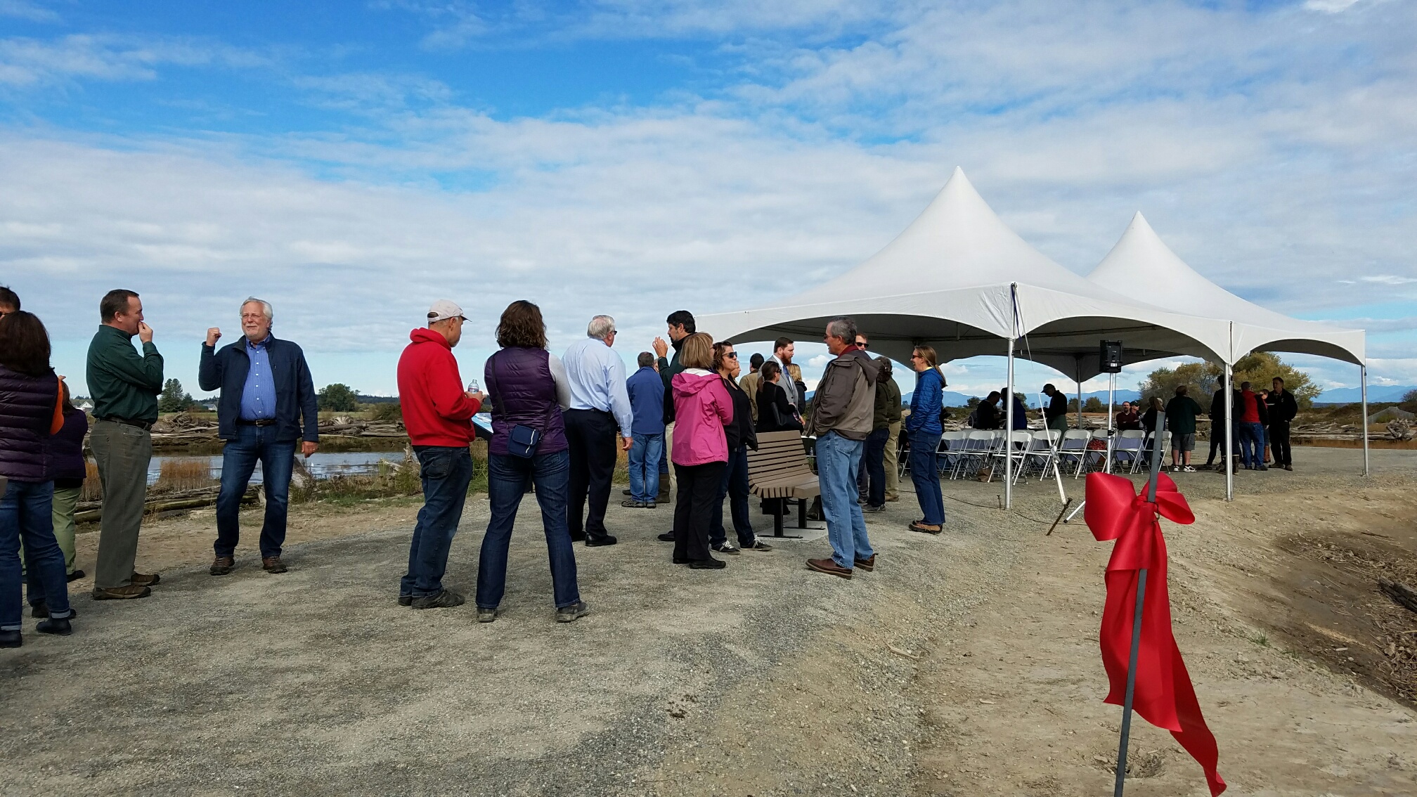
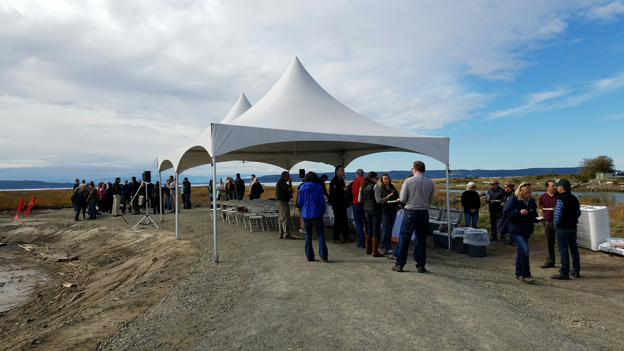
The Fir Island Farm ribbon cutting was a wonderful event celebrating project completion with the large community of folks who have helped usher the project to the finish line over the last seven years.
This 131-acre project restores habitat for salmon, improves flood protection and drainage infrastructure for agriculture and provides public access at the intersection between the fertile farms of Fir Island and the salty marsh beyond.
See the breaching of the dike that let the tide back in after 100 years.
A new dike keeps neighboring farmland dry, while we still make room for thousands of juvenile salmon. Read more about the project here.
Floodplains by Design—a collaborative and community driven approach for reimagining floodplains—is being used as a model for flood prevention and management across the U.S. and internationally, creating floodplains that work for people and nature
Indigenous leadership in Washington and Canada are drawing from the lessons learned by Floodplains by Design to mitigate severe flooding events seen in the Fraser River.
Legislators in the state Senate must pass HB 1099 in order for Washington to build a climate resilient future and drastically reduce our carbon footprint that’s exacerbating the climate crisis.
Washington state’s innovative Floodplains by Design program is leading the way toward holistic river and floodplain management, bringing together all the benefits of investing in river restoration: communities protected from flooding, thriving farms, habitat for salmon and other wildlife, clean water, and recreational opportunities.
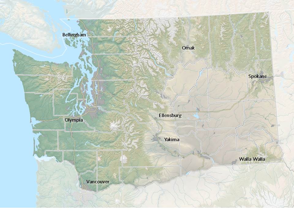
Explore maps that show how fluid rivers in Washington state have been over time.
How do we solve big flood events? By listening and learning from each other.
In the Pacific Northwest, every major flood has been associated with an atmospheric river event. What exactly is an atmospheric river?
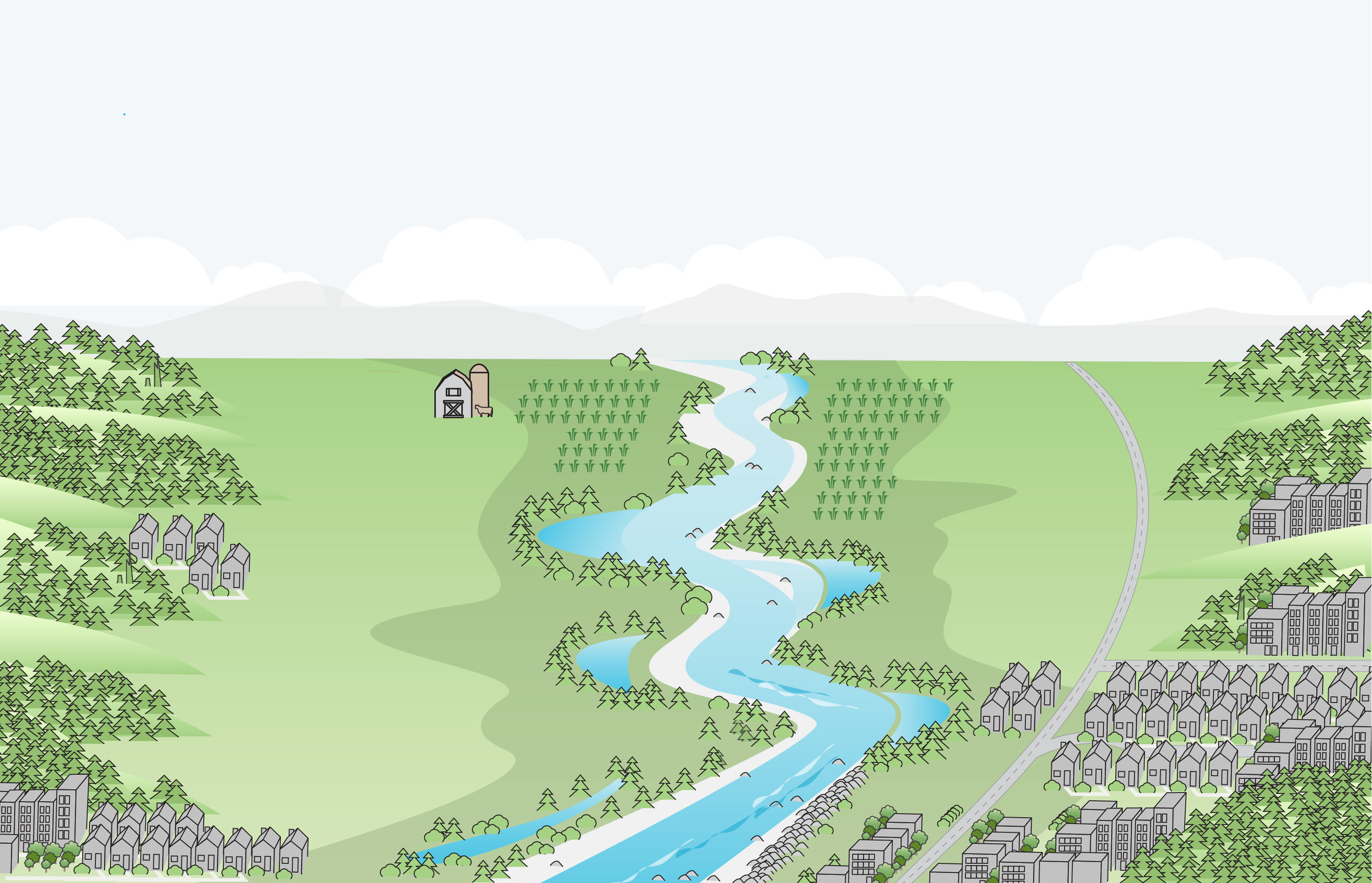
Floodplains are all around us, quietly at work, providing rich soil for our farms, habitat for our salmon and beautiful backdrops for our lives.
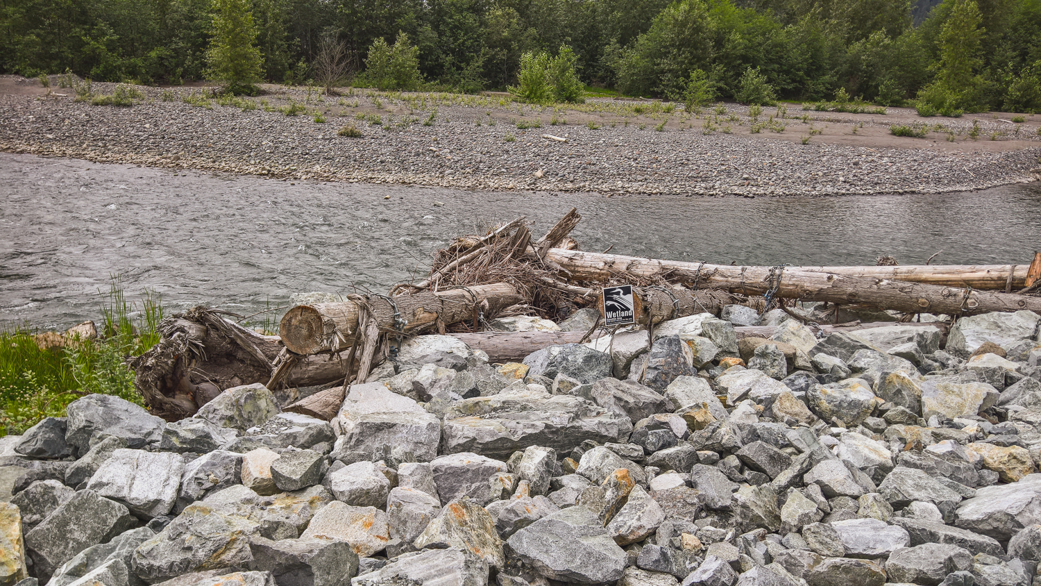
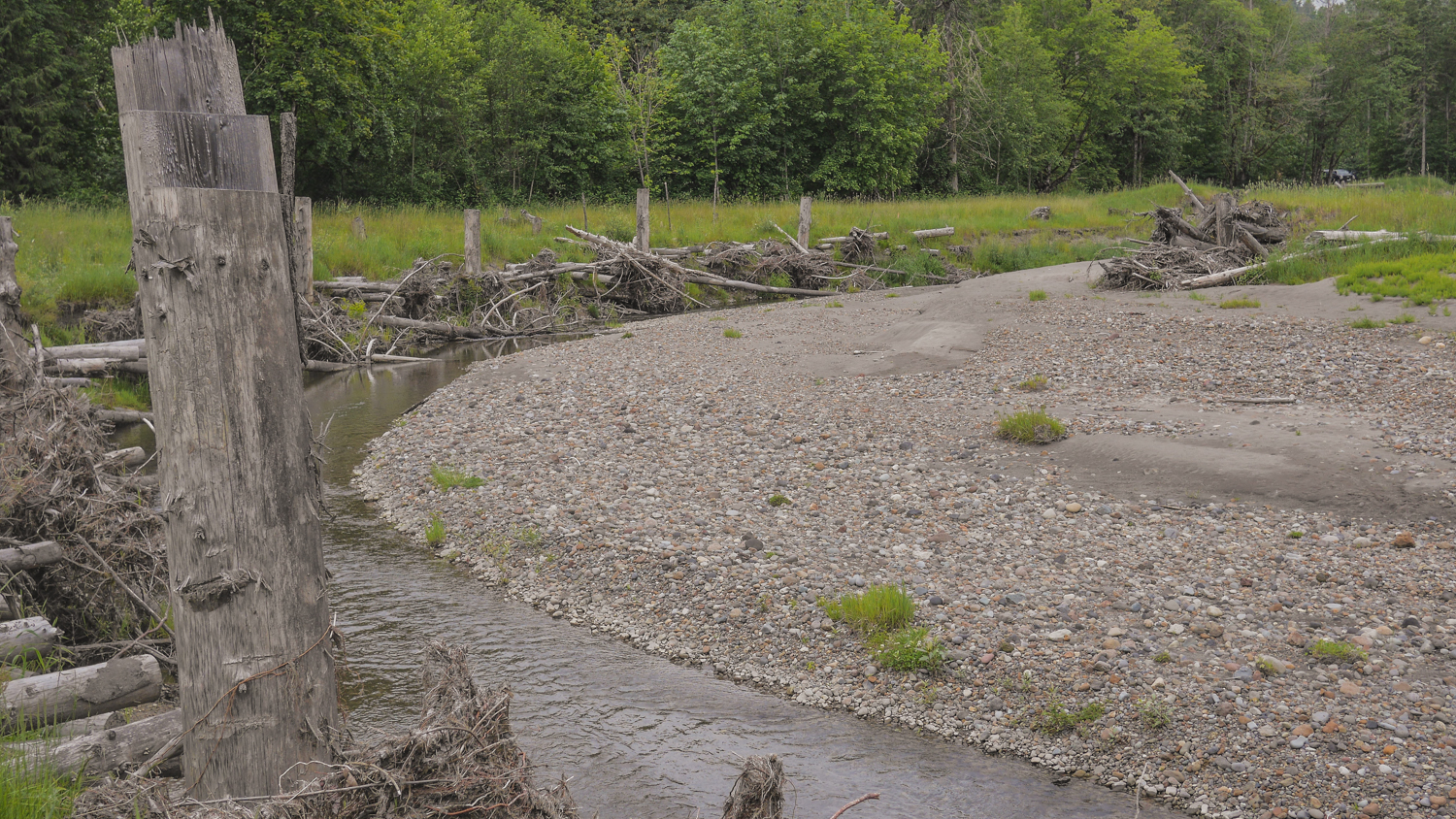
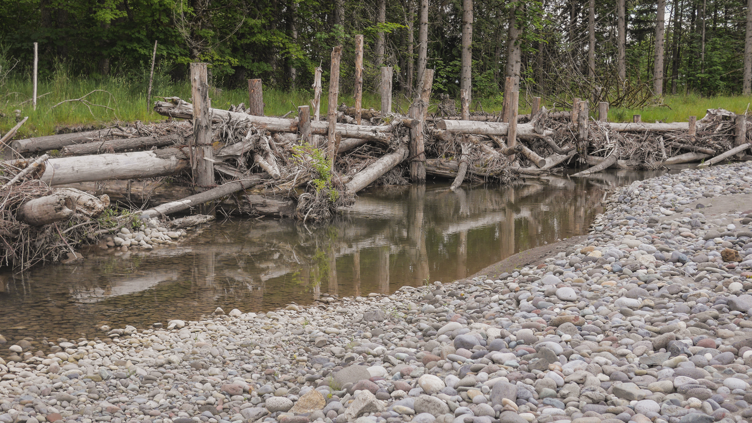
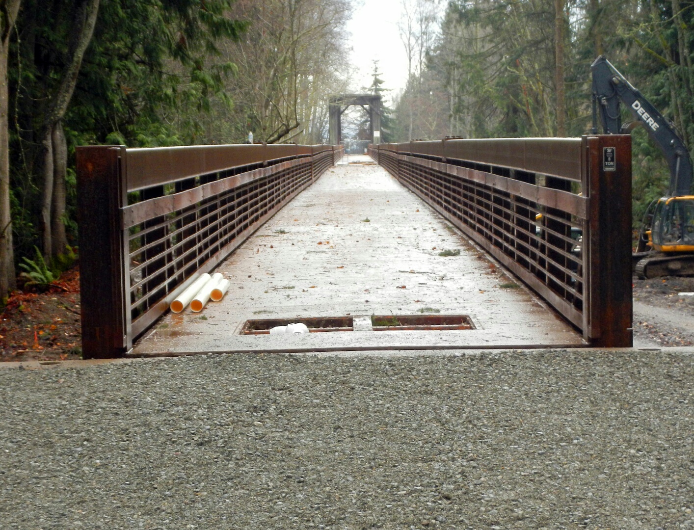
What's the purpose of a launching toe? Learn about projects that are restoring floodplains and estuaries in north Puget Sound for juvenile fish and improved flood control.
As important as estuary and floodplain restoration is to the health of Puget Sound’s water, salmon and people, it is rare to be able to fully document project outcomes.
Written by Bob Carey, Strategic Partnerships Director
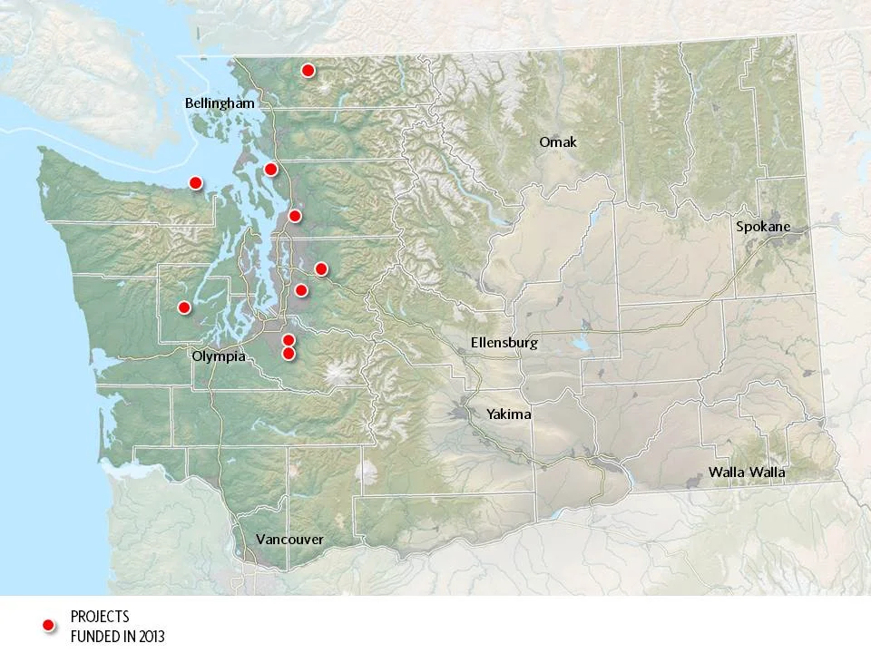
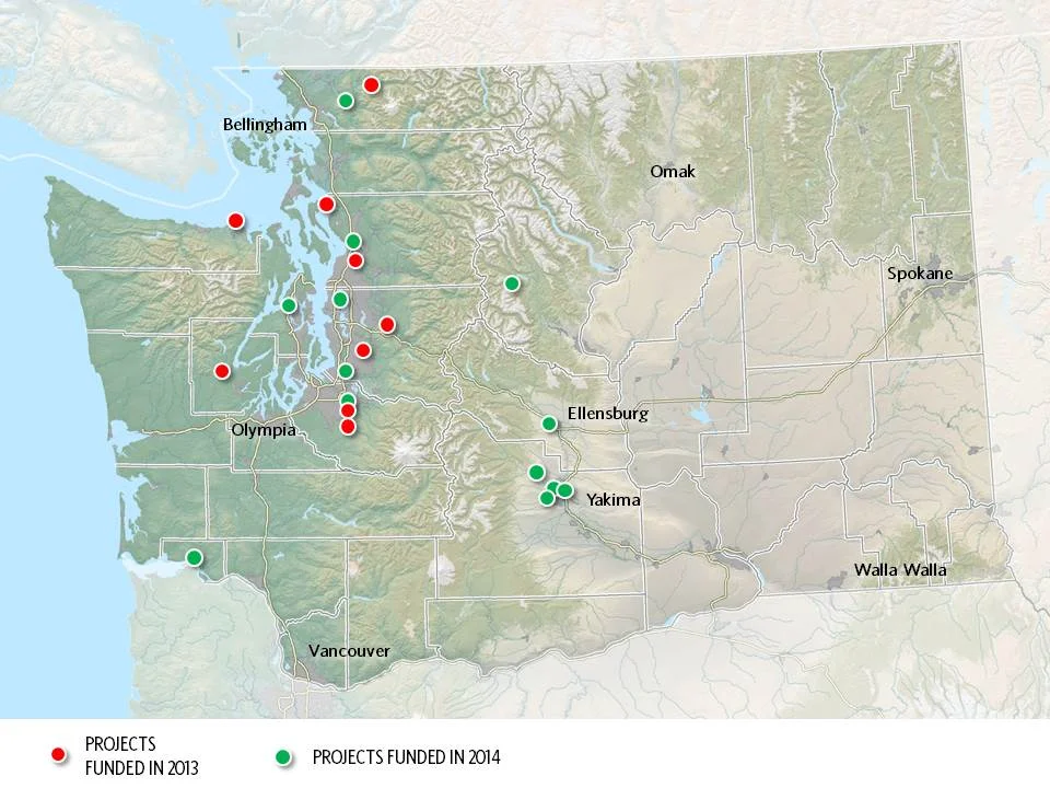
Maps by Erica Simek-Sloniker, Visual Communications
Floodplains by Design, a public-private partnership aimed at revolutionizing river management across Washington, came together in 2012 with the goal of making our communities safer and rivers healthier. It started as a concept: get the leaders of programs and interest groups that influence coastal and riverine floodplains out of their silos, have them work together to figure out how to manage these landscape in a collaborative, integrated fashion, and we’ll collectively do a better job of delivering society’s goals of reduced flooding, stronger salmon runs, clean water, economic development and a high quality of life.
Floodplain managers of various sorts – county flood managers, tribal fisheries biologists, agricultural drainage districts, conservationists, etc. – embraced the concept, having seen the folly of trying to “control rivers” and the inefficiency of trying to manage only one cog in a complex social and environmental landscape. In 4 short years the concept has evolved into a broad partnership – a “movement” in the words of one local partner. The “movement” has benefitted from strong support from the state legislature which has given $80M to the Washington Department of Ecology for the new state Floodplains by Design grant program.
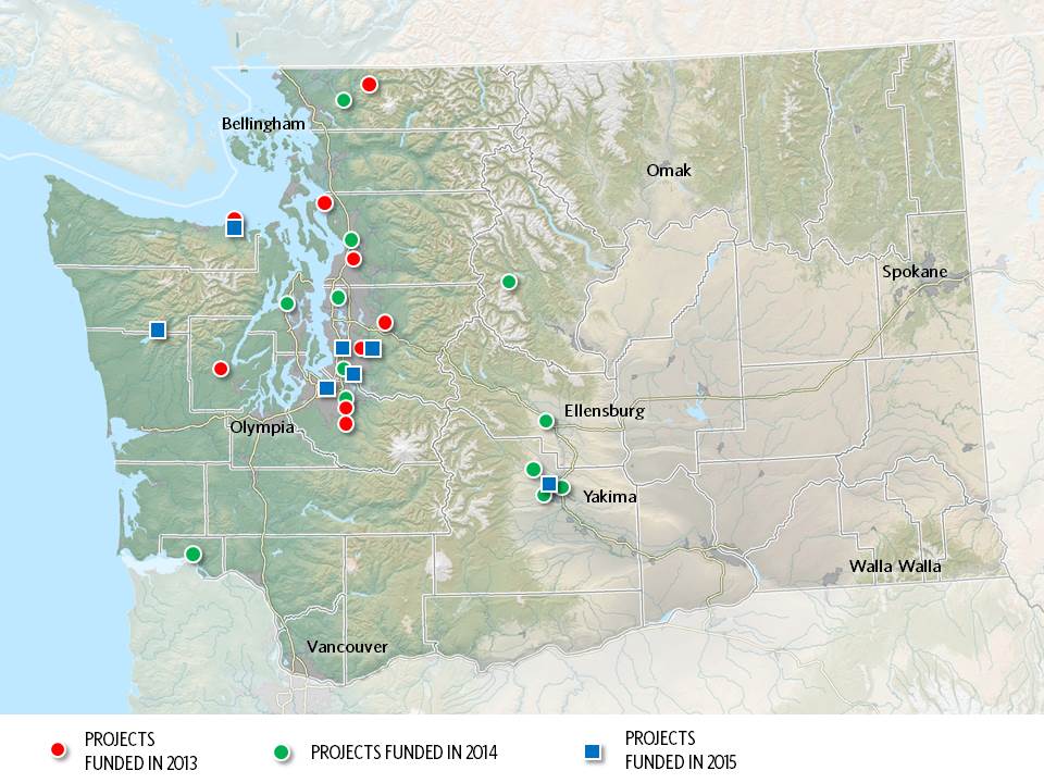
Erica Simek Sloniker, Cartographer and Visual Communications specialist for The Nature Conservancy, has produced a map series that documents the evolution from concept to movement. The initial 9 Floodplains by Design demonstration projects were funded by the state legislature in 2013. 2014 brought 13 more and 2015 another 7. Earlier this year, the Department of Ecology received 56 proposals for the next round of funding – an indication of the strong interest in joining this river revolution.
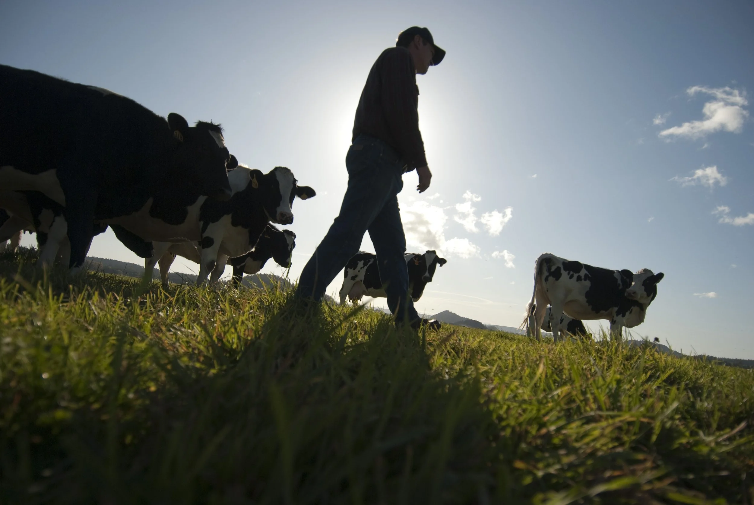
Investments that recognize the role farmers have in restoring our lands will provide an all encompassing approach to reaching our climate and habitat goals.
Seven years later, and over $200 million dollars spent in Floodplains by Design alone, we are seeing a new level of resilience, creativity and impact in our floodplains across the state.
Read about how Floodplains by Design pivoted to virtual workshops and the lessons they learned.
Did you know that rivers are constantly changing, carving new paths over the years? Come along and take a trip to the Nooksack River, where you'll learn that the only constant is change
Washington state lawmakers approved groundbreaking policy and budget priorities this session, positioning our state for a more resilient future.
We caught up with Cindy Dittbrenner, Natural Resource Program Manager for the Snohomish Conservation District, to discuss why data and webmaps are so important for farmers in Snohomish County.
Imagine you’re a third-generation farmer in the Puget Sound. You’re witnessing more rain and wetter fields. How can you make decisions about the future? A new tool will help.
Explore maps that show how fluid rivers in Washington state have been over time.
The loss of another orca is a stark reminder of how sick our Puget Sound really is and the importance of river health, salmon recovery, climate change and the impacts of a fast-growing Puget Sound.
Climate change is bringing greater precipitation to Washington, with more frequent and severe storms. Healthy floodplains are a key natural solution: They absorb heavy flows, reduce flooding and temper storm surges.
The governor’s executive actions give us a unique and historic opportunity to come together as Northwesterners to save these majestic and intelligent whales
Through sideways rain as the tide rushed behind him, the tribal chairman talked about the turning point that this project represented.
Snohomish County farmers take part in advocacy after participating in a Photovoice project.
hanksgiving Day floods found many people evacuating their homes around Puget Sound and fish searching for quiet places to get away from fast-moving floodwaters.
Written & Photographed by Robin Stanton, Media Relations Manager
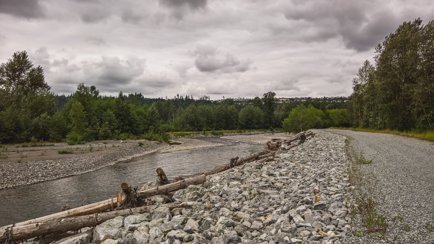
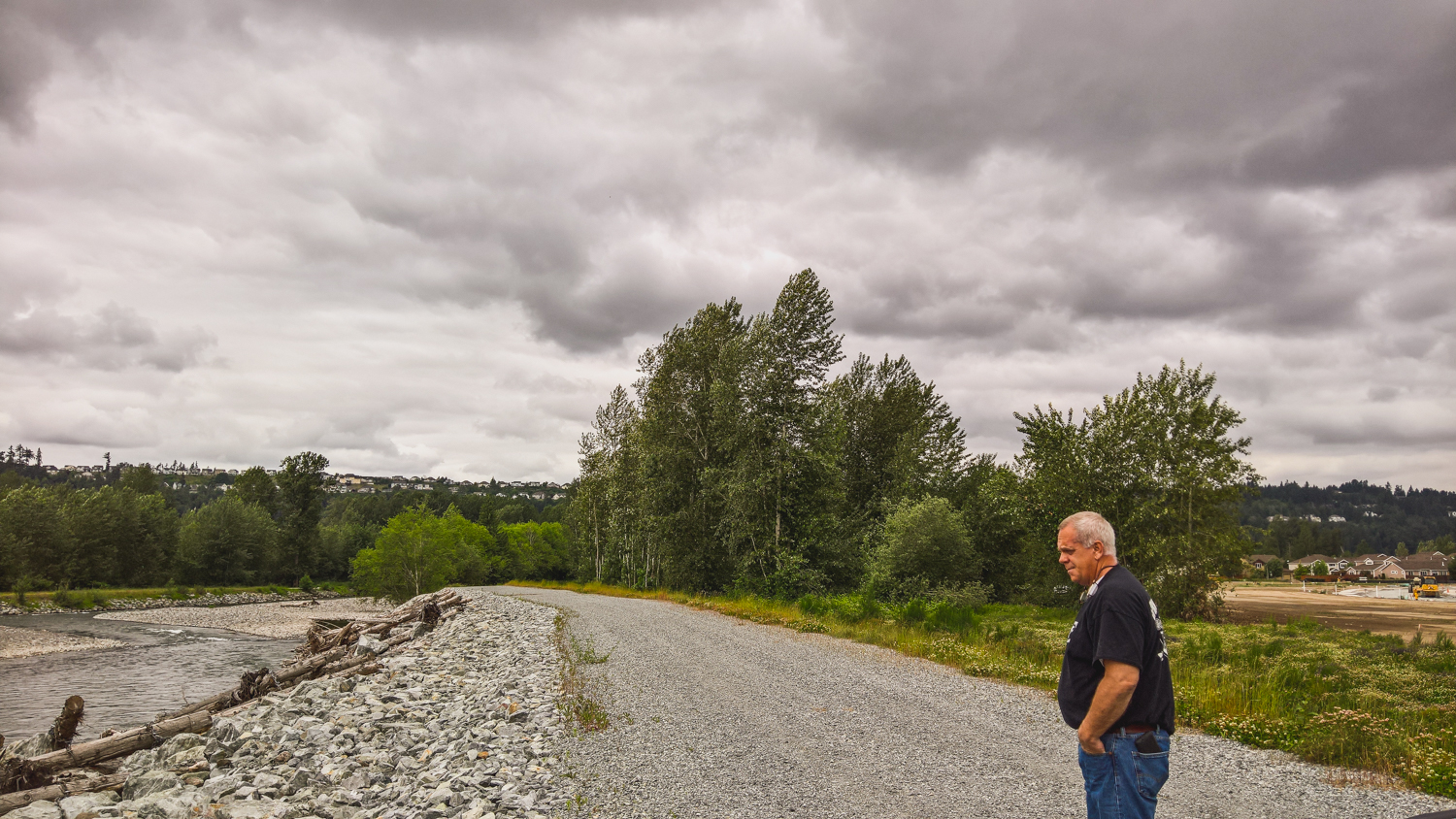
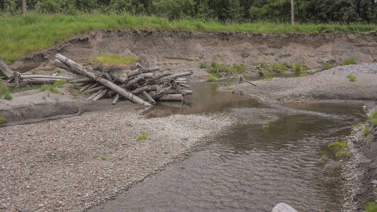
I revisited two Floodplains by Designs sites on the Puyallup River – the Calistoga Reach project in the town of Orting, and the South Fork project a few miles north and downriver from there.
These were both projects designed to re-connect the Puyallup River with its historic floodplain, provide more salmon habitat, and reduce the threat of flooding to people.
The Calistoga Reach project was completed in November of 2014—a week later the river hit a flood stage that previously had sent thousands of people fleeing from their homes. This time, Building Official Ken Wolfe said, “We didn’t have to deploy even one sandbag.” The river rose again in 2015, and again the town stayed dry.
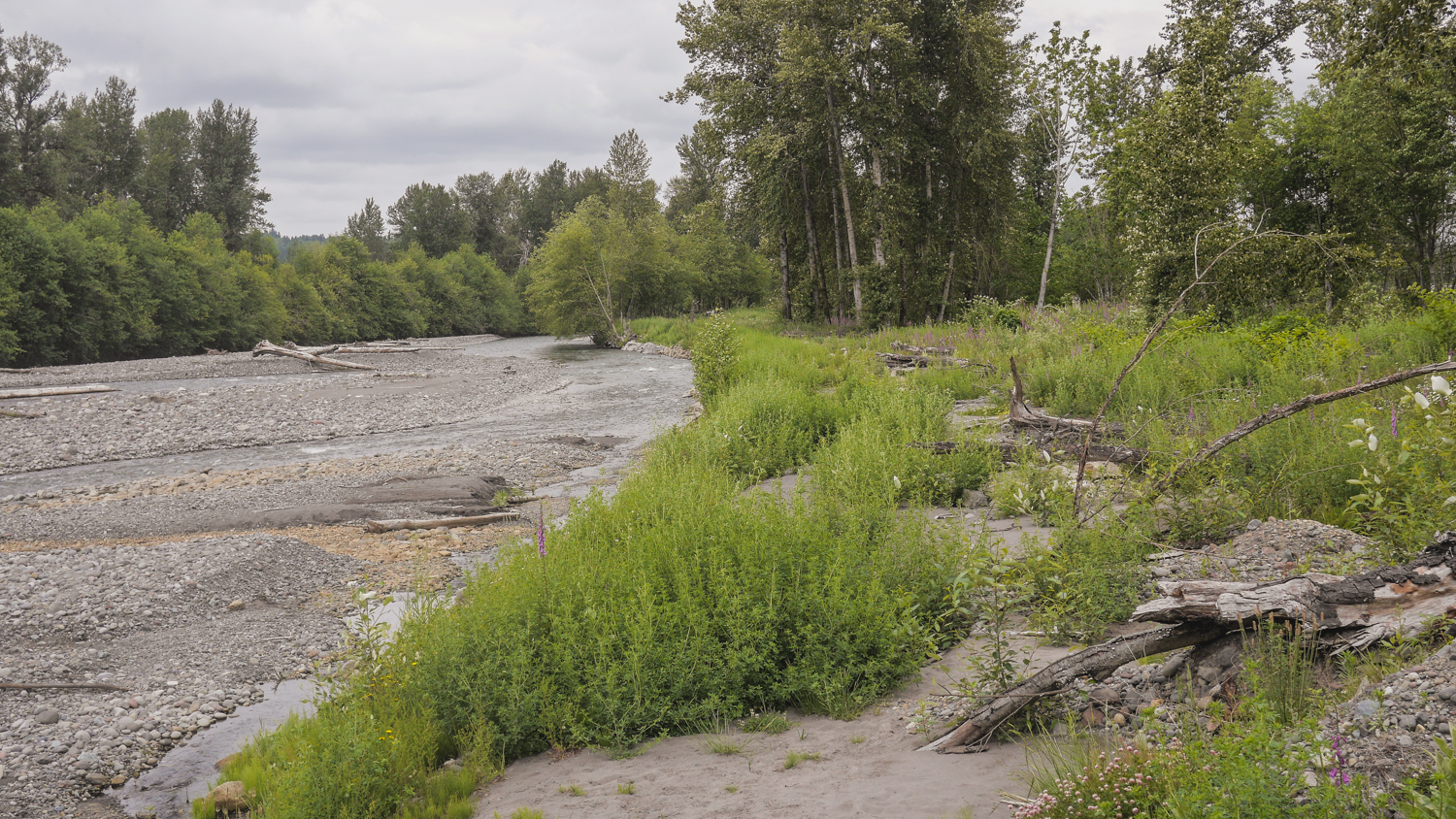
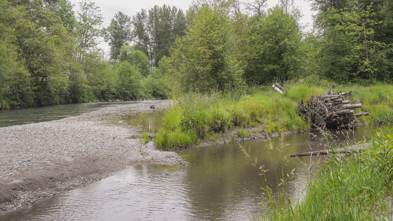
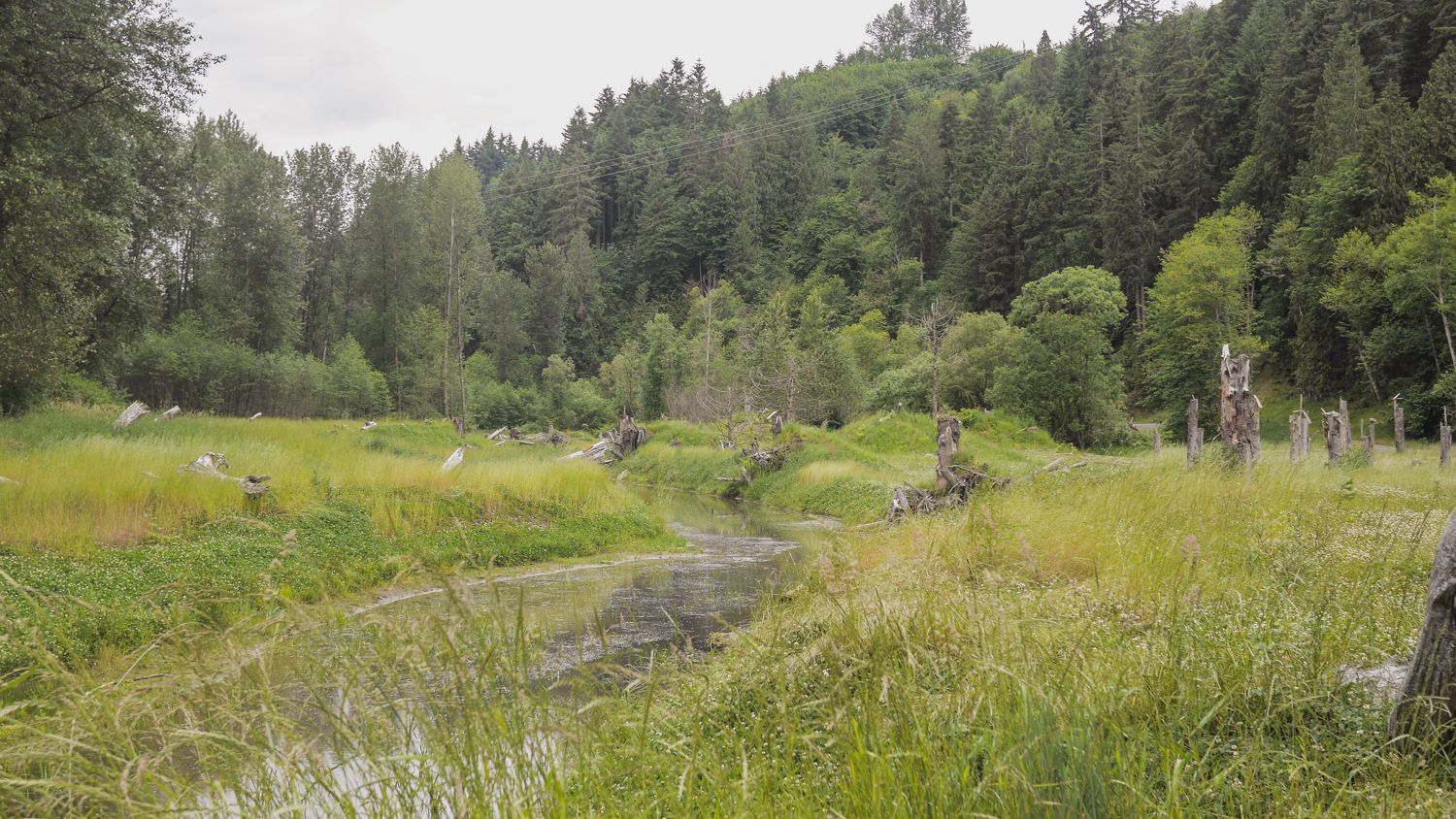
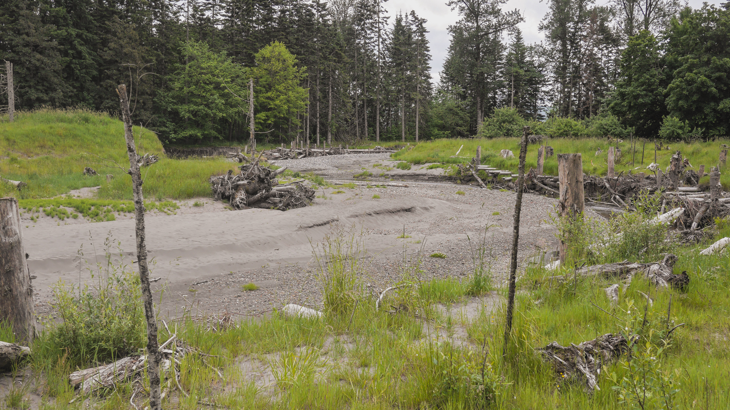
Today, you can see the reclaimed natural areas that in times of flood give the river room to rise, and also offer refuge to juvenile salmon and other wildlife and walking paths for people.
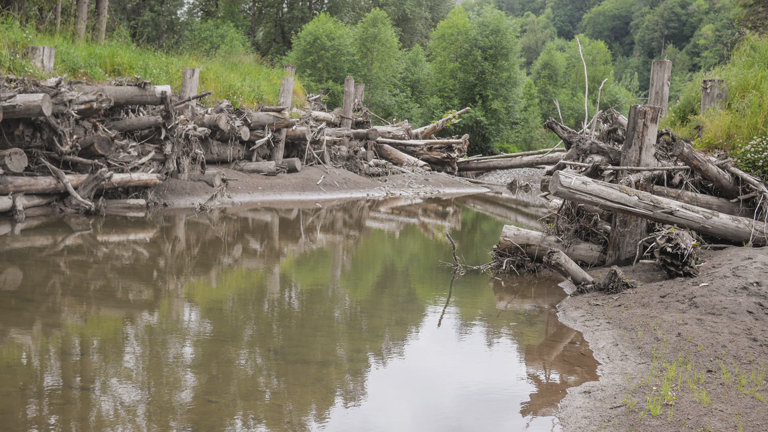
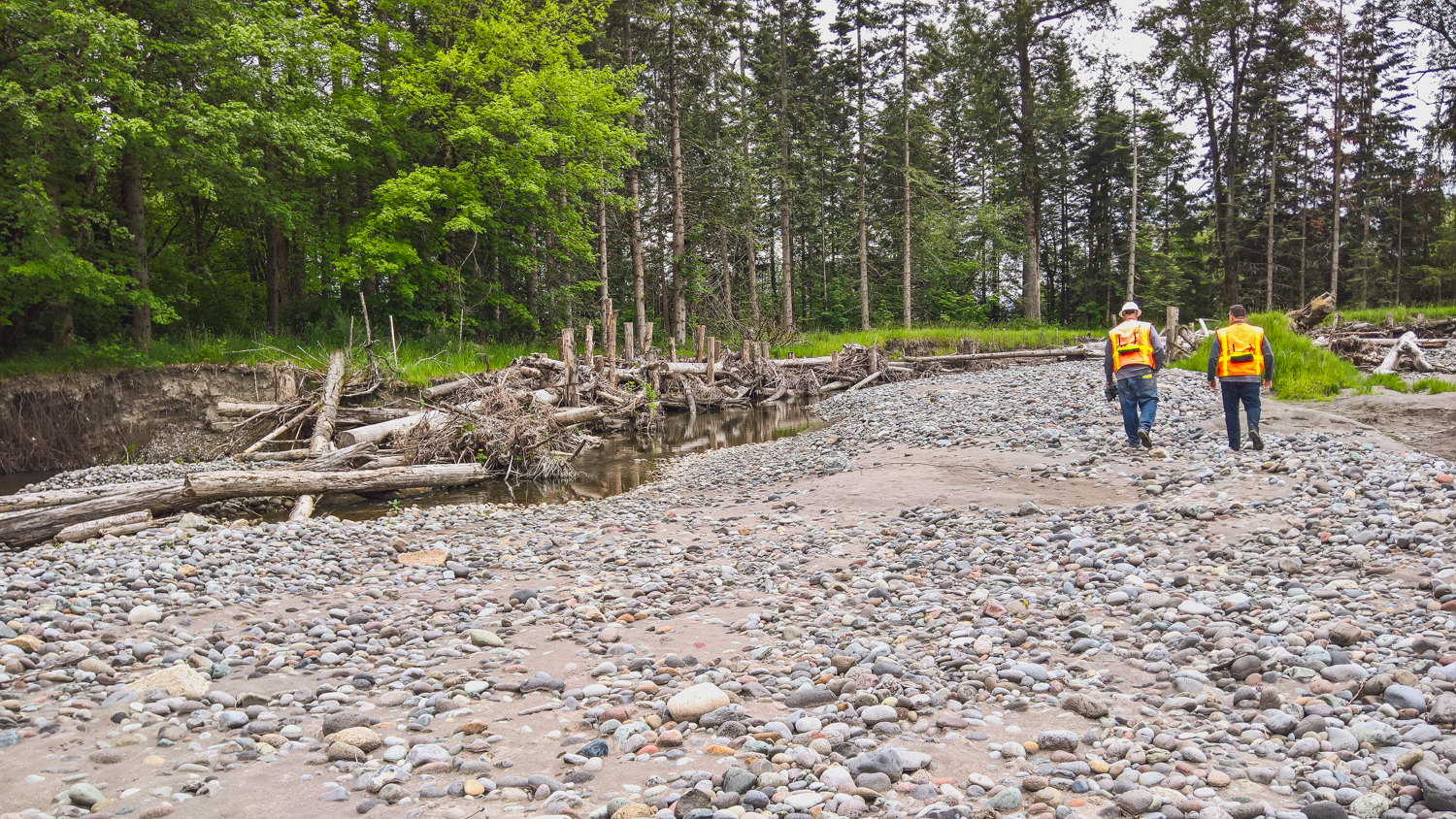
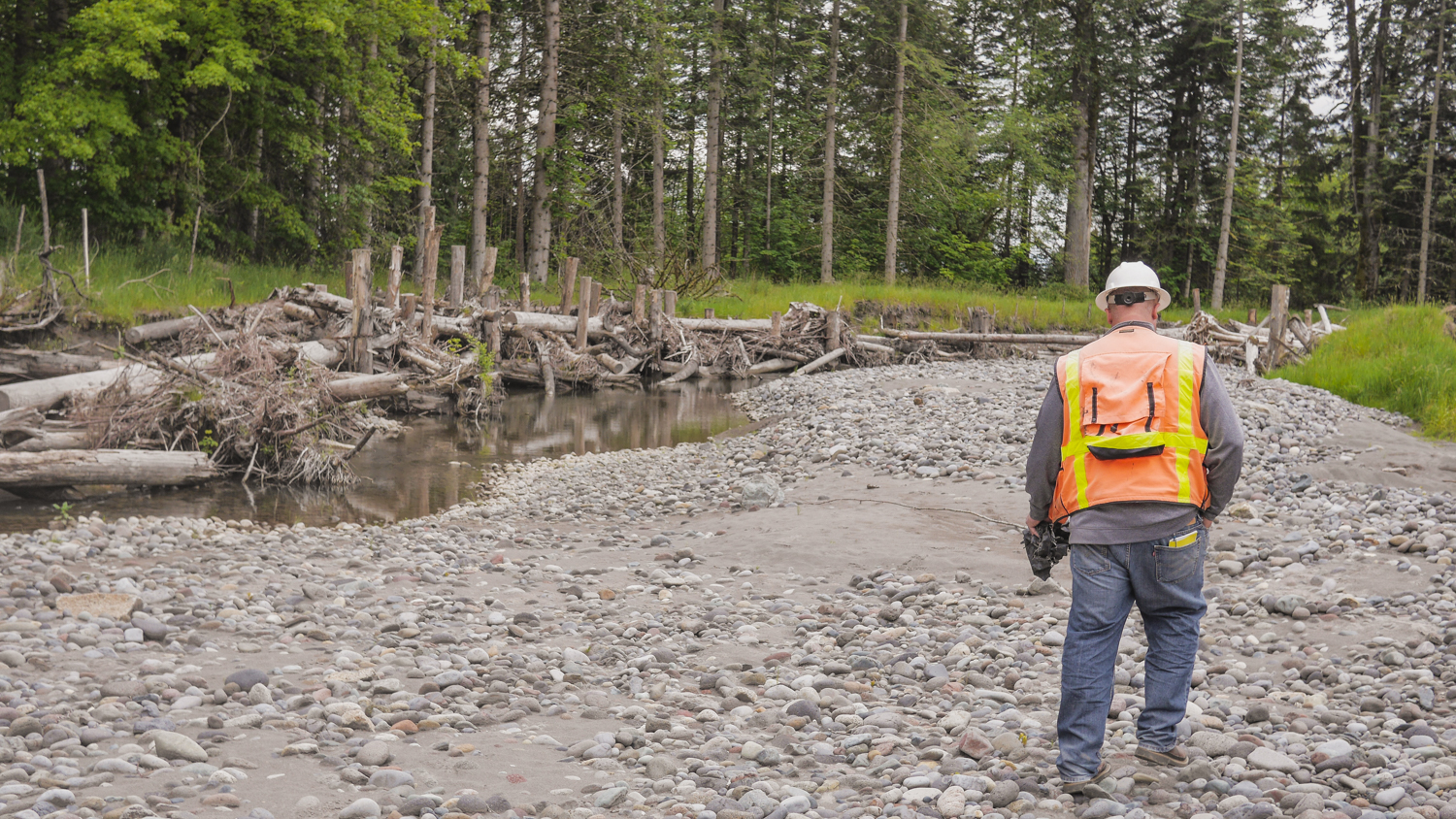
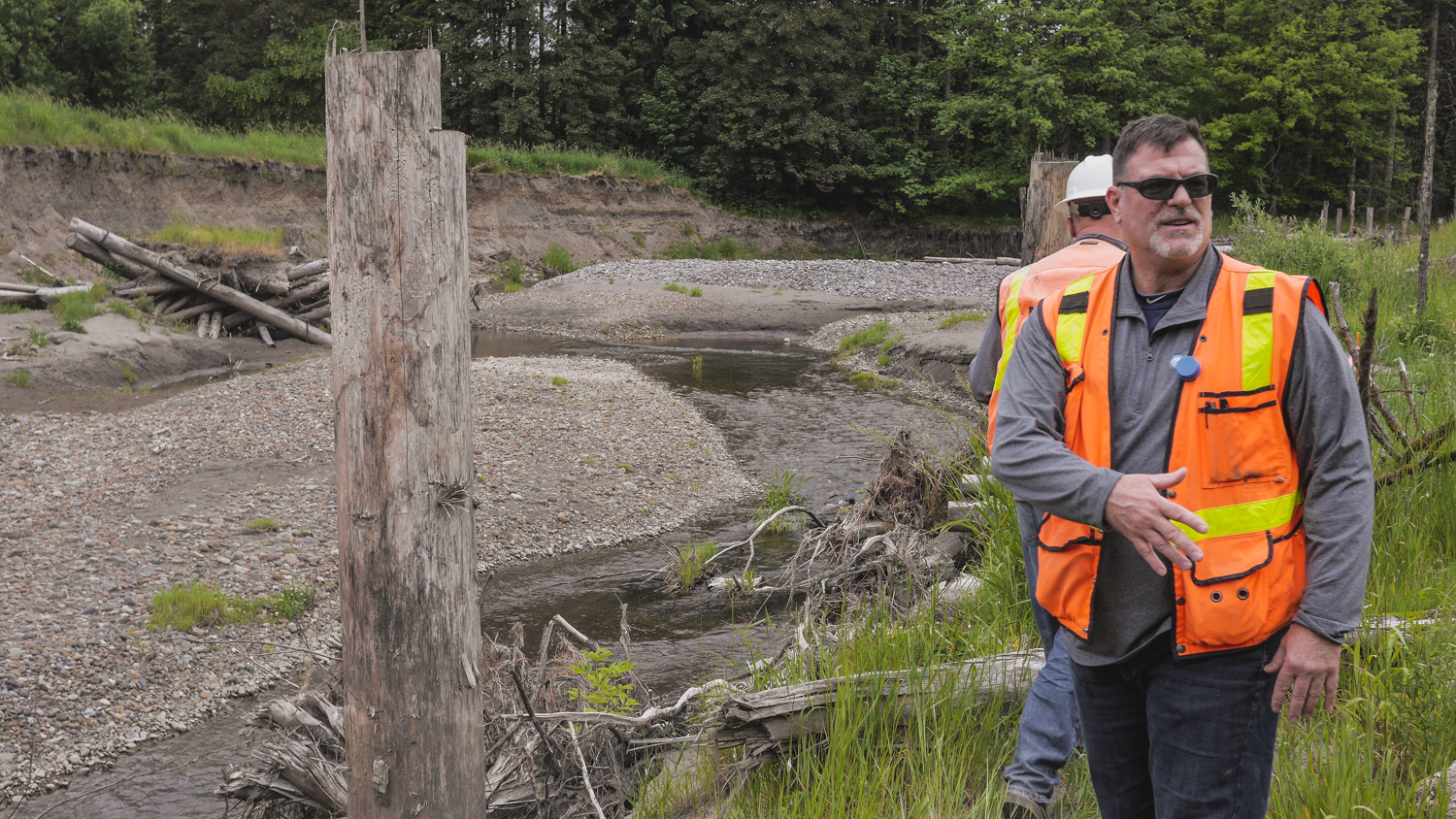
The South Fork project is a new side channel for the river, again giving the water places to go when the volume is high, along with great salmon habitat. It’s being completed in stages, and by the time it’s finished, it will be a mile-long side channel, the longest on the Puyallup River. Engineers Jeffrey Davidson and David Davis helped me scramble all over the site, Pointing out new channels created by the river, engineered logjams that are evolving as the river runs through, and new gravel bars and sediment deposits brought down from Mount Rainier by the power of the river. Salmon are using the site, and they’ve seen black bear and deer out there as well.
It's remarkable to see how nature can come back and revive when you give it a chance!
Written by Robin Stanton, Media Relations Manager
Photographs by Chris Hilton, Grant Fundraising Director
Floodplain leaders from around the Puget Sound region gathered today for a workshop on advancing floodplain restoration, including a new focus on integrating climate change data.
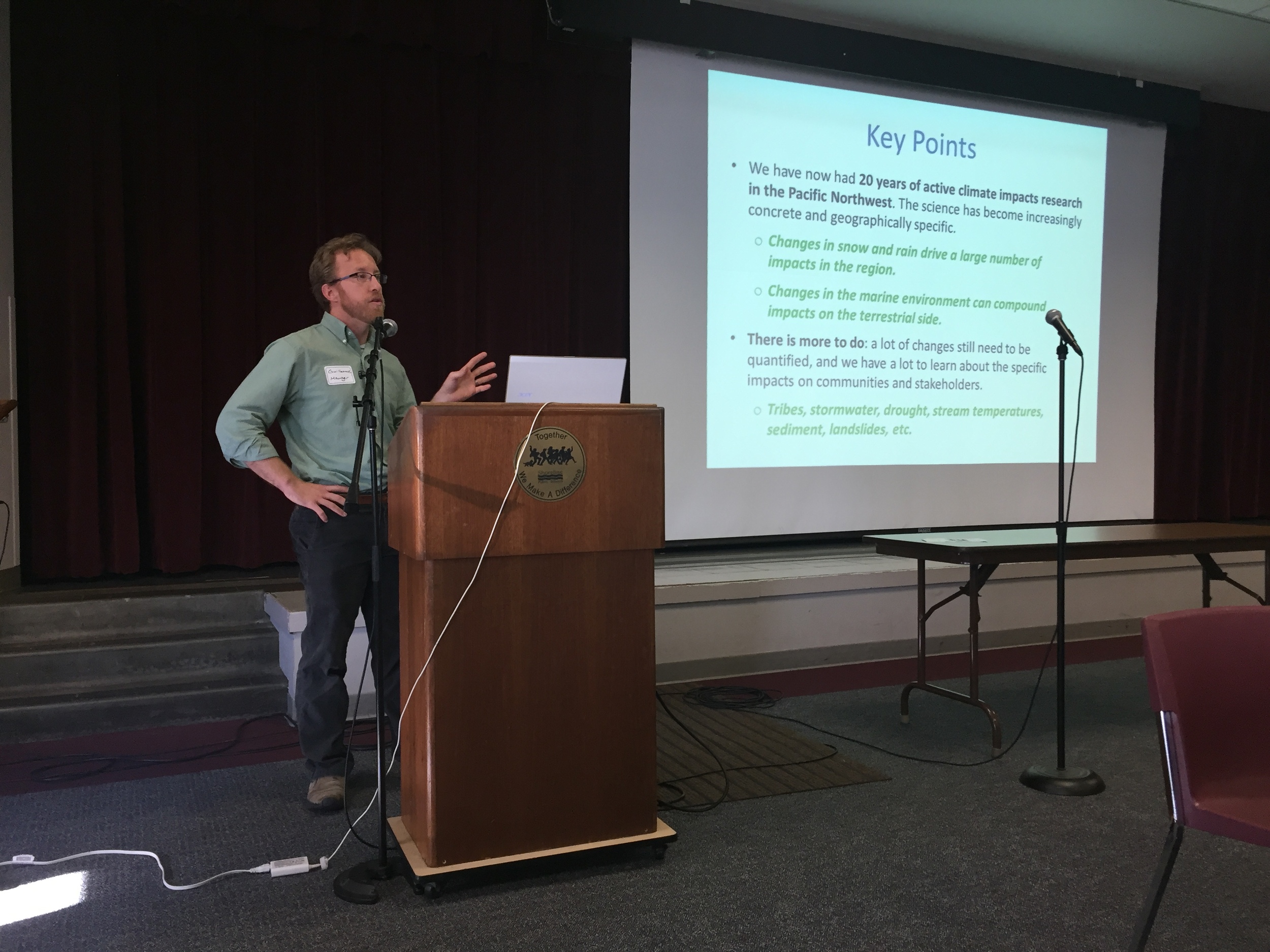
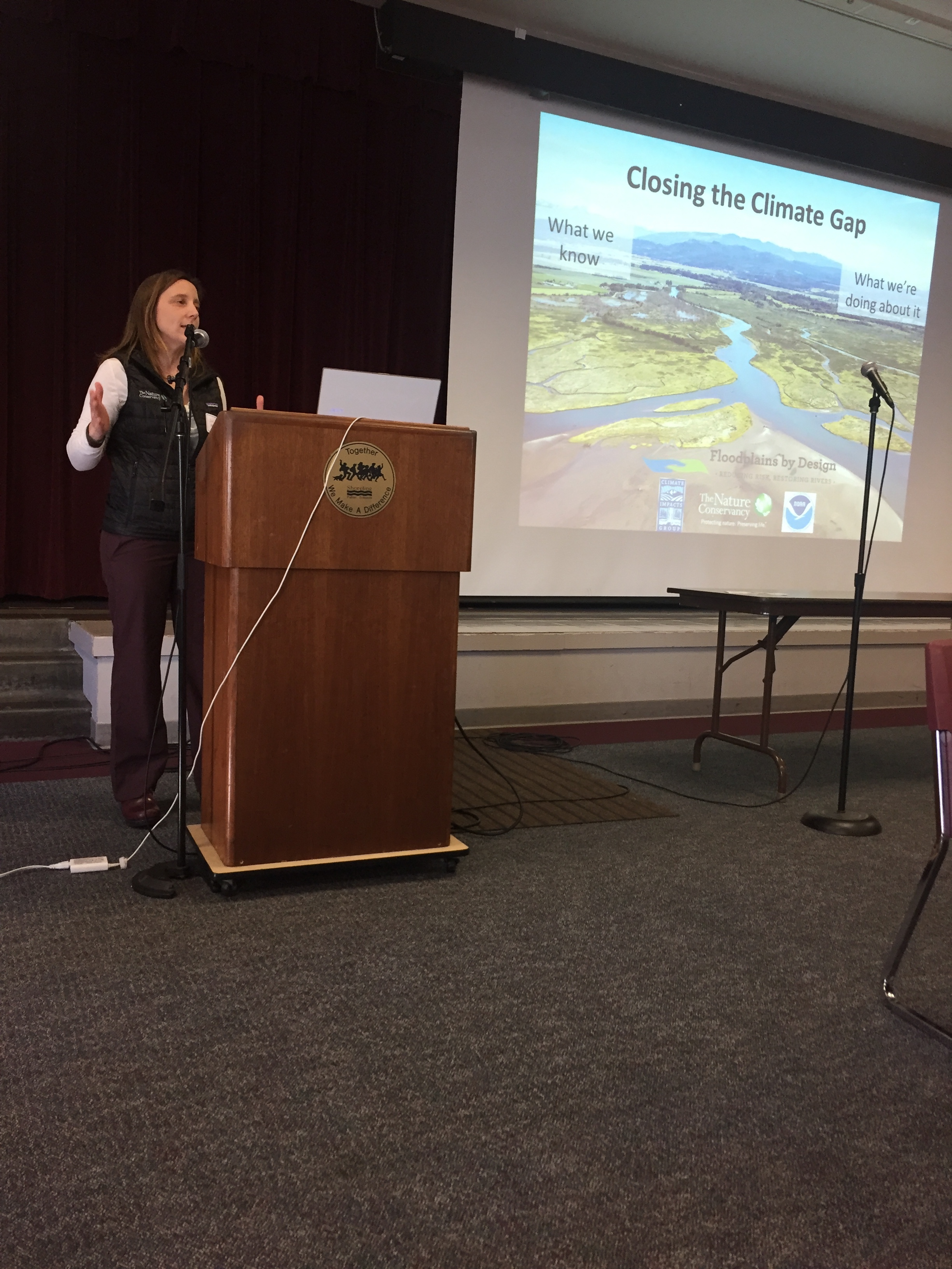
“There’s a big gap between what we know and what we’re doing about it,” says Julie Morse, the Conservancy’s regional ecologist.
“It’s not unique to Puget Sound, we find it all over the country.”
At today’s workshop, floodplain leaders will begin to develop strategies for including climate impacts into the work they’re already doing.
The Conservancy has been working with the University of Washington Climate Impacts Group to take its recent Puget Sound Climate Synthesis Report and turn it into information that is really useful to city, county and state leaders grappling with these issues on the ground. Today’s workshop is a chance for floodplain leaders to work hands on with this information.
Written by Kris Johnson, Senior Scientist, The Nature Conservancy
Flooding is increasingly becoming a fact of life along the Snohomish River. In early December the severe flooding in the cities of Snohomish and Monroe inundated homes and farms and closed roads and a city park. For residents in the area it was déjà vu all over again, as just weeks before some of the same areas experienced a separate major flooding event. Clearly, managing flood risk along the Snohomish, and throughout western Washington, is challenging yet essential to the lives and livelihoods of millions of people.
And climate change is compounding this problem: warmer temperatures are leading to sea level rise and higher tides, and more winter precipitation is falling as rain rather than snow, causing flashier flows in the rivers. Understanding how flood risk is changing and incorporating best-available information into planning and decision-making is crucial for communities in Puget Sound.
With this in mind the Nature Conservancy led a recent pilot project to both evaluate how climate change might impact flooding and then provide this information to local decision-makers. In partnership with the University of Washington Climate Impacts Group and West Engineering we assessed how varying scenarios of climate change could alter flooding in the Lower Snohomish River and cause potentially greater impact to farms and buildings and infrastructure.
This analysis suggested that in just a few decades what is currently considered a “100-year” flood could be much more severe and could inundate part of I-5 near Everett and cause nearly 20% more costly property losses (see image).
To make this information useful and readily available we created new Floodplains by Design ‘app’ on the Coastal Resilience decision support tool so that local partners with the Sustainable Lands Strategy in Snohomish County could integrate maps and images of potential flooding into their project planning and decision-making process.
Managing increasing flood risk while sustaining high-value agriculture and also restoring salmon populations and protecting the environment will be a major challenge in Puget Sound in the 21st century. Rigorous science and sophisticated tools, like those developed by The Nature Conservancy for the Lower Snohomish River, can provide local communities with the best-available information that can help them plan accordingly.
Written and Photographed by Randy Johnson, Habitat program manager, Jamestown S’Klallam Tribe
Aerial Photographs provided by John Gussman
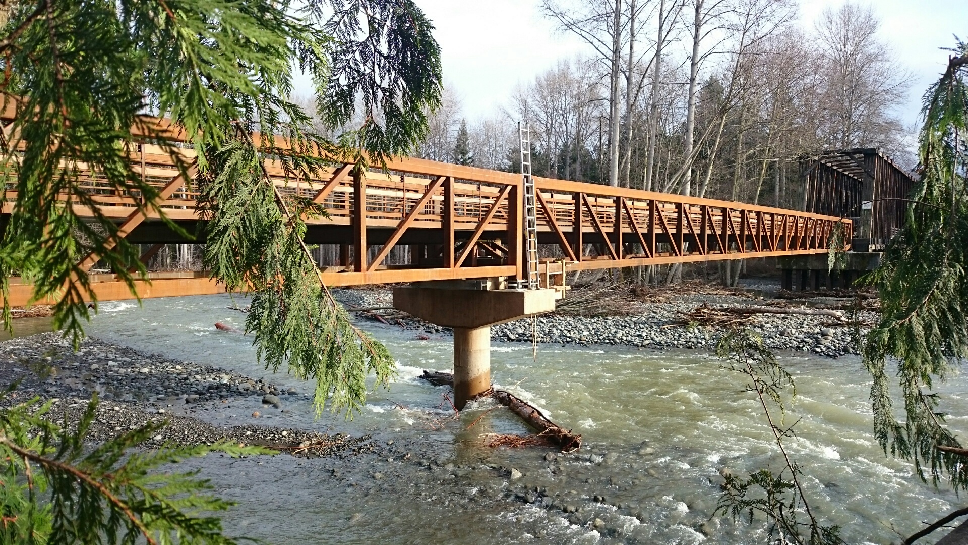
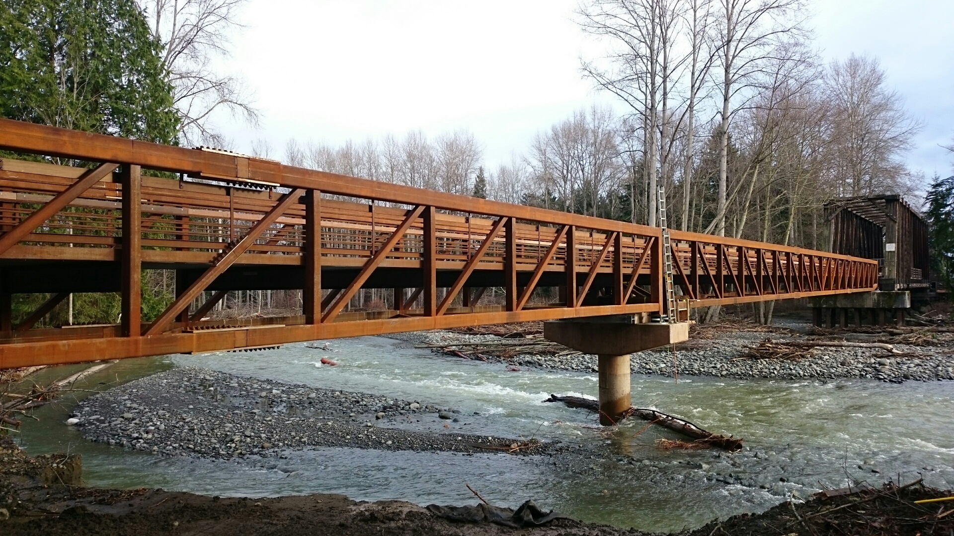
Since the first of February 2015, four floods have rumbled down the Dungeness River. The first one damaged the old creosoted RR trestle and closed the Olympic Discovery Trail (ODT). The three floods in the past six weeks have occurred while we've been building the new pedestrian bridge that will replace the trestle. During the floods, the river has migrated 230 feet west. Had the trestle not been removed, at least 15 pile bents - 75 creosoted piling, creosoted timbers, and bridge decking - would have been knocked down and strewn all the way from the Dungeness River RR Park to Dungeness Bay.
It was a given that the Tribe would replace the trestle's functions for users of the Olympic Discovery Trail. 10 Months and 2 days later, the entire 585' of trestle and its dripping creosote are gone from the floodplain forever and 720 feet of salmon friendly and river worthy pedestrian bridge is connected to the ODT. All 750 feet of new bridge are now in place, and just a few relatively minor tasks remain. The construction access road is being removed, and by the end of today both floodplain channels will be flowing free again. You can look forward to the ODT being reopened soon.
Floodplains by Design funding was a perfect fit for this project because of the program’s focus on reconnecting rivers to their floodplains for fish and flood risk reduction, and the additional community benefit of recreational access.
Thank you everyone for your role in making this bold vision a reality.
OLYMPIA, WA – Last week state legislators awarded $35.5 million dollars to the Floodplains by Design grant program in the capital budget paving the way for seven multiple benefit projects across the state to move forward.
Floodplains by Design, administered by the Department of Ecology, supports collaborative floodplain management efforts that combine flood risk reduction, habitat protection, agricultural preservation and recreational access. Projects funded by the program emphasize multiple benefits to maximize effectiveness and ensure tax dollars are well spent.
Legislators approved $33 million for Floodplains by Design in the last biennium, funding projects that supported over 750 jobs in nine locations, restored natural salmon habitats, and protected homes worth over $115 million. The newly approved funding is a testament to the success and growth of the program.
“As flood risk and clean water needs continue to grow while public dollars become more limited, it is critical that we coordinate our investments to maximize outcomes per dollar spent,” said The Nature Conservancy’s Washington State Director Mike Stevens. “The multiple benefits approach of Floodplains by Design is a model for how our state can tackle our greatest challenges.”
“We’re gratified that the Legislature has recognized the value of the proactive approach of the Floodplains by Design program. Our collaborative Puyallup basin project will reconnect the Puyallup River floodplains and will dramatically reduce the risk of flooding to communities from Alderton to Tacoma, while enhancing salmon habitat and protecting farmlands,” said Hans Hunger, Capital Projects Manager with Pierce County. “We appreciate the support for this project, and hope by the demonstrated benefits it brings many more communities will be able to follow its example of working with rivers rather than against them.”
Washington’s floodplains contain billions of dollars in property and infrastructure, and are home to Washington’s richest farmland and signature salmon runs. Studies show that for every $1 spent on flood risk reduction saves $4 in flood damages. As Washington’s communities continue to grow, it is essential to keep floodplain management at the same pace. Flooding is becoming more frequent, severe and costly, which poses a serious threat to Washington’s communities and businesses.
The funding for Floodplains by Design approved today will allow communities across the state to properly manage their floodplains and the benefits they provide
Floodplains by Design is an ambitious public-private partnership working to reduce flood risks and restore habitat, while also supporting other floodplain priorities such as clean water, agriculture and recreation, along Washington’s major river corridors. Because Floodplains by Design projects are built collaboratively from the ground up and serve diverse interests, they enjoy broad support and deliver multiple benefits. For more information visit www.floodplainsbydesign.org
CONTACT
Tom Bugert
The Nature Conservancy
(509) 885-6991
tom.bugert@tnc.org


Written by Robin Stanton, Media Relations Manager
Photographed by (1-5) Robin Stanton; and (6-7) King County
Opportunities don’t come along very often to reconnect a river to dozens of acres of floodplain and dramatically restore fish and wildlife habitat, while maintaining flood protection for nearby homes and roads.
King County’s Upper Carlson Floodplain Restoration project along the Snoqualmie River near Fall City is just such an opportunity – and a broad coalition of local, state, tribal and federal governments and organizations came together this week to celebrate completion of this complex, multi-year effort.
The work was done on King County’s Fall City Natural Area – a 50-acre forested floodplain that historically contained the Snoqualmie River’s main stem. The project included removing roughly 1,600 linear feet of aging levee that constrained the river to an unnaturally narrow channel.
With the old levee gone, wintertime flooding brought fresh flows across much of the newly reconnected floodplain, and widened the river channel by approximately 40 feet. As these natural processes are restored, gravel bars and log jams will form, providing additional salmon habitat.
To maintain protection for nearby homes, roads and fertile farmland, project managers designed and installed log structures and a new 850-foot-long rock structure at the lower end of the site to provide additional protection where the river is most likely to migrate.
King County acquired the Fall City Natural Area with funding from the Conservation Futures Levy and Salmon Recovery Funding Board, for preserving and restoring critical salmon habitat.
The site restoration work included invasive vegetation removal, and planting acres of native trees, to improve habitat for the birds, mammals, reptiles and other wildlife.
The $3.5 million project was funded by grants from:
For more information, visit the project website, or contact Mary Maier at 206-477-4762 or mary.maier@kingcounty.gov.


Guest blog by Gordon White, Program Manager, Shorelands & Environmental Assistance, Department of Ecology
Photograph by (1) Andy Porter, Northwest Photographer
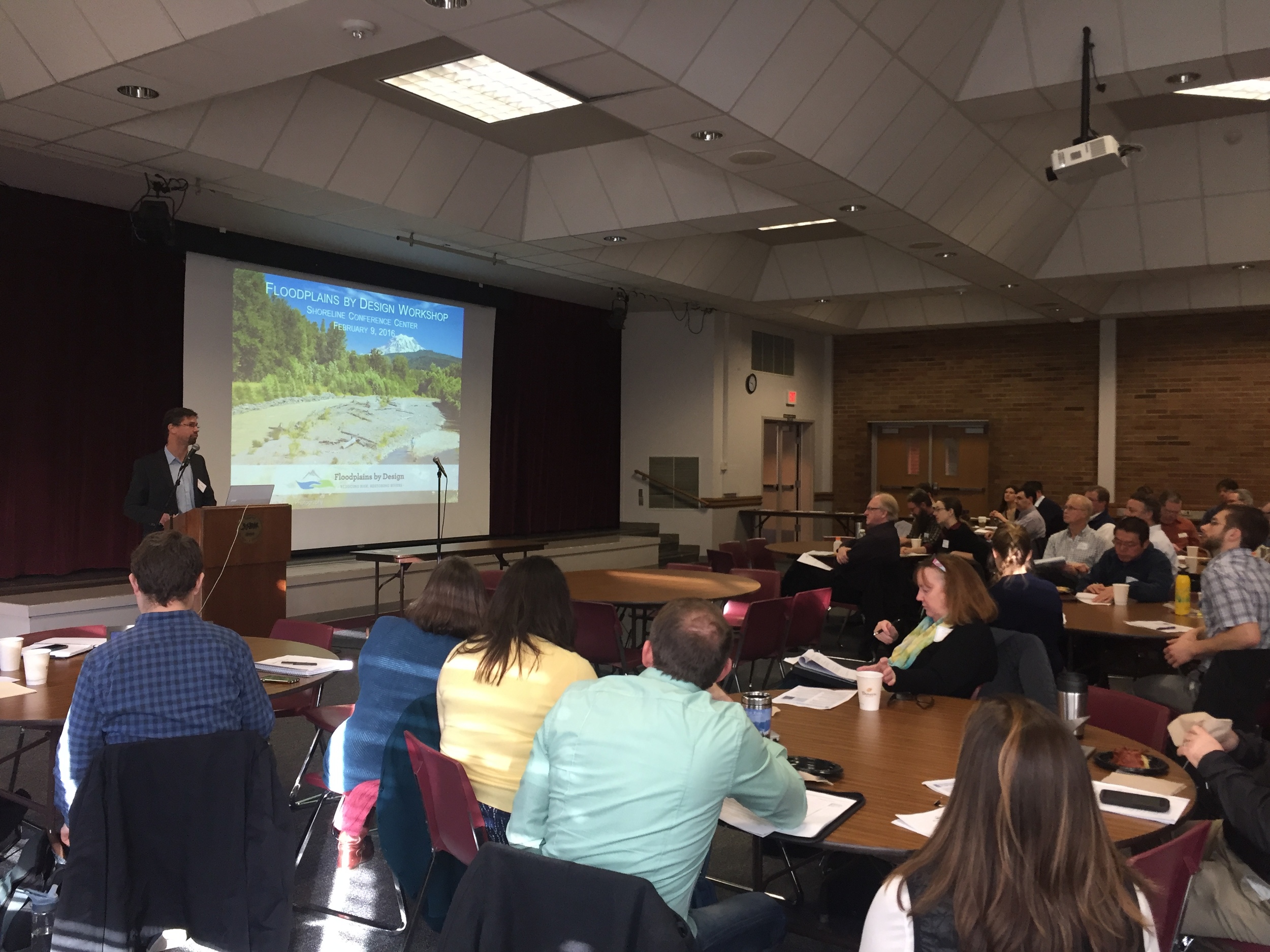
What do we want our rivers and valleys to look like in ten years? How can we strategize and plan now so that we have reduced flooding, clean water and ample wildlife habitat a decade from now? Those are some of the topics that were tackled at Floodplains by Design Management meeting hosted by The Nature Conservancy, Department of Ecology and Puget Sound Partnership.
“Fun” and “enlightening” are not words you usually hear after an all-day workshop on a beautiful Friday in Seattle. Yet I came away from the gathering feeling I’d enjoyed myself and gained important new insights into our challenges and our work.
The workshop was a working session with key leaders and project proponents from across the region with an interest in advancing integrated floodplain management and implementing Floodplains by Design-like projects. It presented an opportunity to continue the dialogue on what “it” is; what makes for useful planning scales and timeframes; and how to talk about success measures and stories.
Bob Carey from The Nature Conservancy gave an overview of the Floodplains by Design initiative, which created a strong entry point for everyone to work from as they discussed the finer points of the program. Jim Kramer, who specializes in building collaborative programs and initiatives, facilitated moving the dialog from conceptual to specific.
Cogs began spinning for attendees when Carol MacIlroy, a specialist in natural resource planning, shared a regional vision and planning scale along with timing. Participants were challenged with how best to capture the multi-benefit approach in their watersheds and regions. The Nature Conservancy’s Kris Johnson of gave a clear explanation of a GIS tool that creates new possibilities for scoping projects, leaving participants eager to learn more and try the tool.
For a summary of the legislative process and the Capital Budget we turned to Tom Bugert of The Nature Conservancy. The time is critical for this kind of information, and participants were empowered to play a role in fostering a successful outcome to the current legislative session.
We covered a lot of ground in one day and it was truly a team effort – one that is sure to yield long term results around our region. Results that will help our communities and ecosystems thrive well into the future.
You can learn more about Floodplains by Desgn.
Related Blog Posts
Orting Honored for Puyallup River Project