Words and graphics by Erica Simek Sloniker
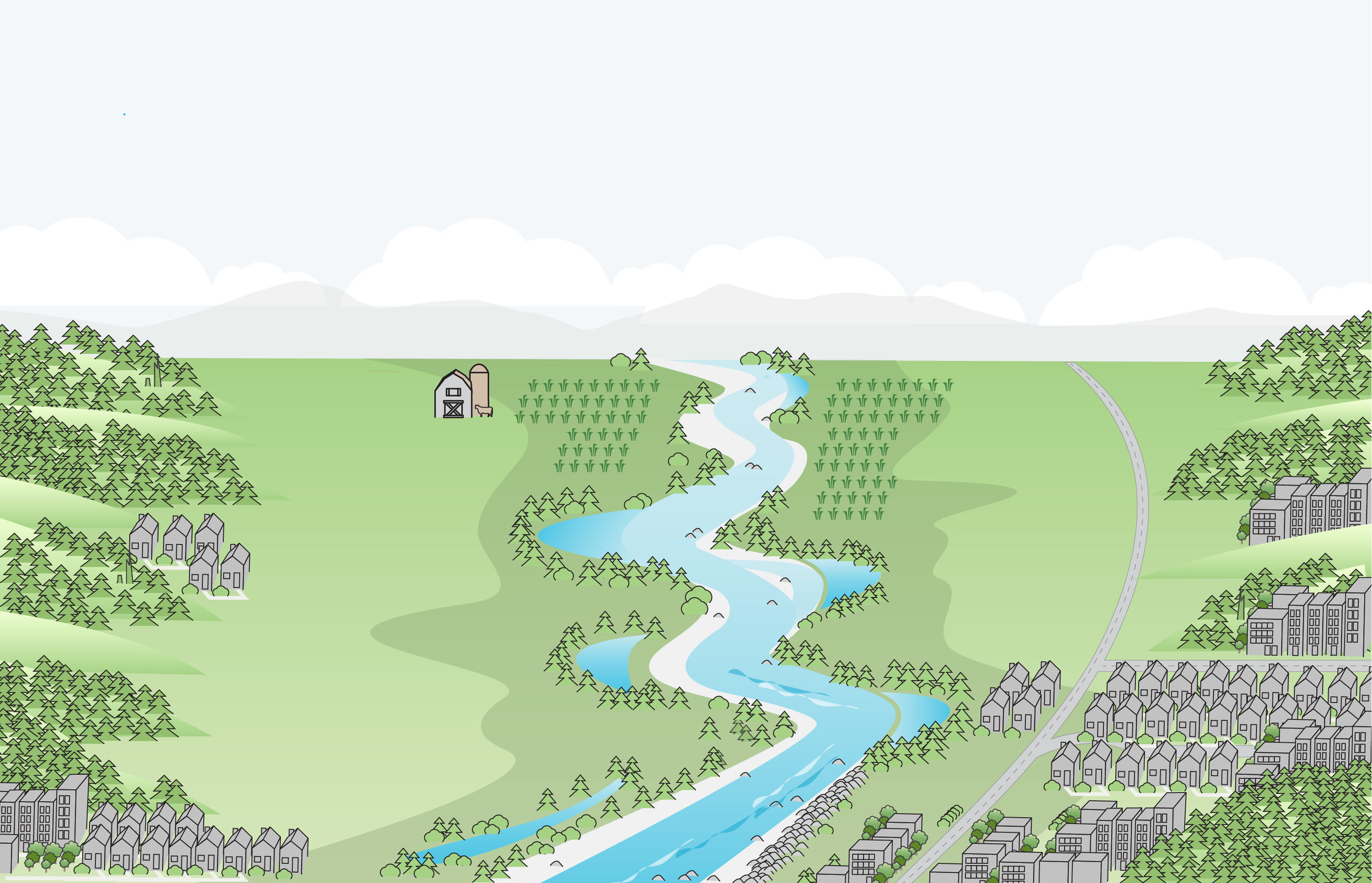
Many of us live near a river. Over time, we grow accustomed to observing its flow at various times of the year as well as the path it follows. In many cases, we simply enjoy watching the wildlife or the beautiful glossy hue a river casts in the evening light. Even through these observations, a river can seem locked in place.
In river valleys across Washington, rivers have been confined to their channels by levees and other infrastructure built up around them to prevent flooding. As such, development slowly entered these valleys and many of our homes and businesses are located within floodplains.
In contrast, through the centuries, rivers naturally flowed and meandered sinuously across their floodplains. While doing so, they created loops and arcs that today we can view from above using elevation data gathered from lasers with pulses of light called Lidar. This information can illuminate where the river once flowed and, in combination with current land-use patterns, can also illuminate future risks to those who occupy floodplains.
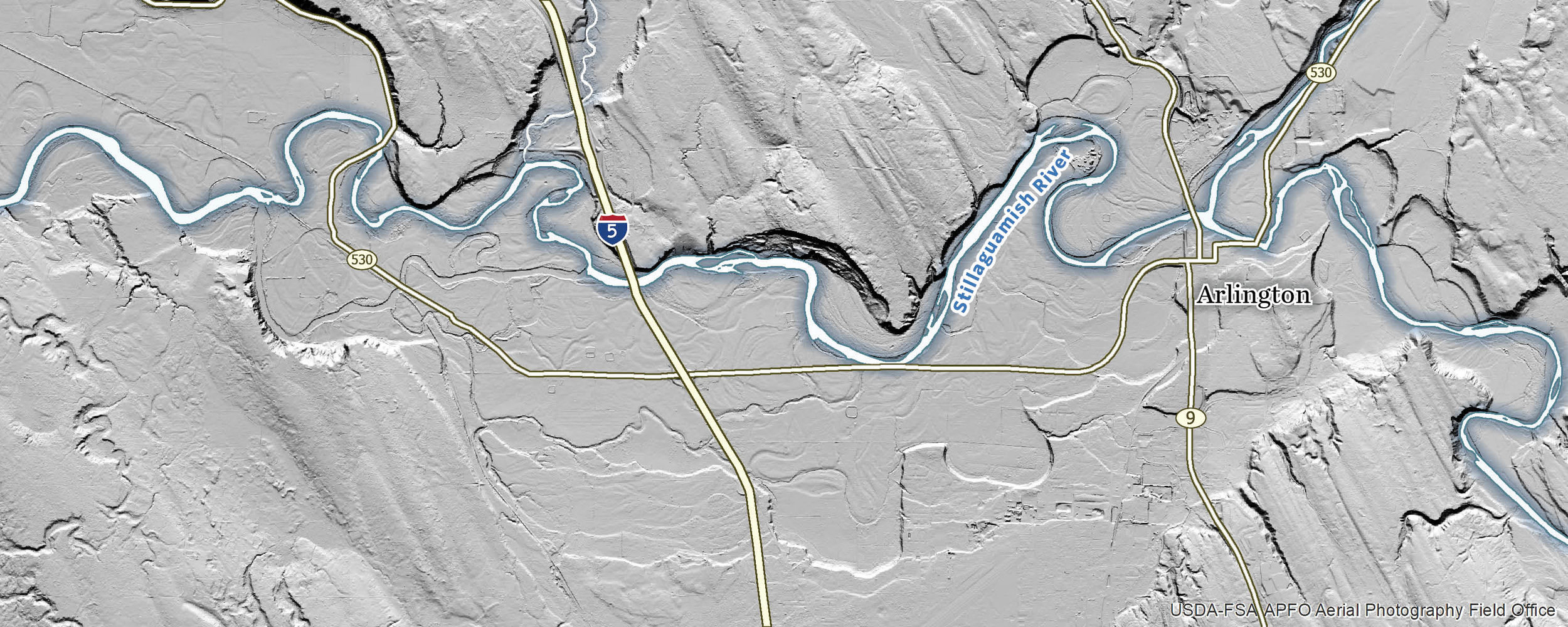
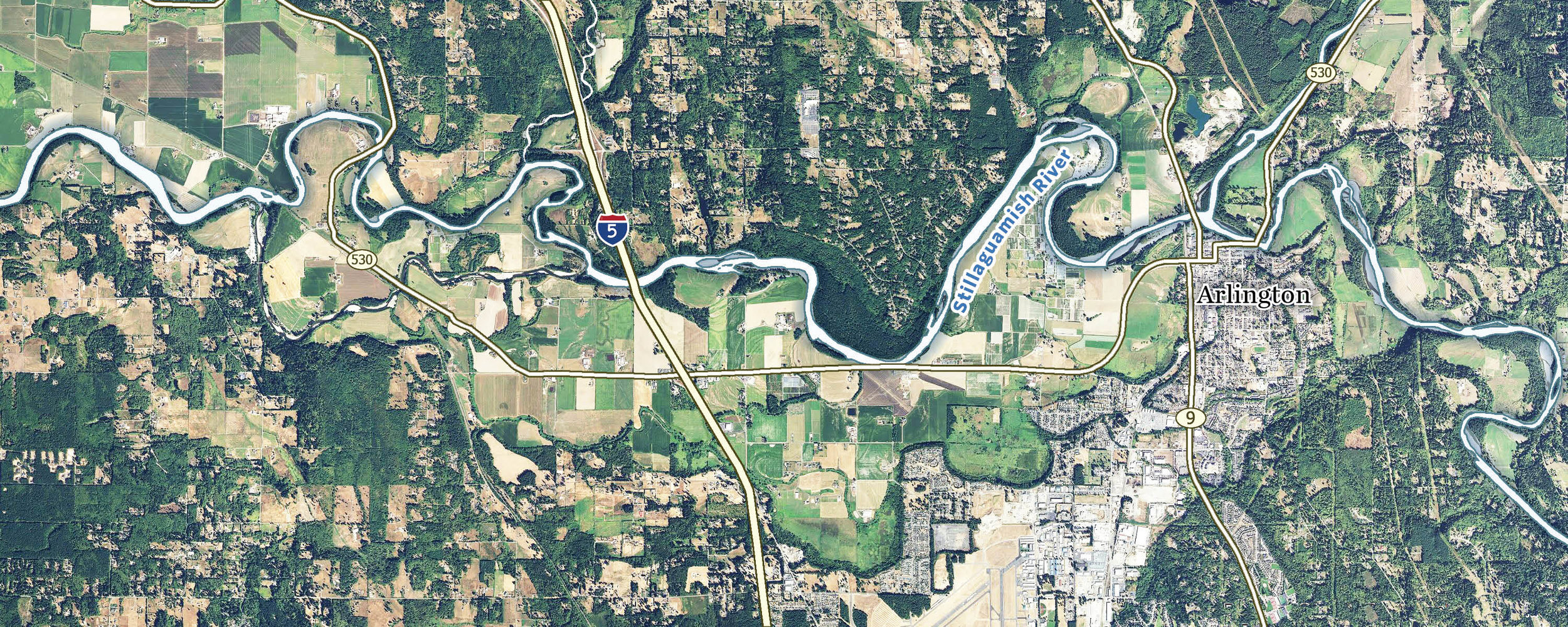
Use the slider above to compare Lidar and aerial imagery of the Stillaguamish River valley near Arlington.
In the image above, Lidar and land-use imagery are blended to illustrate the overlay of landscape features and current land use in the floodplain and surrounding area.
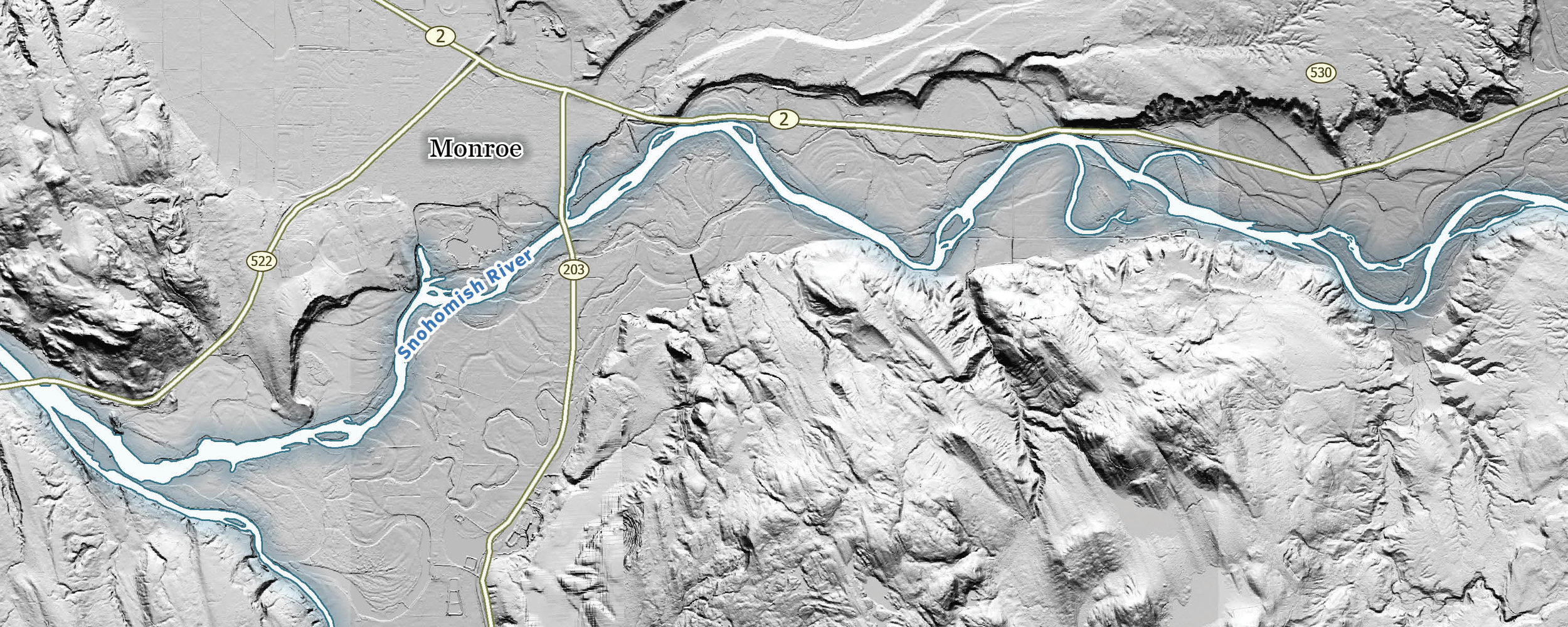
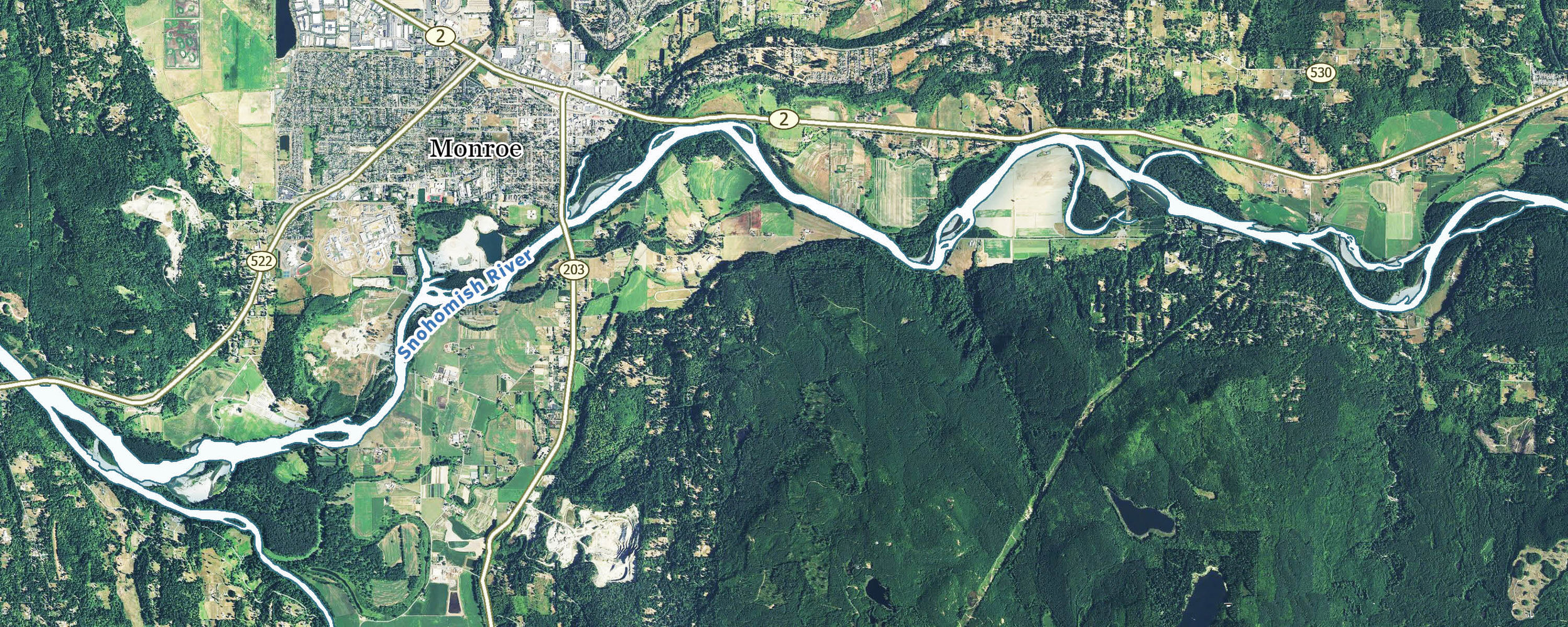
Use the slider above to compare Lidar and aerial imagery of the Snohomish River valley near Monroe.
In the image above, Lidar and land-use imagery are blended to illustrate the overlay of landscape features and current land use in the floodplain and surrounding area.
We all know the famous saying, “The only thing that is constant is change." The maps above show us how fluid rivers have been over time. Another harbinger of change is that of our climate. More severe flooding will be one of climate change’s biggest impacts in Washington state. What will become of these river valleys as flooding events become more severe? What will become of the confined paths of our rivers as sediment chokes their channels due to increased erosion in the mountains?
The Nature Conservancy is helping to protect both people and nature in floodplains today and into the future as our world continues to change. Floodplains by Design, a statewide program, is giving rivers more room to roam and enabling communities and the environment to thrive together in new and unexpected ways. We are transforming freshwater systems to support thriving rivers, salmon recovery, flood management, water quality and a healthier Puget Sound.