A transplant from Arizona reflects on dramatic weather changes back home and here in the Pacific Northwest.

Washington shellfish growers receive funding from the Supporting Oyster Aquaculture and Restoration (SOAR) program’s Shellfish Growers Resiliency Fund, investments in new and more sustainable solutions to common aquaculture practices.
Earth Day was born out of a movement to improve the lives of people and nature, inspiring sweeping legislative action and investments. Today, federal infrastructure funding and WA Climate Commitment Act are a continuation of this movement, investments making a tangible impact locally. As an example, Washington’s historic funding of the Floodplains by Design program is contributing to nature-based floodplain management across the state to reduce flood risk, protect communities and protect salmon habitat. These state and federal dollars are just the start of local climate action that will improve the daily lives and the future of all Washingtonians.
Meet DeAnne Hamilton: Learn how the general manager of Tacoma’s KBTC Public Television and TNC in Washington trustee, uses the power of storytelling to engage people in conservation and create a better future for the next generation.
Nestled in the cliffs in Moses Coulee is an import desert water sources that every springs attracts thousands of Pacific Tree frogs. I came to Whisper Lake for a night concert. It was anything but quiet. The chorus of frogs was soothing, calming—the quintessential sound of spring.
The Cle Elum Wildlife Project is improving our understanding of how wildlife use and move through protected forest landscapes, providing us with an opportunity to test how forest management practices impact wildlife and building an evidence base for permanent protection.

Written by John Lombard, Lombard Consulting
In the ten years since my book, Saving Puget Sound, came out, Floodplains by Design is the most impressive regional initiative that I have seen for Puget Sound conservation. Focusing on floodplain restoration, it is tackling one of the most important parts of the landscape for conserving Puget Sound as an ecosystem, serving as a model for how we might address other key issues, such as the Puget Sound shoreline and stormwater management. Even more impressive, while starting in Puget Sound, Floodplains by Design has quickly grown into a statewide initiative.
Taking a multi-benefit approach, Floodplains by Design recognizes that virtually by definition any major action in floodplains affects multiple interests—agriculture, salmon recovery, flood hazards (locally, downstream, and even sometimes upstream), and often a significant amount of development and infrastructure. We have traditionally funded actions in the floodplain from different pots focused on these different interests, which tends to lead to partial solutions, conflicts with the other interests, and insufficient resources to take a more holistic view—even when that holistic approach is cheapest and better for everyone in the long run.
Floodplains by Design is a model for how to approach these types of issues more effectively. It is a perfect example of a role that The Nature Conservancy can fit extremely well—facilitating a partnership that takes a creative approach to a common problem across the region and state, and attracting legislative and funding support because it offers real solutions and brings communities together.
John Lombard is the owner and principal of Lombard Consulting. He is the author of the book Saving Puget Sound which won the Haig-Brown Award for environmental writing from the North Pacific International Chapter of the American Fisheries Society.
Written by Bob Carey, Strategic Partnerships Director
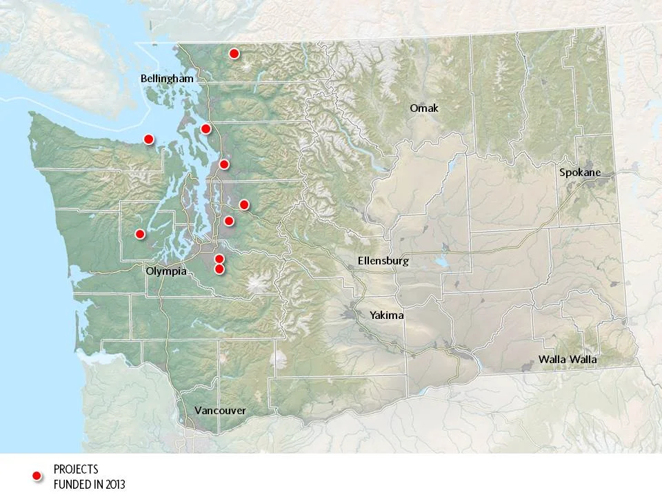
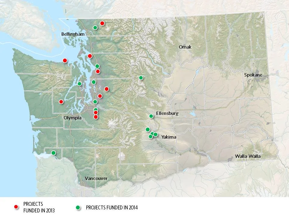
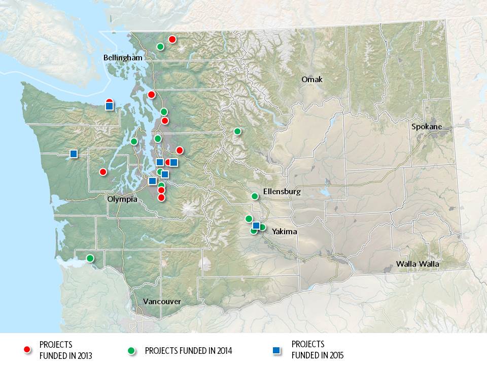
Maps by Erica Simek-Sloniker, Visual Communications
Floodplains by Design, a public-private partnership aimed at revolutionizing river management across Washington, came together in 2012 with the goal of making our communities safer and rivers healthier. It started as a concept: get the leaders of programs and interest groups that influence coastal and riverine floodplains out of their silos, have them work together to figure out how to manage these landscape in a collaborative, integrated fashion, and we’ll collectively do a better job of delivering society’s goals of reduced flooding, stronger salmon runs, clean water, economic development and a high quality of life.
Floodplain managers of various sorts – county flood managers, tribal fisheries biologists, agricultural drainage districts, conservationists, etc. – embraced the concept, having seen the folly of trying to “control rivers” and the inefficiency of trying to manage only one cog in a complex social and environmental landscape. In 4 short years the concept has evolved into a broad partnership – a “movement” in the words of one local partner. The “movement” has benefitted from strong support from the state legislature which has given $80M to the Washington Department of Ecology for the new state Floodplains by Design grant program.
Erica Simek Sloniker, Cartographer and Visual Communications specialist for The Nature Conservancy, has produced a map series that documents the evolution from concept to movement. The initial 9 Floodplains by Design demonstration projects were funded by the state legislature in 2013. 2014 brought 13 more and 2015 another 7. Earlier this year, the Department of Ecology received 56 proposals for the next round of funding – an indication of the strong interest in joining this river revolution.
Investments that recognize the role farmers have in restoring our lands will provide an all encompassing approach to reaching our climate and habitat goals.
Seven years later, and over $200 million dollars spent in Floodplains by Design alone, we are seeing a new level of resilience, creativity and impact in our floodplains across the state.
Read about how Floodplains by Design pivoted to virtual workshops and the lessons they learned.
Did you know that rivers are constantly changing, carving new paths over the years? Come along and take a trip to the Nooksack River, where you'll learn that the only constant is change
Washington state lawmakers approved groundbreaking policy and budget priorities this session, positioning our state for a more resilient future.
We caught up with Cindy Dittbrenner, Natural Resource Program Manager for the Snohomish Conservation District, to discuss why data and webmaps are so important for farmers in Snohomish County.
Imagine you’re a third-generation farmer in the Puget Sound. You’re witnessing more rain and wetter fields. How can you make decisions about the future? A new tool will help.
Explore maps that show how fluid rivers in Washington state have been over time.
The loss of another orca is a stark reminder of how sick our Puget Sound really is and the importance of river health, salmon recovery, climate change and the impacts of a fast-growing Puget Sound.
Climate change is bringing greater precipitation to Washington, with more frequent and severe storms. Healthy floodplains are a key natural solution: They absorb heavy flows, reduce flooding and temper storm surges.
The governor’s executive actions give us a unique and historic opportunity to come together as Northwesterners to save these majestic and intelligent whales
Through sideways rain as the tide rushed behind him, the tribal chairman talked about the turning point that this project represented.
Snohomish County farmers take part in advocacy after participating in a Photovoice project.
hanksgiving Day floods found many people evacuating their homes around Puget Sound and fish searching for quiet places to get away from fast-moving floodwaters.
Written by Jeanine Stewart, Volunteer writer
In the political world of environmental activism, so often the tendency is to side with one issue at all costs, destroying any and all interests that get in the way.
That’s not the case for The Nature Conservancy’s Puget Sound community relations manager Heather Cole, who joined last October. She works with communities to find environmentally sound solutions to Puget Sound major river systems.
The major question she’s tasked with? How to help communities in Puget Sound develop floodplain management visions – minimizing flood risk in areas prone to flooding while also improving ecosystem benefit, such as improving salmon habitat and water quality – that take into account the often-conflicting interests of a diverse list of stakeholders.
“Local jurisdictions, , tribes, farmers, diking districts, for example – they all have competing values for how they want to manage the same piece of land,” Cole said. “The question is, how do we integrate all those multiple values of the local community?”
Rapid population growth necessitates swift movement on these discussions. The Puget Sound region’s population will likely grow 8 percent between 2014 and 2020, and 28 percent by 2040, according to the Puget Sound Regional Council.
This puts pressure on local jurisdictions to allow more construction. Meanwhile, farmers face a daily struggle to make a living from the same land. And the region’s iconic salmon need habitat and clean water. All these needs must be balanced with those of flood safety, Cole explains.
She’s now hard at work on the first step of balancing these interests, identifying the barriers that get in the way of conservation planning by collaborating with all the parties involved, including local leaders.
Working through conflicting interests to find common ground is Cole’s specialty. She brings nearly a decade of experience working for the state of Washington on natural resource issues, doing research, planning and community development. She also received a master’s in international development and environmental analysis in Australia.
Cole sees each group’s interests as a key piece of the puzzle rather than barriers to a tunnel-vision view of the solution.
“Coming from a natural resources perspective and working in the natural resources field for a number of years, you come to realize that these issues can’t be solved with a technical silver bullet,” Cole said. “We have to understand the people landscape. People are part of the problem, and they are part of the solution.”
This simple and clear-headed approach is a calming reprieve from the complex and lofty goals Cole has her eyes on.
Asked to summarize her work, she says it focuses on “integrated floodplain management where local groups can find agreement on strategies and actions for our rivers that have multiple benefits, such as improving flood safety, agriculture preservation and restoring floodplain connections that support endangered species like salmon; while also bringing in climate change information so that we are making wise investments today that will survive in a changing climate fifty to a hundred years from now.”
Written by Robin Stanton, Media Relations Manager
Photographs by Chris Hilton, Grant Fundraising Director
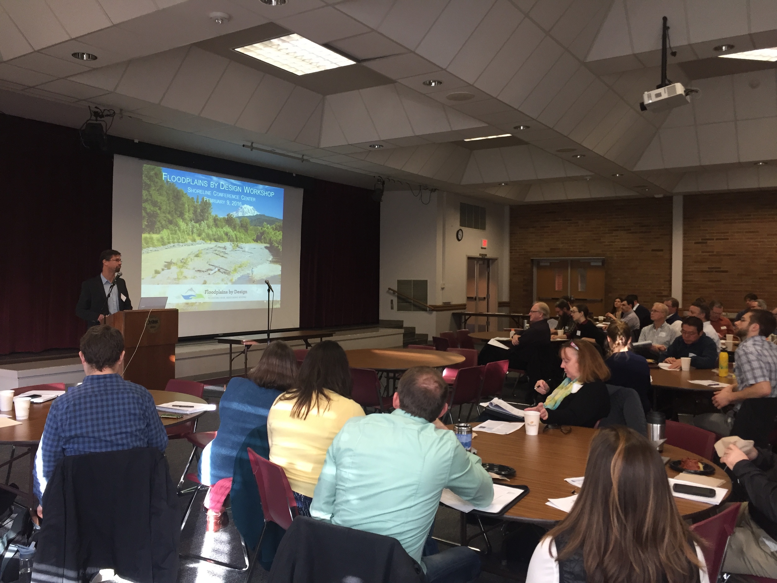
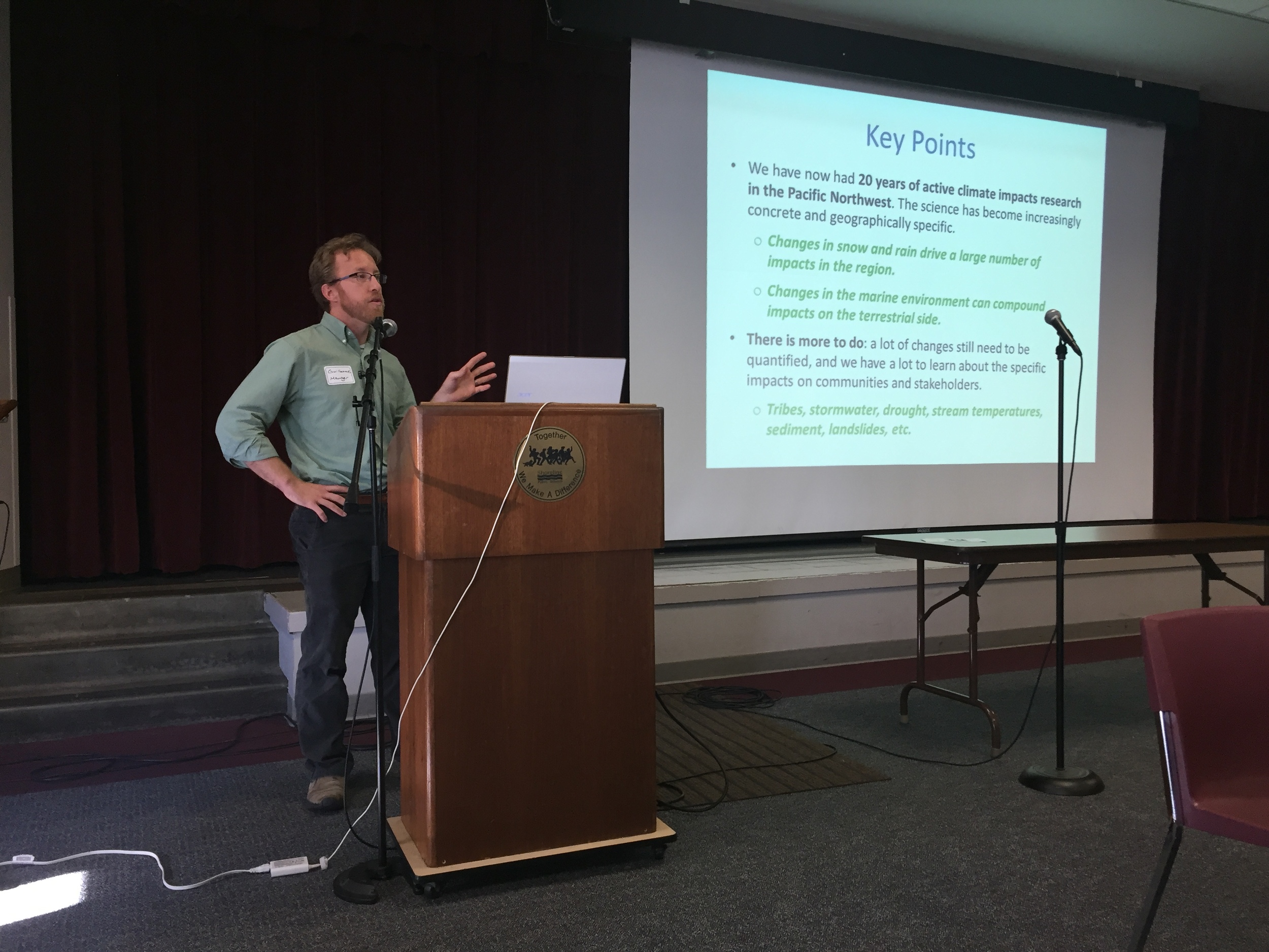
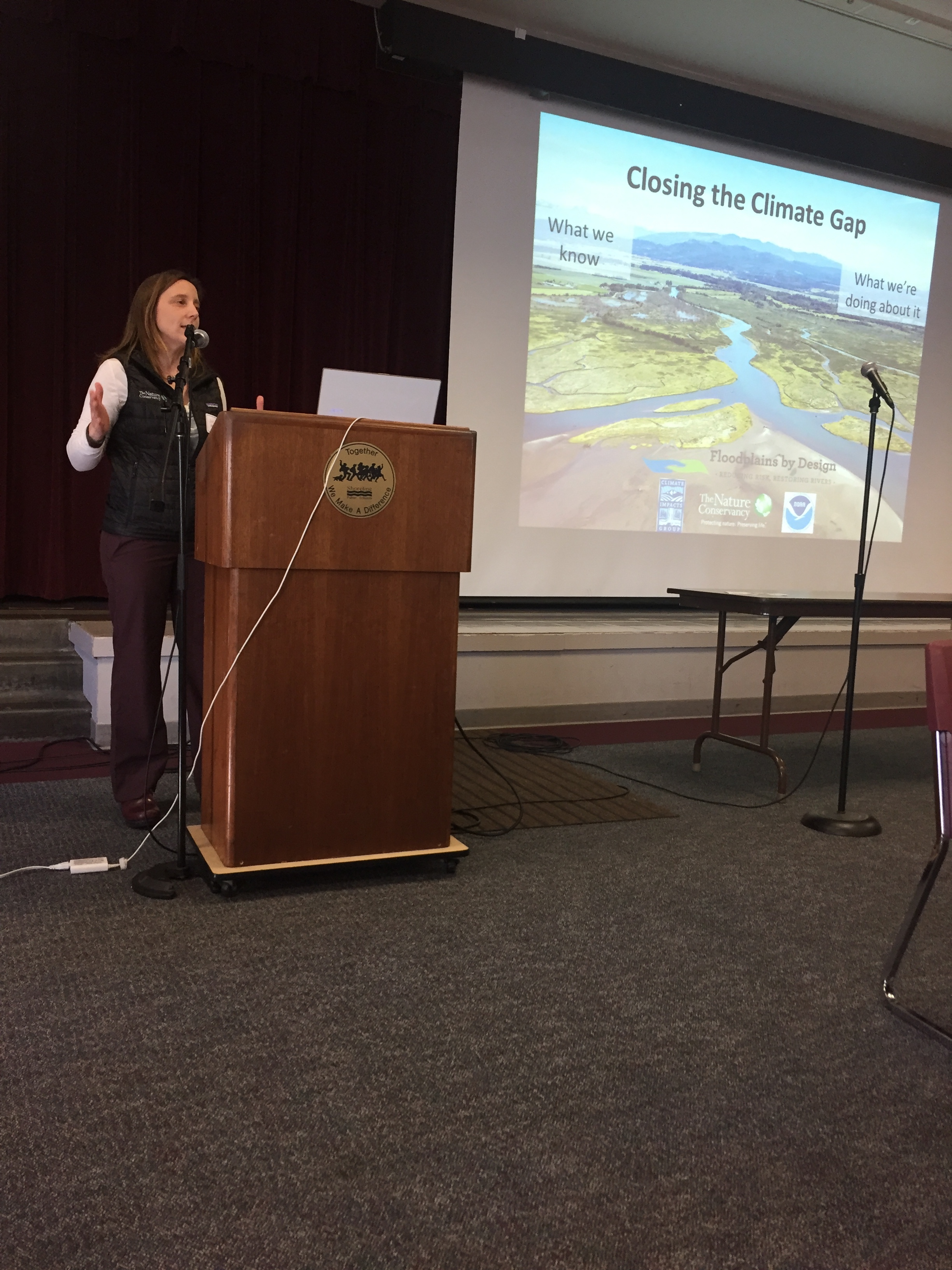
Floodplain leaders from around the Puget Sound region gathered today for a workshop on advancing floodplain restoration, including a new focus on integrating climate change data.
“There’s a big gap between what we know and what we’re doing about it,” says Julie Morse, the Conservancy’s regional ecologist.
“It’s not unique to Puget Sound, we find it all over the country.”
At today’s workshop, floodplain leaders will begin to develop strategies for including climate impacts into the work they’re already doing.
The Conservancy has been working with the University of Washington Climate Impacts Group to take its recent Puget Sound Climate Synthesis Report and turn it into information that is really useful to city, county and state leaders grappling with these issues on the ground. Today’s workshop is a chance for floodplain leaders to work hands on with this information.
Written by Kris Johnson, Senior Scientist, The Nature Conservancy
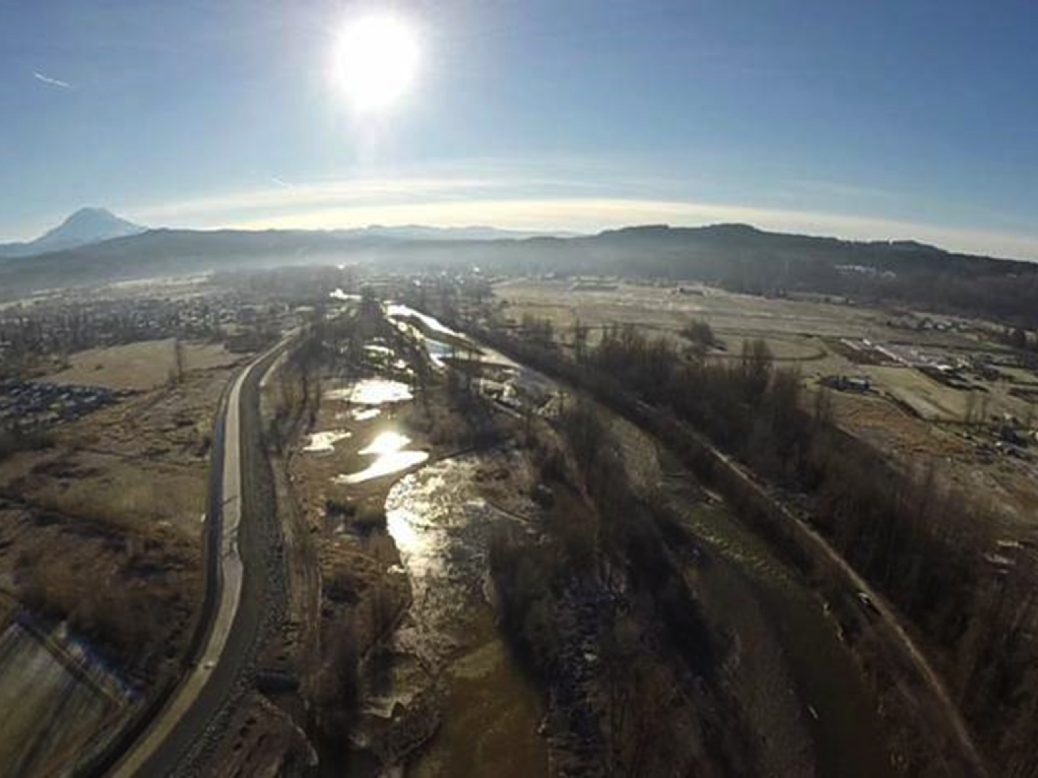
Flooding is increasingly becoming a fact of life along the Snohomish River. In early December the severe flooding in the cities of Snohomish and Monroe inundated homes and farms and closed roads and a city park. For residents in the area it was déjà vu all over again, as just weeks before some of the same areas experienced a separate major flooding event. Clearly, managing flood risk along the Snohomish, and throughout western Washington, is challenging yet essential to the lives and livelihoods of millions of people.
And climate change is compounding this problem: warmer temperatures are leading to sea level rise and higher tides, and more winter precipitation is falling as rain rather than snow, causing flashier flows in the rivers. Understanding how flood risk is changing and incorporating best-available information into planning and decision-making is crucial for communities in Puget Sound.
With this in mind the Nature Conservancy led a recent pilot project to both evaluate how climate change might impact flooding and then provide this information to local decision-makers. In partnership with the University of Washington Climate Impacts Group and West Engineering we assessed how varying scenarios of climate change could alter flooding in the Lower Snohomish River and cause potentially greater impact to farms and buildings and infrastructure.
This analysis suggested that in just a few decades what is currently considered a “100-year” flood could be much more severe and could inundate part of I-5 near Everett and cause nearly 20% more costly property losses (see image).
To make this information useful and readily available we created new Floodplains by Design ‘app’ on the Coastal Resilience decision support tool so that local partners with the Sustainable Lands Strategy in Snohomish County could integrate maps and images of potential flooding into their project planning and decision-making process.
Managing increasing flood risk while sustaining high-value agriculture and also restoring salmon populations and protecting the environment will be a major challenge in Puget Sound in the 21st century. Rigorous science and sophisticated tools, like those developed by The Nature Conservancy for the Lower Snohomish River, can provide local communities with the best-available information that can help them plan accordingly.
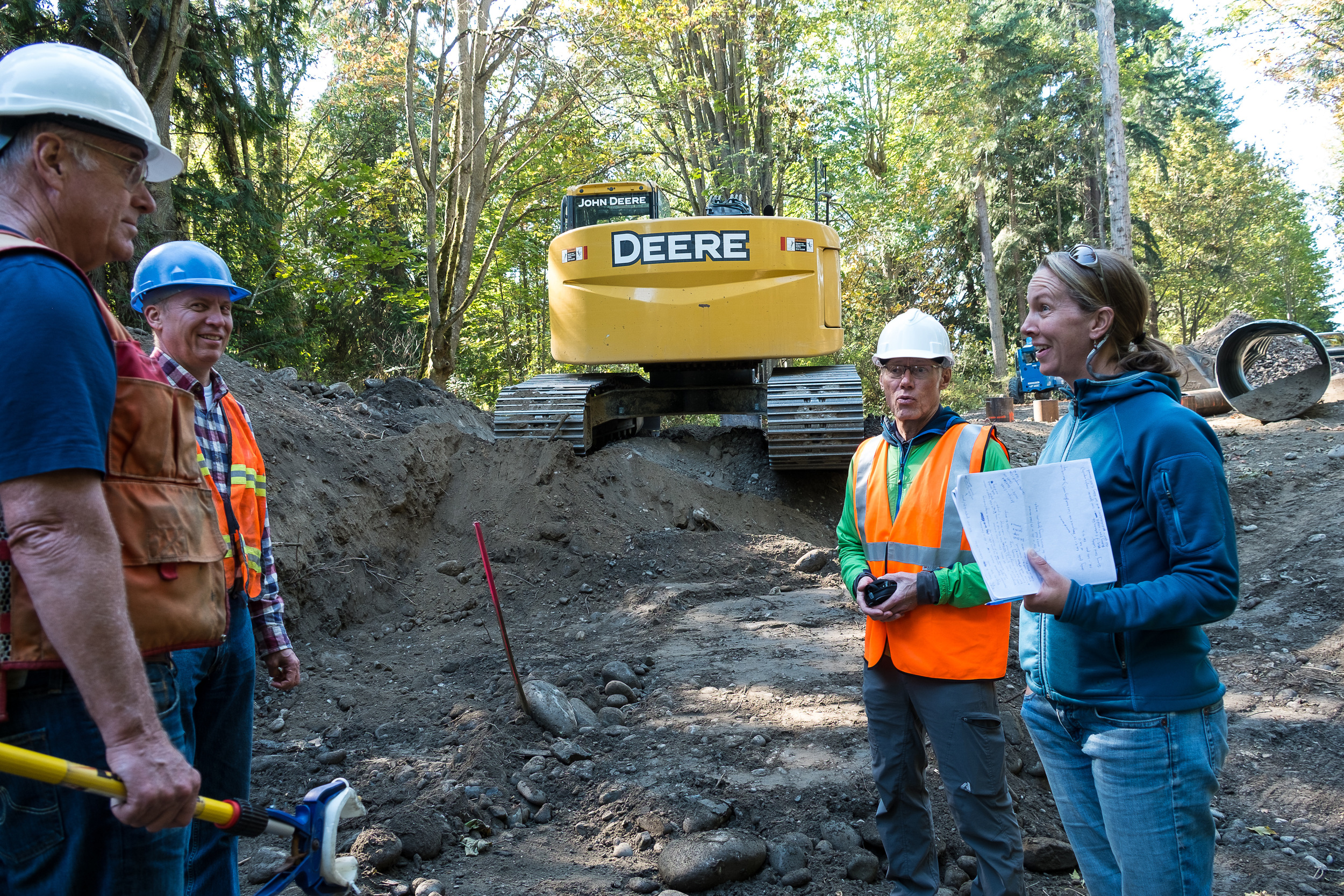
Written and Photographed by Randy Johnson, Habitat program manager, Jamestown S’Klallam Tribe
Aerial Photographs provided by John Gussman
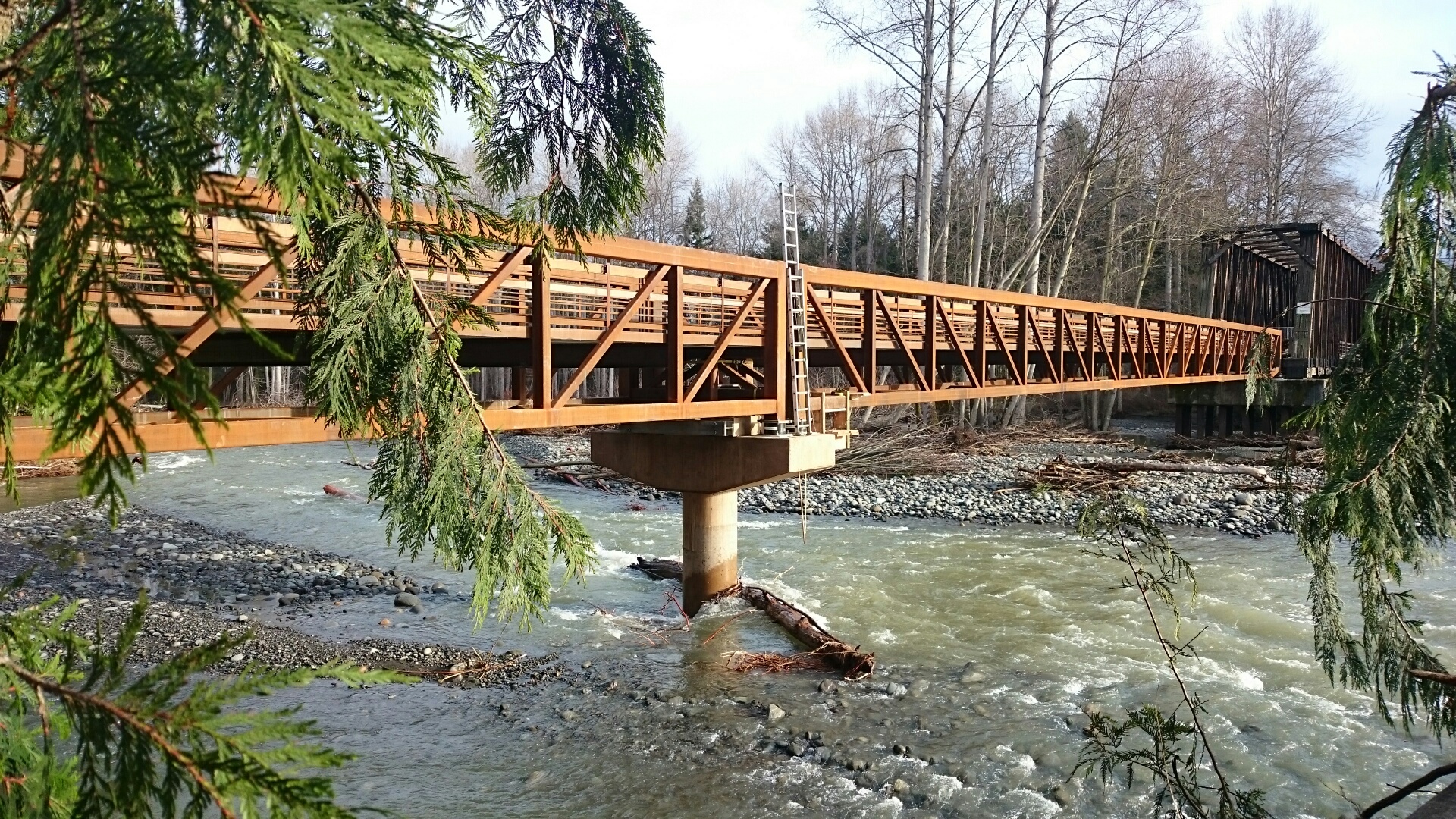
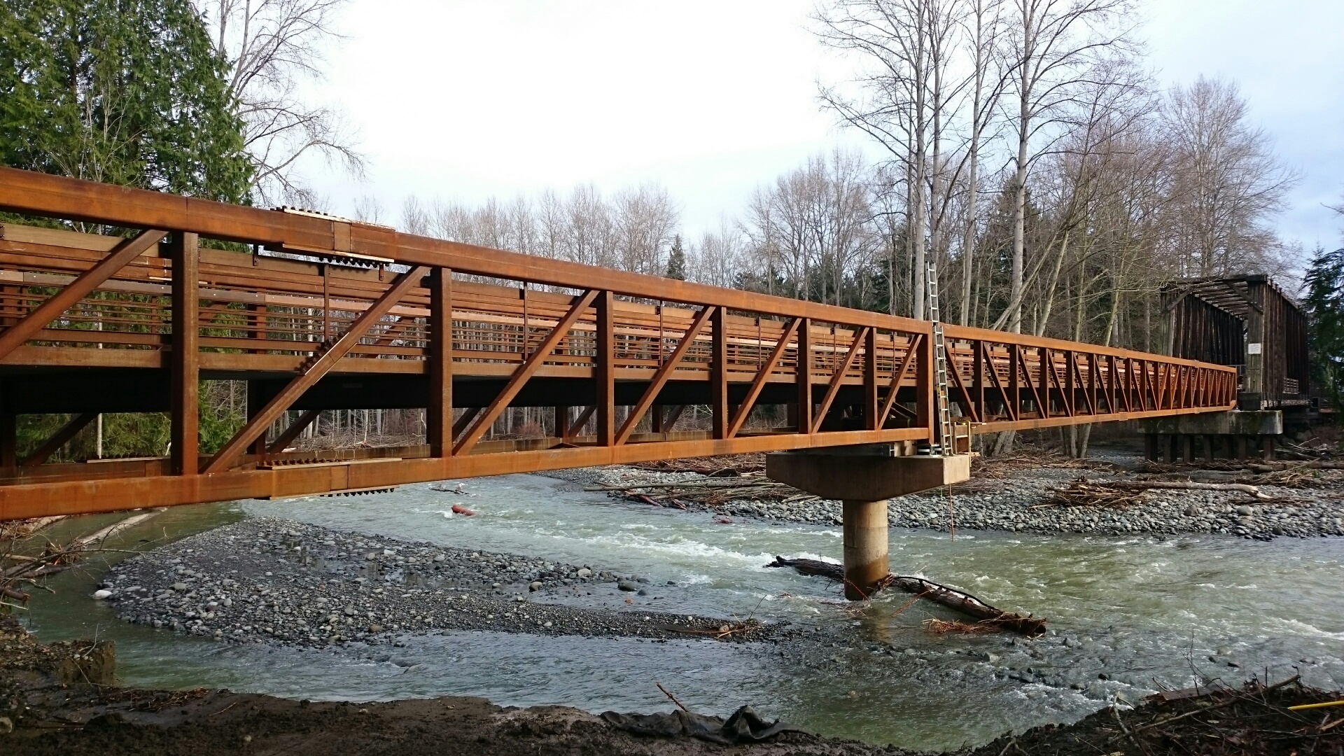
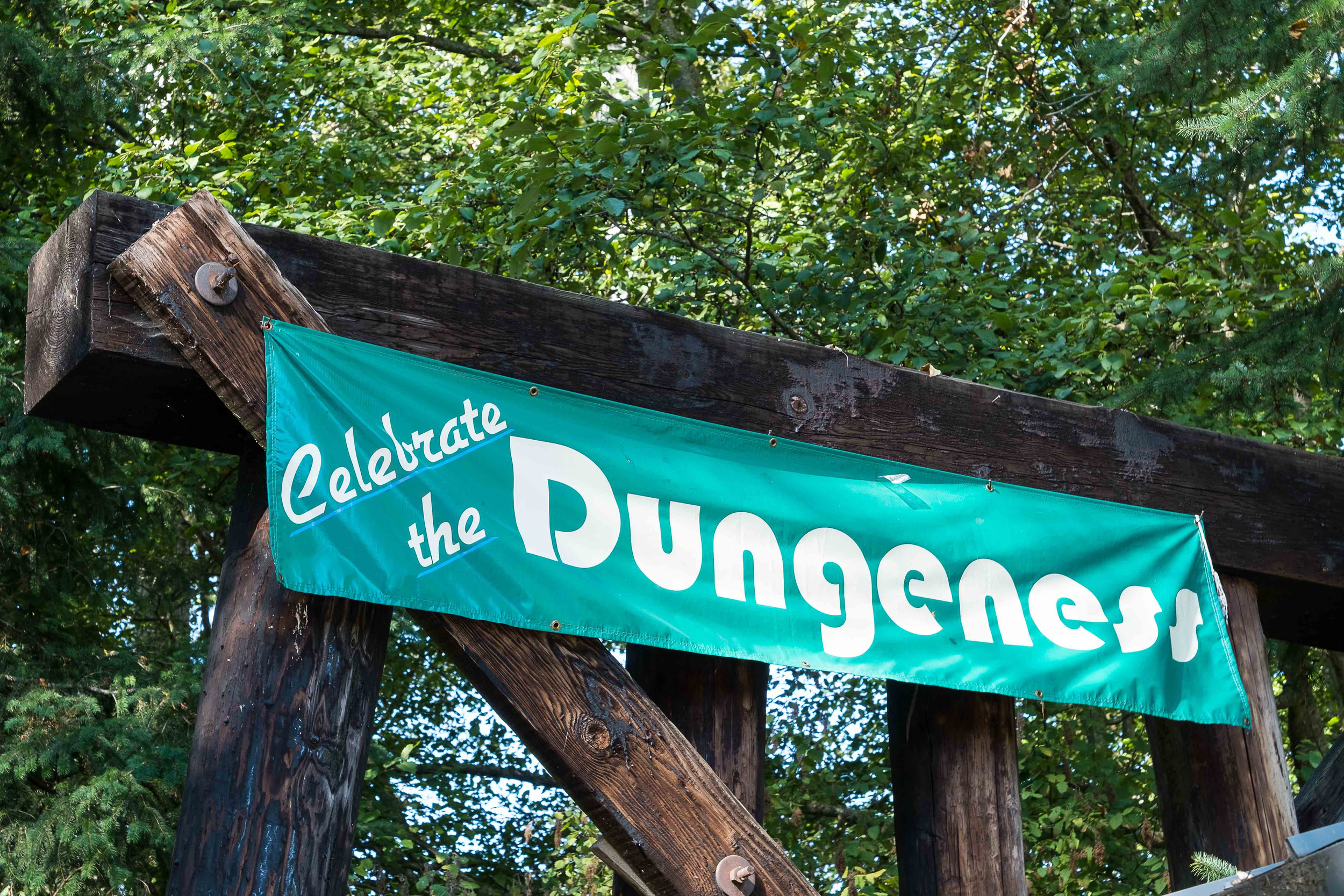
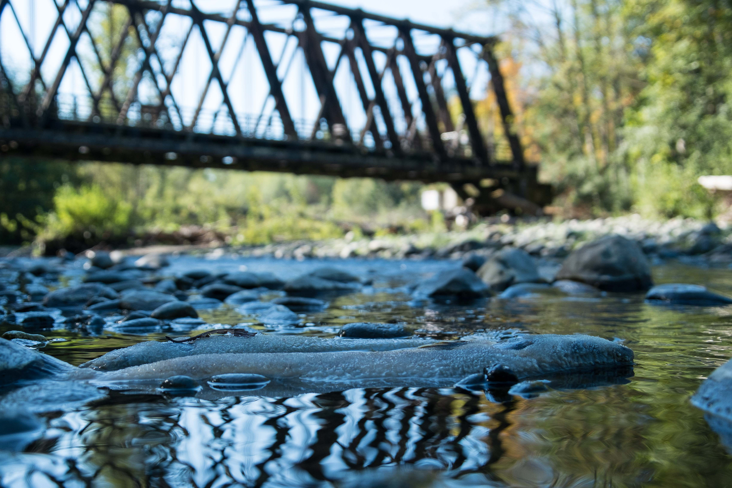
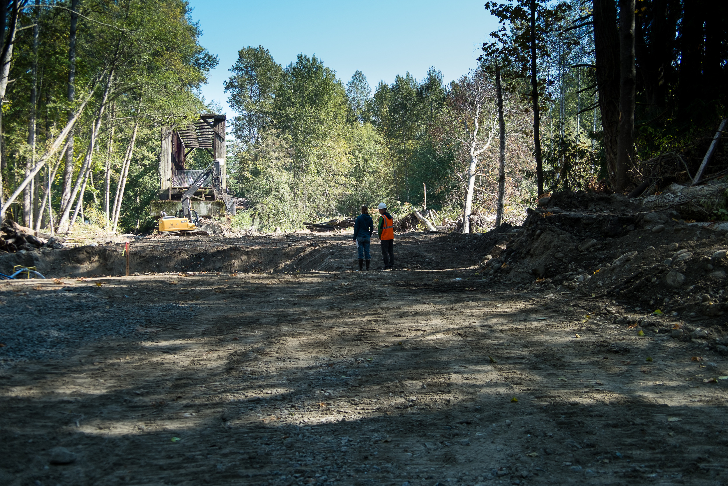
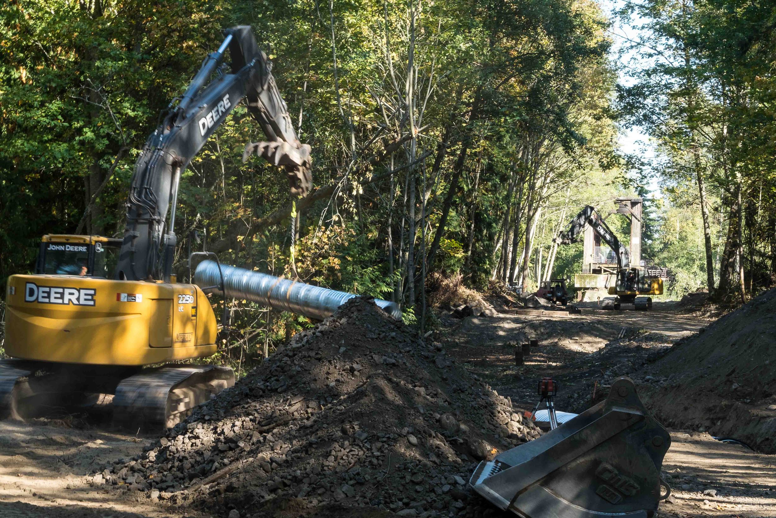
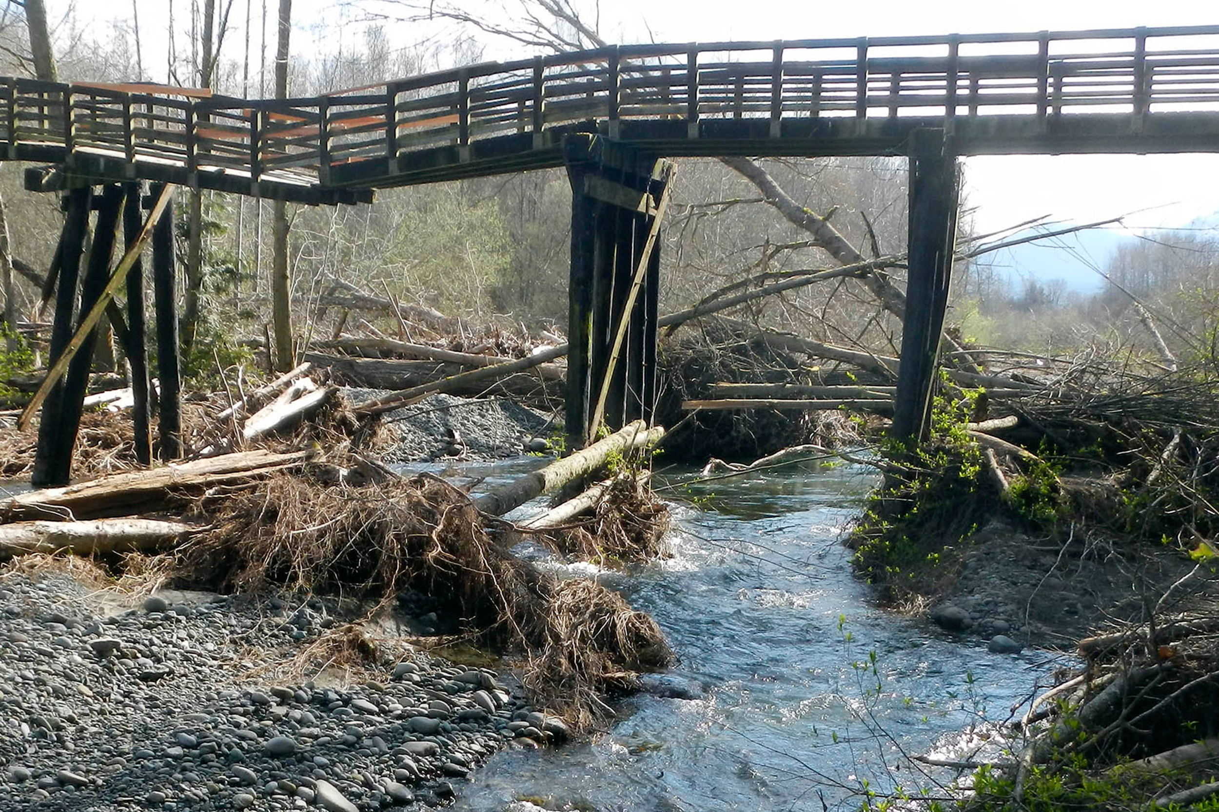
Since the first of February 2015, four floods have rumbled down the Dungeness River. The first one damaged the old creosoted RR trestle and closed the Olympic Discovery Trail (ODT). The three floods in the past six weeks have occurred while we've been building the new pedestrian bridge that will replace the trestle. During the floods, the river has migrated 230 feet west. Had the trestle not been removed, at least 15 pile bents - 75 creosoted piling, creosoted timbers, and bridge decking - would have been knocked down and strewn all the way from the Dungeness River RR Park to Dungeness Bay.
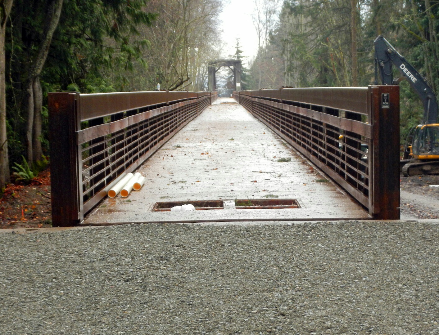
It was a given that the Tribe would replace the trestle's functions for users of the Olympic Discovery Trail. 10 Months and 2 days later, the entire 585' of trestle and its dripping creosote are gone from the floodplain forever and 720 feet of salmon friendly and river worthy pedestrian bridge is connected to the ODT. All 750 feet of new bridge are now in place, and just a few relatively minor tasks remain. The construction access road is being removed, and by the end of today both floodplain channels will be flowing free again. You can look forward to the ODT being reopened soon.
Floodplains by Design funding was a perfect fit for this project because of the program’s focus on reconnecting rivers to their floodplains for fish and flood risk reduction, and the additional community benefit of recreational access.
Thank you everyone for your role in making this bold vision a reality.
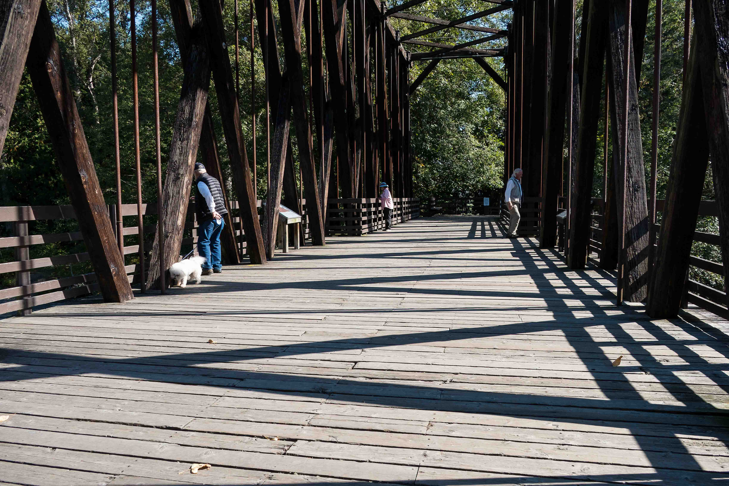
Over 100,000 people utilize the Olympic Discovery Trail every year. A portion of the bridge is still open during construction this fall.
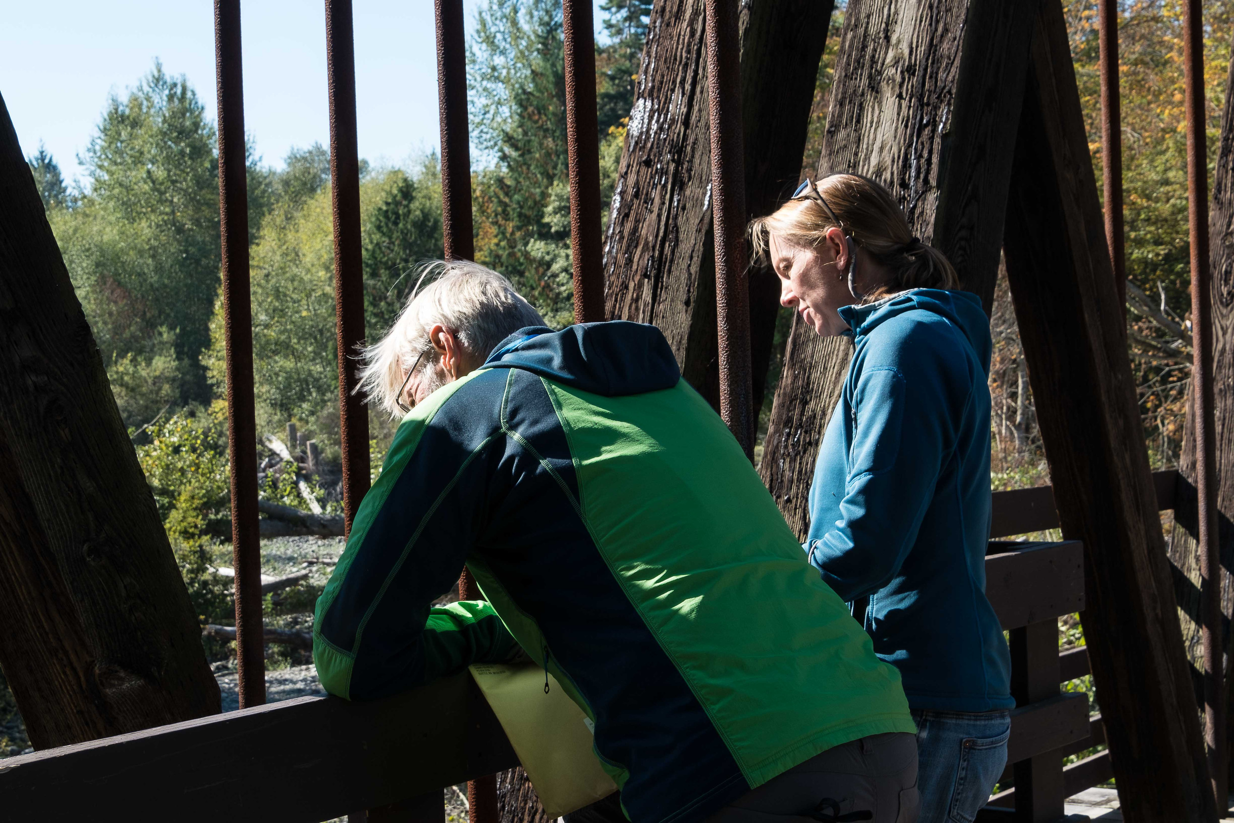
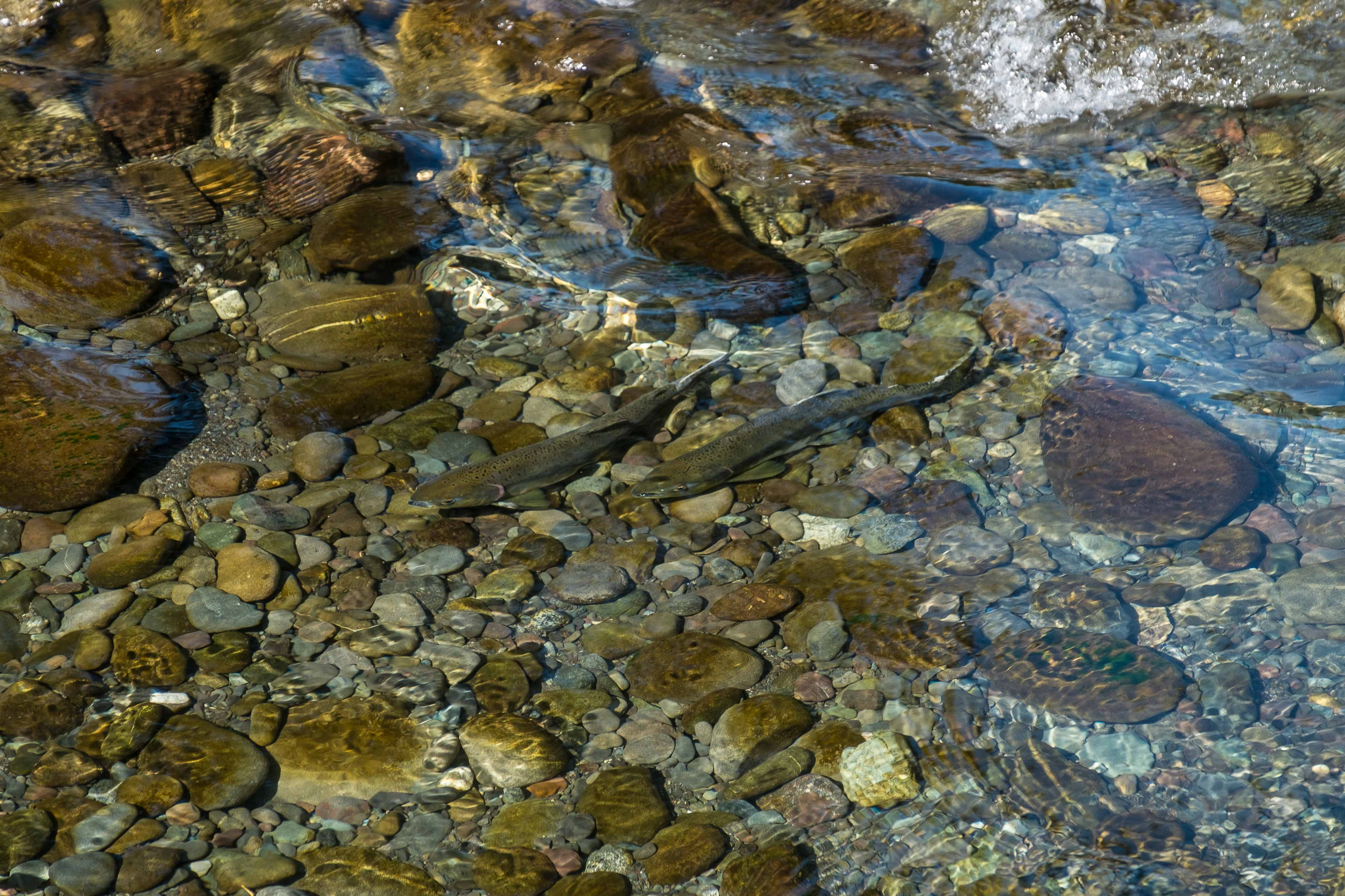
Randy Johnson, Habitat Program Manager with the Jamestown S’Klallam Tribe, and Jenny Baker, Senior Restoration Manager for The Nature Conservancy watch salmon swimming upstream below the trestle bridge.
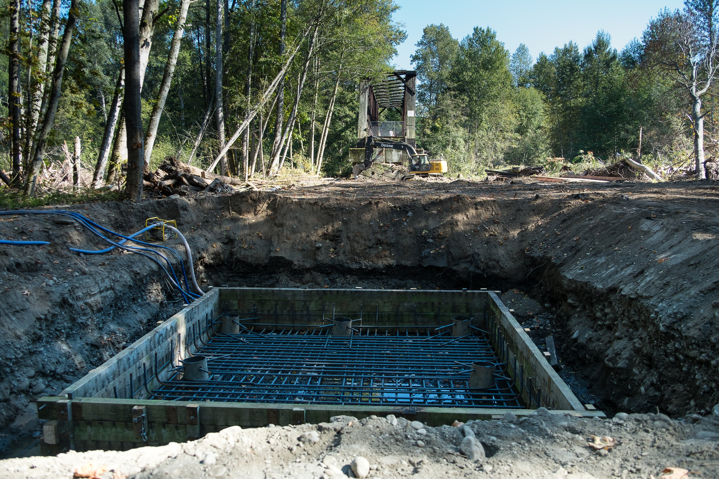
New support beams are being constructed which will increase the span of trestle supports from 16 feet apart, to 180 feet, between supports.
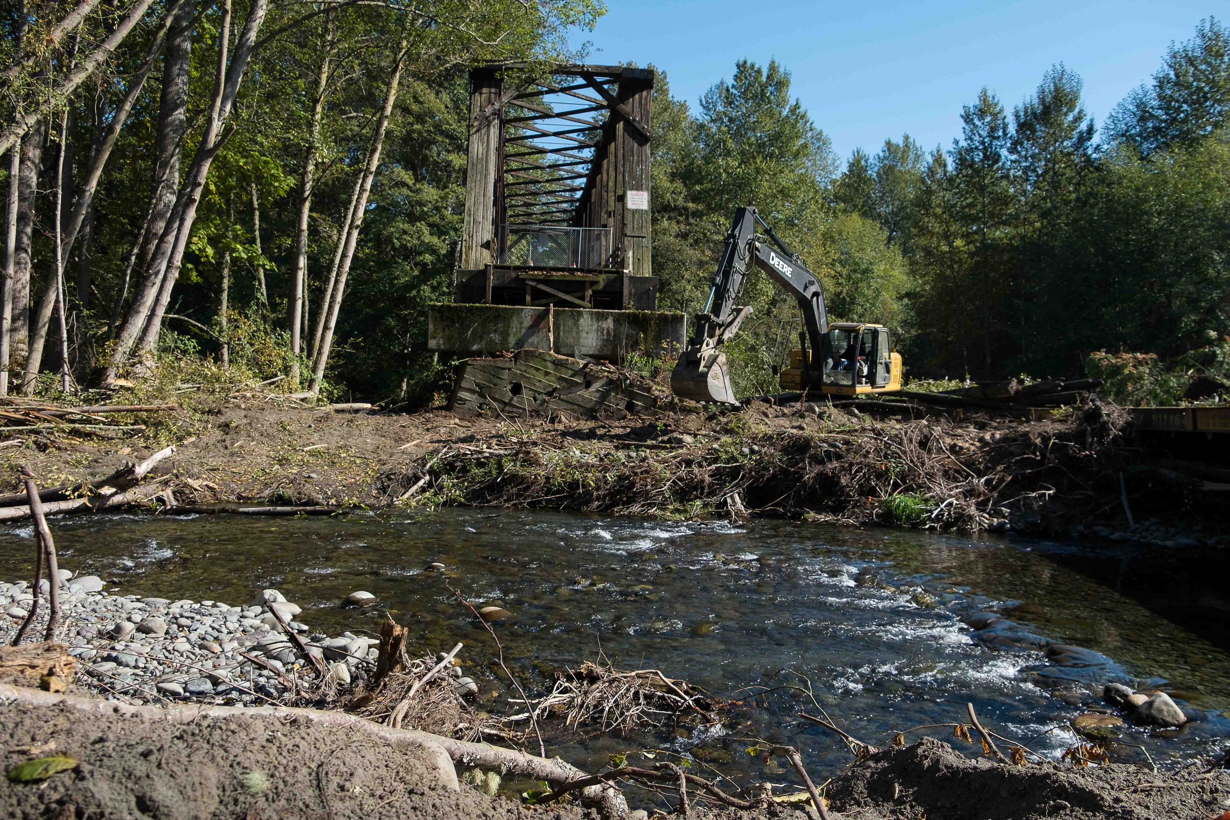
Creosote from pilings drips into floodplain below the trestle. The project will replace pilings with new concrete piers.

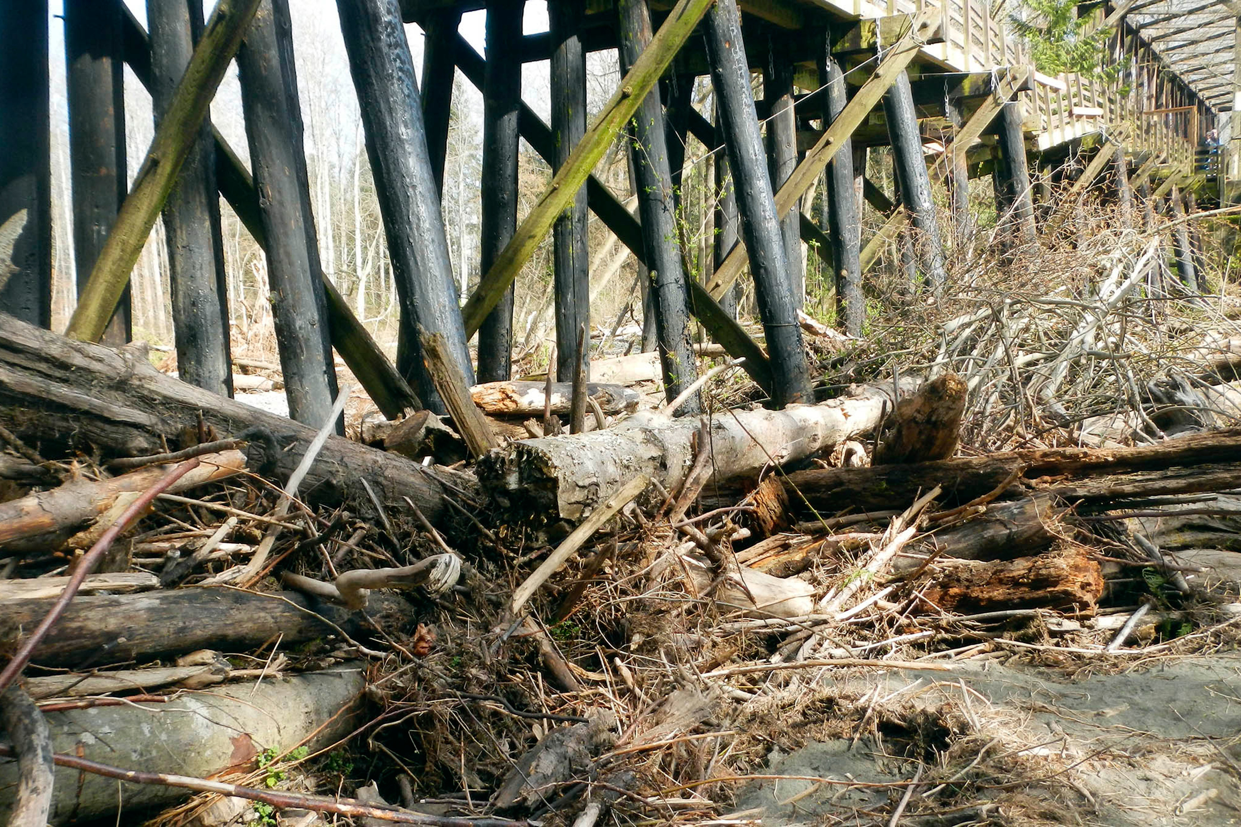
The damaged section of the trestle earlier this year, prior to restoration. The piling structures every 16 feet caused a major blockage on the river, wracking up wood and impeding flow. © Randy Johnson
© Randy Johnson
Written by Jenny Baker, Senior Restoration Manager, and Photographed by Julie Morse, Regional Ecologist
When a popular recreational trail on the Olympic Peninsula was damaged by a flood and closed last February, there were two options: either 1) fix the trail for walkers and bikers, or 2) fix the trail for walkers and bikers AND do it in a way that improved fish habitat and reduced flood risk. The choice was obvious: build a project with many positive outcomes.
The Olympic Discovery Trail is a rails-to-trails system that currently extends from Discovery Bay to Port Angeles and receives 100,000 visits per year. When a portion of the trail over the Dungeness River near Sequim was damaged, walkers and bikers were anxious to get it fixed quickly. Randy Johnson, Habitat Program Manager with the Jamestown S’Klallam Tribe, saw a great opportunity for a win-win-win project, but he had to act fast to make sure the project could incorporate benefits to fish and flooding, and get the trail back in use.
The damaged section was part of a 585-foot-long trestle supported by creosote pile structures every 16 feet across the floodplain. Fill had been placed across an additional 165 feet of floodplain to meet the pile-supported trestle. These structures caused a major blockage, wracking up wood, blocking flood flows and requiring that the river be “trained” to go under a bridge. This essentially forced the river into one place and cut it off from the floodplain. Healthy rivers move around in their floodplains, creating vital habitat for fish, storing floodwater and keeping people nearby safe. These processes had been severely limited by the trestle and fill.
Because the project had several positive outcomes and support from various stakeholders, it moved forward quickly. Using funding from Floodplains by Design, Salmon Recovery Funding Board, Bureau of Indian Affairs Climate Adaptation fund and other sources, the design was completed, permits were obtained and construction was underway before the end of August. By early October, the old pilings had been removed and new footings to support a just a few concrete posts - 180 feet apart instead of 16 feet apart - were being constructed.
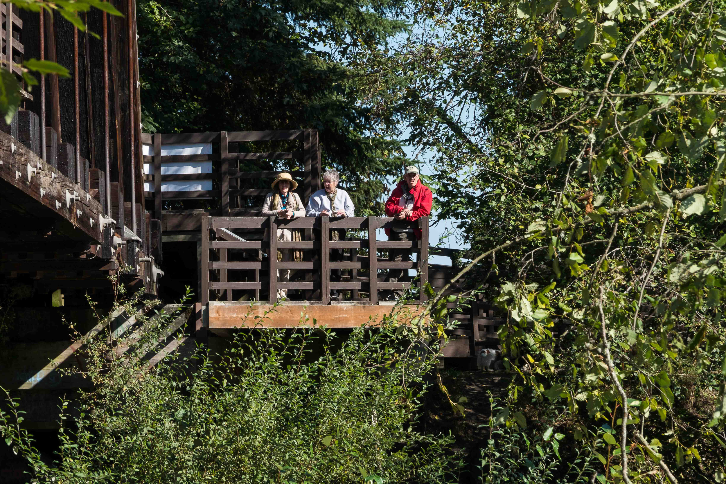
By December 2015 the reconstructed trail will be completed, allowing the river access to an additional 750-foot-wide floodplain. Recreational trail users will be able to get back on the trail. Viewing platforms will allow groups of students and birders to gather out of the way of walkers and bikers, and take in the river and its wilder inhabitants.
This year there has been a large number of pink salmon returning to the Dungeness River to spawn. When we toured the project site in early October, the river was alive with fish hovering over their redds. As an avid biker myself, I love that there are trails like this where I can look down and see salmon spawning.
The Olympic peninsula provides critical habitat for several species of threatened salmon. The last few years have seen some big restoration projects completed, between JimmyComeLately, the Elwha River Dam removals, and now several projects along the Dungeness River and estuary. It’s inspiring to see the impact these big projects are having on restoring salmon habitat.
Written by Jenny Baker, Senior Restoration Manager and Bob Carey, Director of Strategic Partnerships
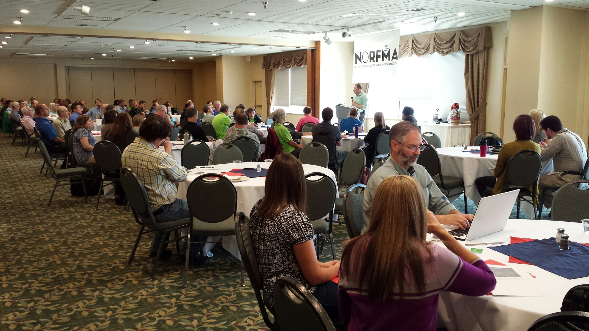
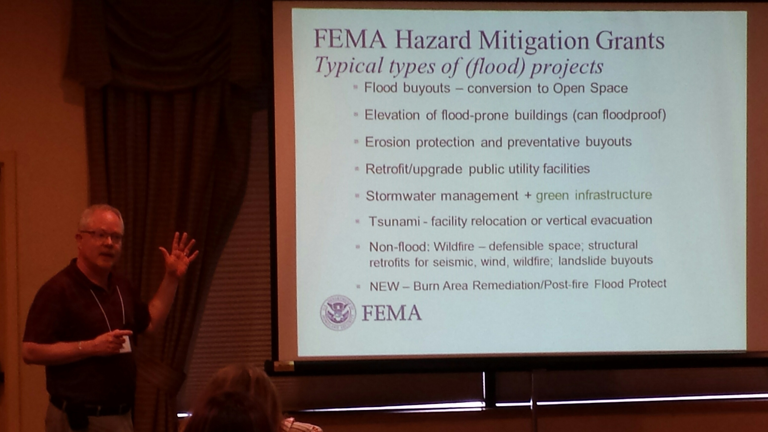
At a recent Northwest Regional Floodplain Management Association conference, there was lots of talk not just about flooding and how to keep people reasonably safe in floodplains (the charge of floodplain managers), but also about habitat for salmon and other fish and wildlife. This is a sea change. In many places today, and in this region just a few years back, floodplain management conferences largely entailed presentations and conversations about reducing flooding through engineering and regulations. Conversations about fish, wildlife, clean water and recreation occurred at different gatherings by different people – even though they were talking about the same rivers and coasts.
Today, to the Northwest is leading the nation in developing a more holistic and sustainable approach to managing our waterways. The idea that floodplains provide a multitude of benefits to people and nature is being incorporated in planning and projects by floodplain managers in cities and counties, state agencies and the feds around the northwest. In addition to a keynote by our own Bob Carey on the Washington Floodplains by Design Initiative, there were sessions on levee setbacks and floodplain restoration, and folks mentioned habitat restoration, green infrastructure and salmon in their presentations. Throughout the conference, presenters and audience members often referred to Floodplains by Design and the work of the Conservancy in Washington State. We’re excited to see the momentum building at multiple levels for plans and projects that have tangible, long-lasting outcomes for nature and people.