


Legislators in the state Senate must pass HB 1099 in order for Washington to build a climate resilient future and drastically reduce our carbon footprint that’s exacerbating the climate crisis.

Earth Day was born out of a movement to improve the lives of people and nature, inspiring sweeping legislative action and investments. Today, federal infrastructure funding and WA Climate Commitment Act are a continuation of this movement, investments making a tangible impact locally. As an example, Washington’s historic funding of the Floodplains by Design program is contributing to nature-based floodplain management across the state to reduce flood risk, protect communities and protect salmon habitat. These state and federal dollars are just the start of local climate action that will improve the daily lives and the future of all Washingtonians.
Meet DeAnne Hamilton: Learn how the general manager of Tacoma’s KBTC Public Television and TNC in Washington trustee, uses the power of storytelling to engage people in conservation and create a better future for the next generation.
Nestled in the cliffs in Moses Coulee is an import desert water sources that every springs attracts thousands of Pacific Tree frogs. I came to Whisper Lake for a night concert. It was anything but quiet. The chorus of frogs was soothing, calming—the quintessential sound of spring.
The Cle Elum Wildlife Project is improving our understanding of how wildlife use and move through protected forest landscapes, providing us with an opportunity to test how forest management practices impact wildlife and building an evidence base for permanent protection.
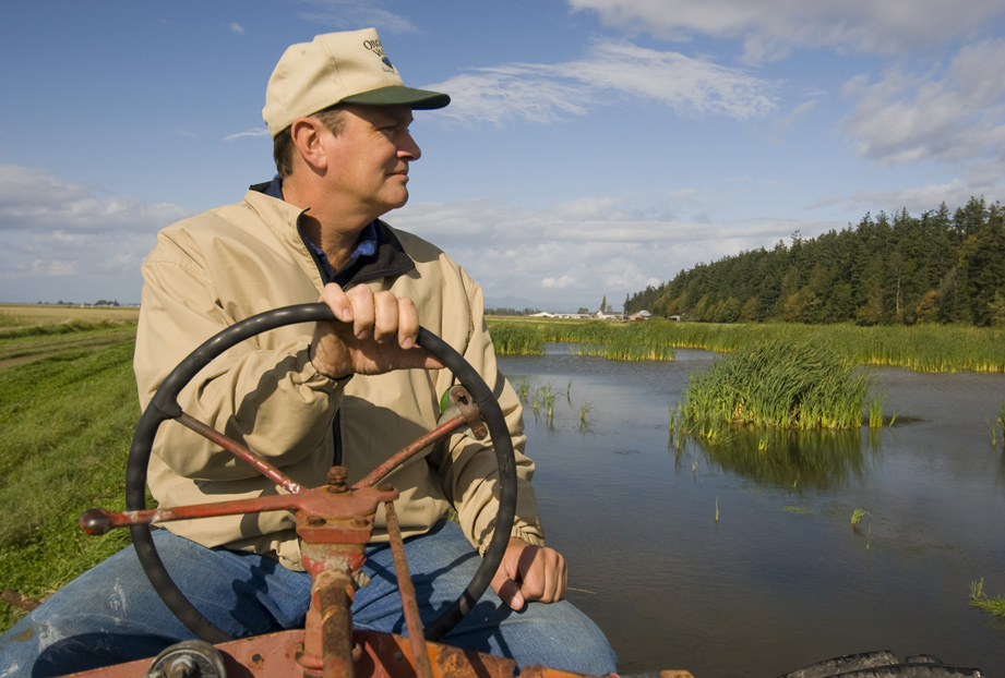
Written by Kris Johnson, Senior Scientist, The Nature Conservancy
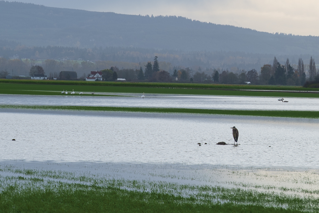
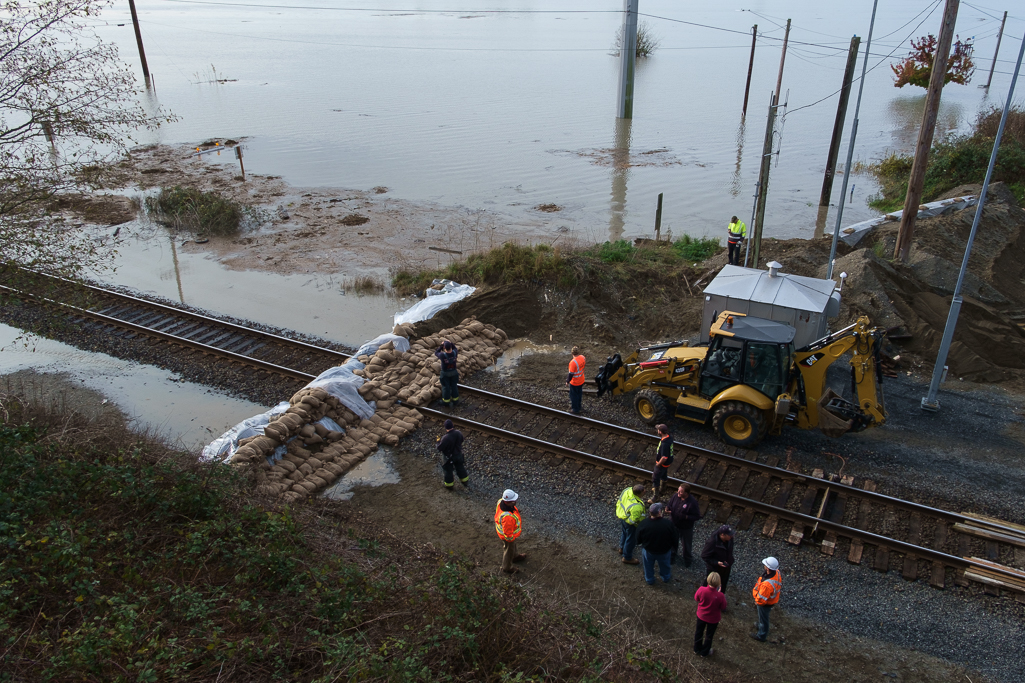
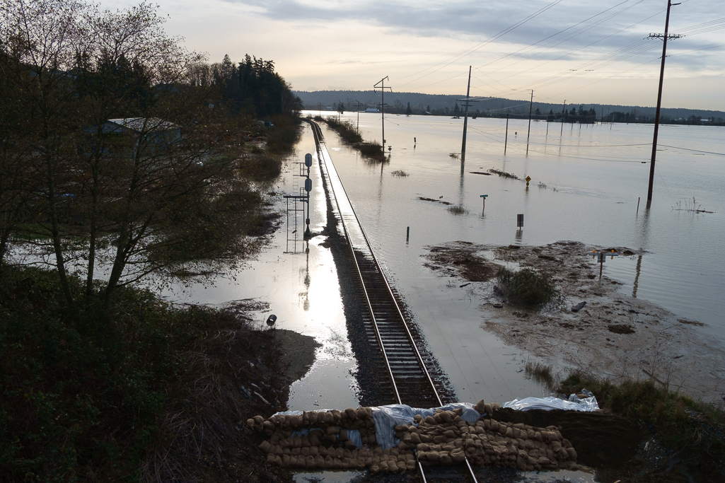
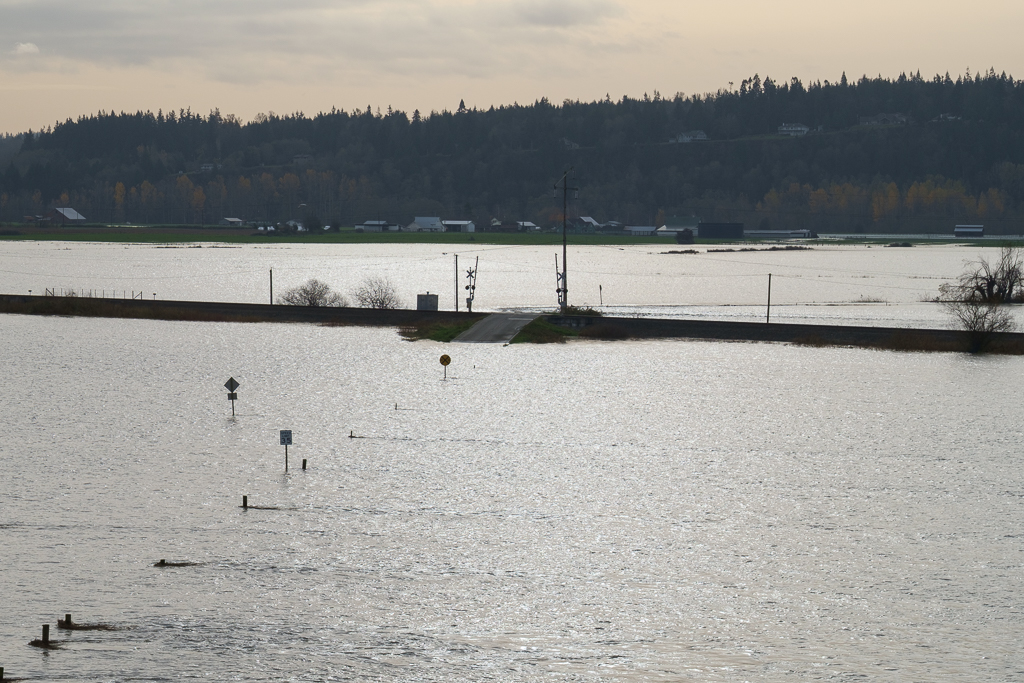
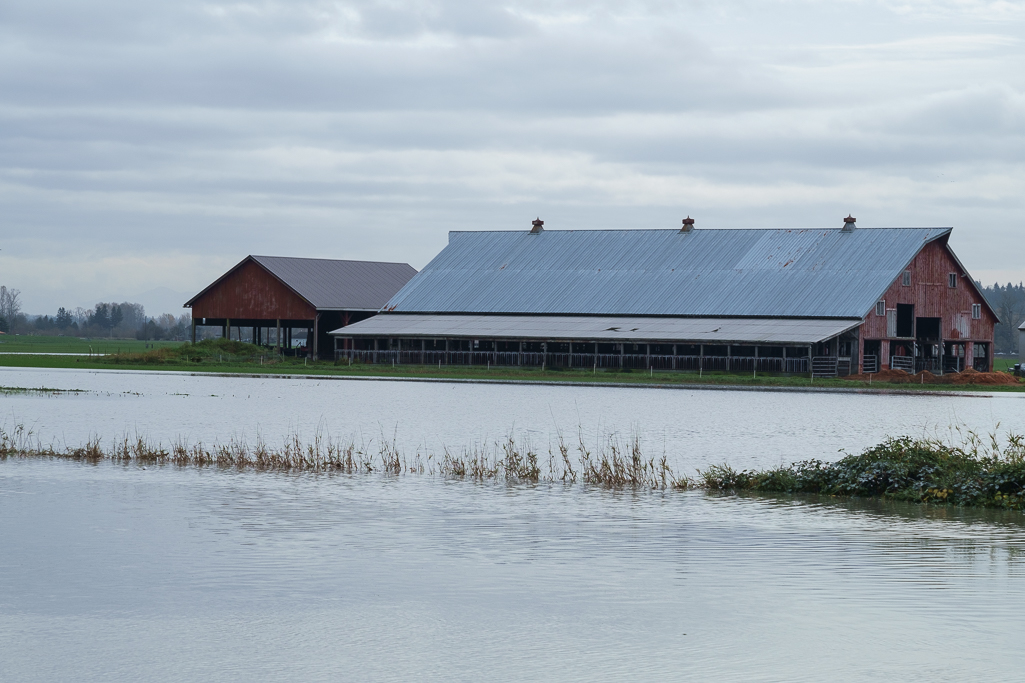
Flooding is increasingly becoming a fact of life along the Snohomish River. In early December the severe flooding in the cities of Snohomish and Monroe inundated homes and farms and closed roads and a city park. For residents in the area it was déjà vu all over again, as just weeks before some of the same areas experienced a separate major flooding event. Clearly, managing flood risk along the Snohomish, and throughout western Washington, is challenging yet essential to the lives and livelihoods of millions of people.
And climate change is compounding this problem: warmer temperatures are leading to sea level rise and higher tides, and more winter precipitation is falling as rain rather than snow, causing flashier flows in the rivers. Understanding how flood risk is changing and incorporating best-available information into planning and decision-making is crucial for communities in Puget Sound.
With this in mind the Nature Conservancy led a recent pilot project to both evaluate how climate change might impact flooding and then provide this information to local decision-makers. In partnership with the University of Washington Climate Impacts Group and West Engineering we assessed how varying scenarios of climate change could alter flooding in the Lower Snohomish River and cause potentially greater impact to farms and buildings and infrastructure.
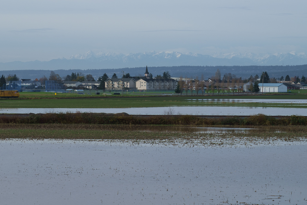
This analysis suggested that in just a few decades what is currently considered a “100-year” flood could be much more severe and could inundate part of I-5 near Everett and cause nearly 20% more costly property losses (see image).
To make this information useful and readily available we created new Floodplains by Design ‘app’ on the Coastal Resilience decision support tool so that local partners with the Sustainable Lands Strategy in Snohomish County could integrate maps and images of potential flooding into their project planning and decision-making process.
Managing increasing flood risk while sustaining high-value agriculture and also restoring salmon populations and protecting the environment will be a major challenge in Puget Sound in the 21st century. Rigorous science and sophisticated tools, like those developed by The Nature Conservancy for the Lower Snohomish River, can provide local communities with the best-available information that can help them plan accordingly.
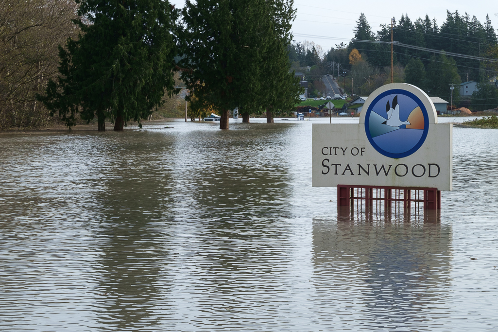
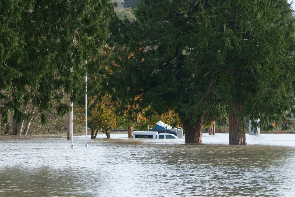
A truck left at the Stanwood Park and Ride went from dry to three feet underwater in only 1 hour during high tide Wednesday morning.
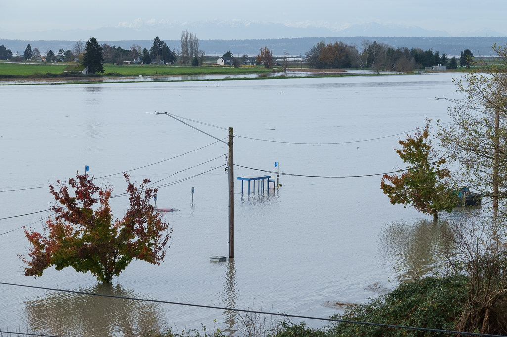
A bus stop on Marine Drive in Stanwood
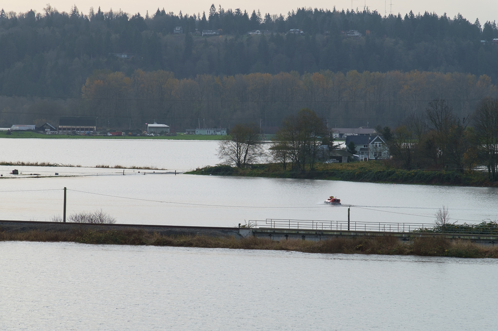
A rescue hovercraft crosses flooded farm fields and roads to check on residents stranded during the flood.
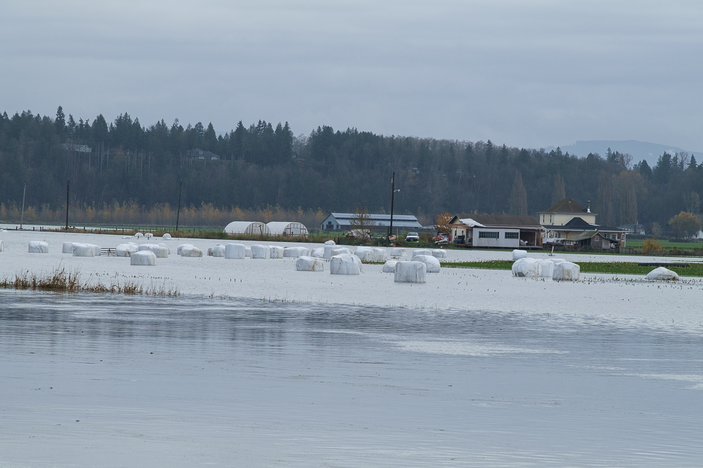
The floods will have a significant economic impact on Stillaguamish farmers. Flood insurance only covers immediate property damage from flooding.
Written and Photographed by Julie Morse, Regional Ecologist
I pulled up to the city park in Arlington on Tuesday about lunchtime to check and see what the river was doing. Guess I wasn’t the only one with that idea, it felt like pulling into a drive thru theatre. There was a line of cars – all facing the river, owners staying inside the cars, just watching and texting photos of a raging river.
It makes sense I thought, this is Western Washington after all. This is flood season. This is what we do for entertainment; we go and watch the river.
Wednesday morning after the storm had passed and the rivers had peaked I again drove down to see what the river was doing in Stanwood. Only it didn’t feel like good ol’ fashion entertainment this time. Instead there was a flurry of activity with fire trucks and rescue vehicles, and one bright orange hovercraft launching right off highway 532, going straight across the valley to rescue people stranded in isolated farmhouses.
This is not the first time the Stilly valley has flooded. In fact, it’s not even the first time this week the Stilly flooded. The Stillaguamish had two “100 year floods” this week, making this at least the 5th 100 year flood in the last ten years1. I know - either I’m really bad at math, or naming a flood after a probabilistic return interval is a really horrible way to communicate flood risk.
Our partners at the UW Climate Impacts Group released a report this week called the State of Knowledge: Climate Impacts in Puget Sound. The report synthesizes 20 years of studies on climate change, boiling it down to key points for our region. One of the key findings of the report – flood risk is increasing in Puget Sound. Not just the frequency of flooding, but the floodwaters themselves are getting higher. Substantially higher, in some places.
In preparing for releasing the report this week, we’ve started calling it the ‘triple whammy’ of increasing flood risk. Basically there are 3 big drivers of climate change that are causing increased flood risk in Puget Sound. First, you’ve got sea level rise backing up the rivers. Second, we’ve got increasing heavy rain events. Locals in Arlington told me “this isn’t our typical Arlington drizzle” and they’re exactly right. Warmer ocean temperatures and warmer air results in more moisture in the storms. And third, with warmer temperatures – more of our precipitation falls as rain not snow. Rain immediately runoffs to the nearest river causing then rapidly rising river levels.
Just to be clear, this report tells us nothing about our weather today – if for example these floods on the Stilly this week were a result of climate change. For that, we need attribution studies – a hot new topic in climate science, but not the intent of this report. Instead this report is intended to provide future estimates, and the range of natural variability we can expect, so that we can plan accordingly.
As I drove around taking photos of the Stilly flood I was amazed by people that were still home, stranded in their homes just waiting for the flood to recede. I could see dogs on the back porch of one house, desperately waiting for a tiny patch of grass so they could go take care of business. I know this certainly isn’t the first flood these folks have gone through, I know they are rich with stories of past floods. And I know they are certainly hardy folks. But I worry the past gives us a false sense of security about the future.
I hope this report helps illustrate clear differences, and helps us understand how our river hydrology is completely changing. I hope it helps us make smart choices. I know it’s easy to get completely overwhelmed and feel hopeless in the face of climate change. But climate change is not hopeless, if you can see it coming.
1Based on a flood return interval calculated through 1998 and reported in Snohomish County’s 2004 flood hazard plan.Wednesdays peak flow was the 5th highest ever recorded at the Arlington gage, and technically a 500 year flood event.

Farms, Fish & Flood Initiative
Where are you working on this project?
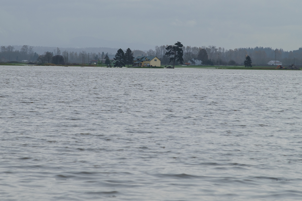
In the Skagit Delta located in North Puget Sound. The Skagit is the largest river in Puget Sound and the Skagit Valley is home to the largest agricultural industry in Puget Sound. We’re working with a group of organizations to come together with a commitment to achieve the Puget Sound Salmon Recovery goals of estuary restoration and resource land protection through the formation of the Farms, Fish and Floods Initiative (3FI).
Which organizations are helping with this initiative?
To date, the 3FI partners (National Oceanic and Atmospheric Association (NOAA), Skagit Conservation District, Skagit County, Skagit County Dike and Drainage Partnership, Skagitonians to Preserve Farmland, The Nature Conservancy, Washington Department of Fish and Wildlife, and Western Washington Agricultural Association) have signed a Memorandum of Understanding to work in the spirit of collaboration to achieve the 3FI mission: To create and advance mutually beneficial strategies that support the long-term viability of agriculture and salmon while reducing the risks of destructive floods.
There are a lot of great people and organizations involved in this project.
Tell us a little more about why this project is so important to learn about
The 3FI is the first landscape scale effort in the Skagit Delta. It’s where the conservation and agricultural interests have agreed to come together to bring about breakthroughs in estuary restoration, flood risk reduction and farmland protection in a way that supports multiple community interests. This is not only great for people but also important for the future of the Skagit Valley in terms of flood protection, viability of agriculture as well as salmon recovery. By approaching our common goals at a landscape scale, the 3FI members will be able to work with a broad base of stakeholders and trustees to identify actions needed to achieve our goals.
Have you done any projects like this before?
After working together on restoration projects and agreements, such as the Fisher Slough Project, Drainage Fish Initiative, Tidegate Fish Initiative, and Guidance on WDFW’s Vision for Conservation and Land Acquisition for the Skagit Delta, we now know what it takes to get projects done, which is reflected in the core values developed by the 3FI member organizations.
See examples at this video link for projects The Nature Conservancy has worked on in the Skagit Valley and Stillaguamish watershed that are similar to the issues we are working to solve with our partners in the Skagit Delta through the Farms Fish and Floods Initiative.
Under Construction: Restoring Estuary Habitat in the Puget Sound from HabitatSeven on Vimeo.


