Controlled burning, is a time-tested and effective tool that maximizes the benefits that low-intensity fire can provide within a variety of landscapes.

Earth Day was born out of a movement to improve the lives of people and nature, inspiring sweeping legislative action and investments. Today, federal infrastructure funding and WA Climate Commitment Act are a continuation of this movement, investments making a tangible impact locally. As an example, Washington’s historic funding of the Floodplains by Design program is contributing to nature-based floodplain management across the state to reduce flood risk, protect communities and protect salmon habitat. These state and federal dollars are just the start of local climate action that will improve the daily lives and the future of all Washingtonians.
Meet DeAnne Hamilton: Learn how the general manager of Tacoma’s KBTC Public Television and TNC in Washington trustee, uses the power of storytelling to engage people in conservation and create a better future for the next generation.
Nestled in the cliffs in Moses Coulee is an import desert water sources that every springs attracts thousands of Pacific Tree frogs. I came to Whisper Lake for a night concert. It was anything but quiet. The chorus of frogs was soothing, calming—the quintessential sound of spring.
The Cle Elum Wildlife Project is improving our understanding of how wildlife use and move through protected forest landscapes, providing us with an opportunity to test how forest management practices impact wildlife and building an evidence base for permanent protection.
Written and Photographed by John Marshall, Northwest Photographer
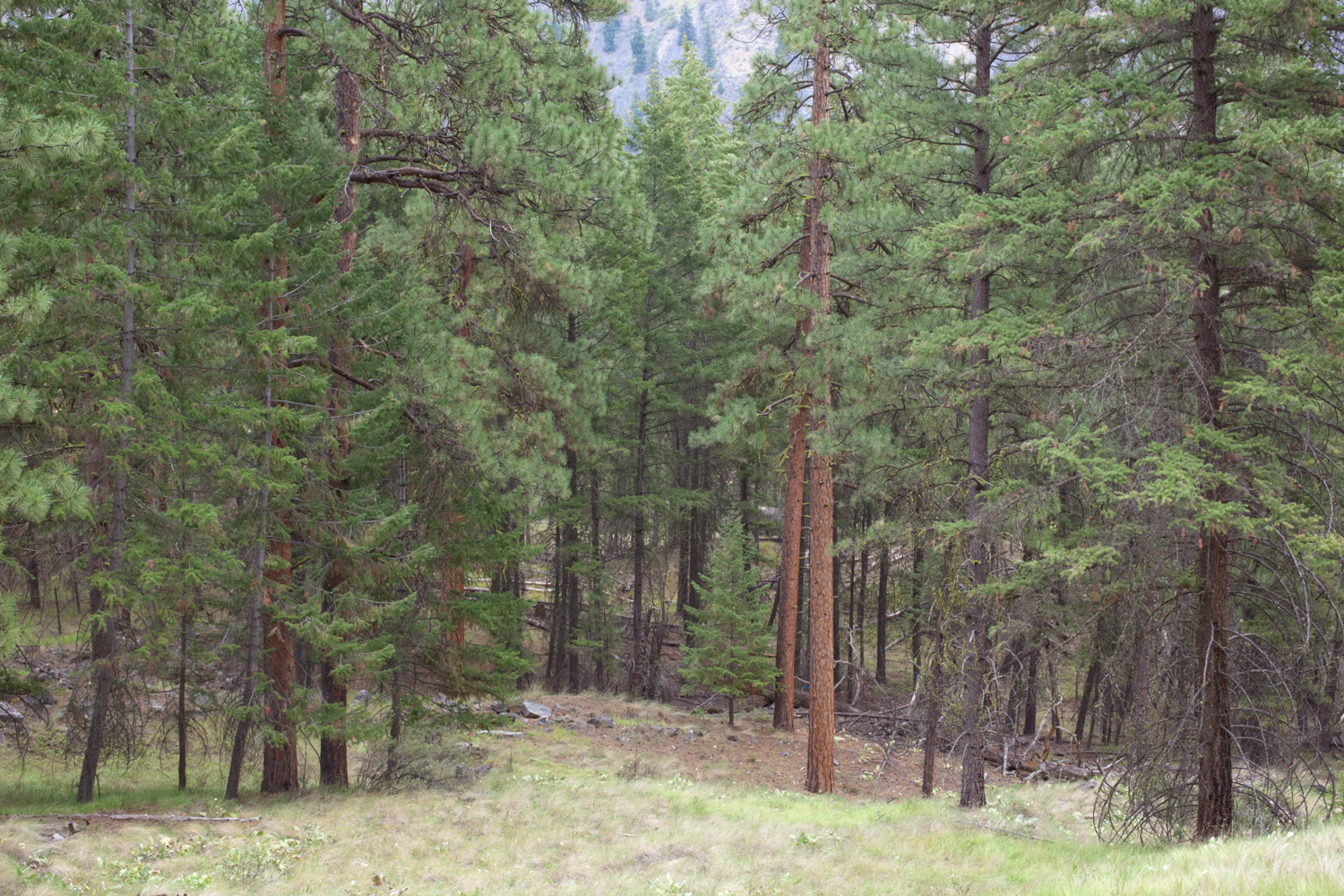
These photos from the Sinlahekin Wildlife Area in Okanogan County illustrate the necessity of controlled burning along with forest thinning to enable our forests to withstand catastrophic fires.
Historically, fires would occur here ever few years, including some intentional burning by Native Americans. Fire suppression in the last century has created an unnaturally high density of trees, multi-layered canopies, and a high accumulation of dead wood which fuels fire. You can see this in the first photo, taken in 2010, where a once-open ponderosa pine forest in the Sinlahekin Valley has filled in with small pines and Douglas-firs.
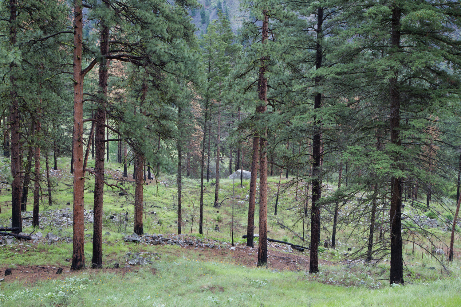
In 2010, Washington Department of Fish and Wildlife, assisted by The Nature Conservancy, began a project to address these concerns by removing small understory trees by thinning and subsequent controlled burning.
In the second photo, taken in June of 2015, you can see the same stand of ponderosa forest. First it was thinned and then careful controlled burns were set to clear out the fuels. Not only is it safer from fire, but grass forage for bighorn sheep, browse for deer, and berries for birds increased.
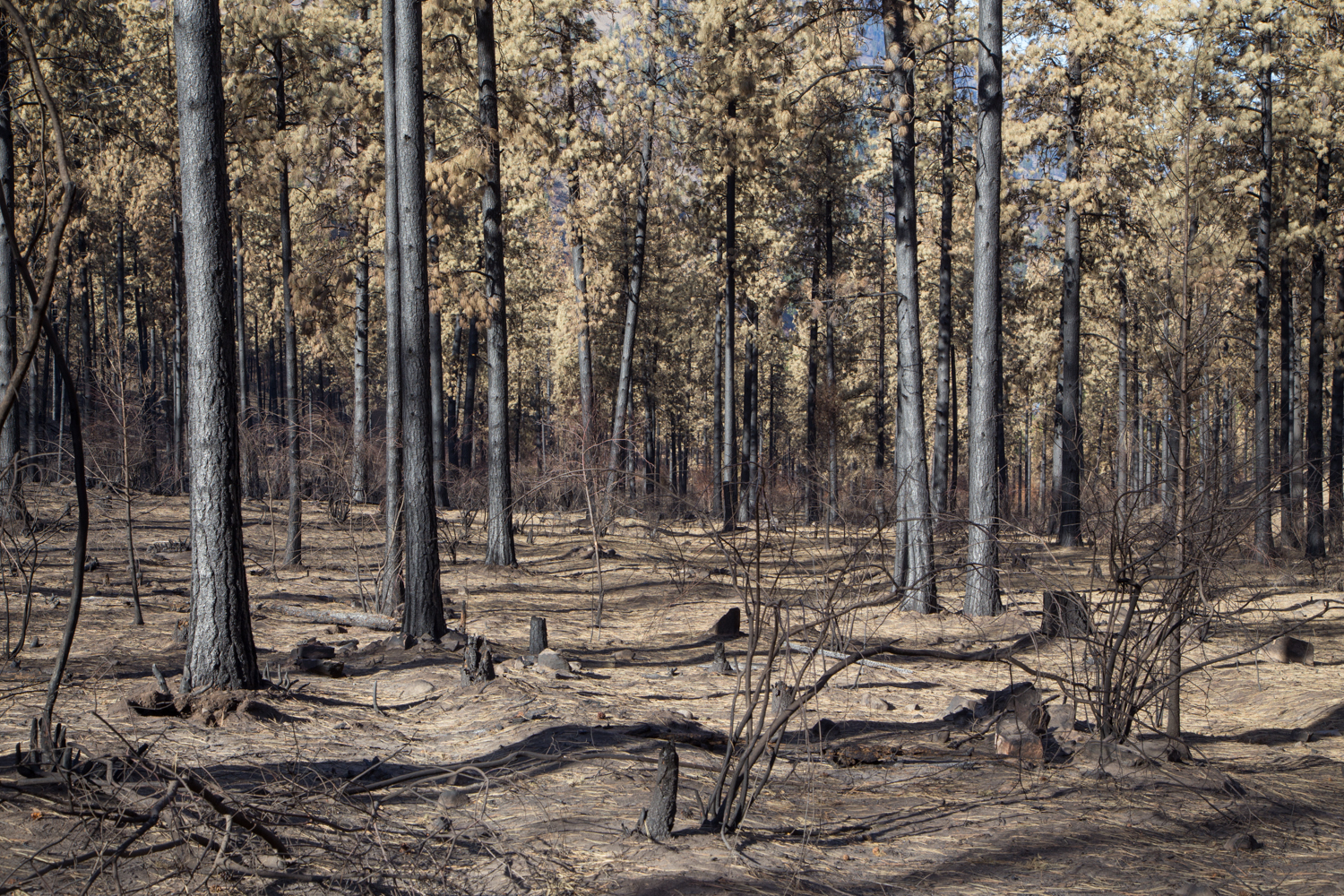
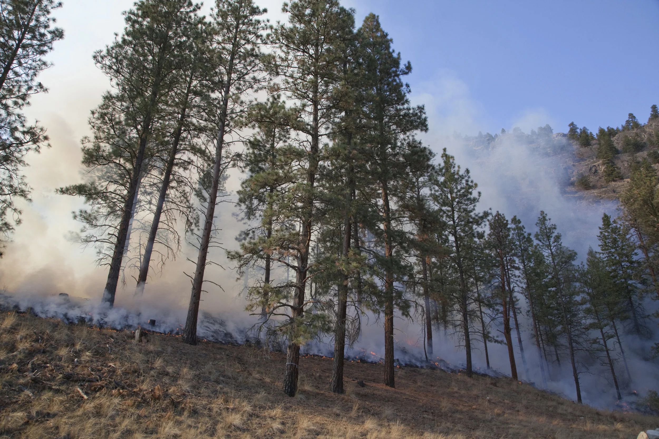
For a week In late August of 2015, the treatments were tested by the Lime Belt Fire, a portion of the vast 133,000-acre Okanogan Complex Fire, which burned through the south half of the wildlife area. Washington Department of Fish and Wildlife and the Washington Department of Natural Resources. Hand-lines, bulldozers, water drops, and retardant were all used. Efforts to thin and burn prior to the wildfire made fire-fighting efforts more successful and safer to implement.
Photographer John Marshall visited the same stand in October of 2015. As you can see in the third photo, where both thinning and prescribed burning were completed, most of the ponderosas survived the wildfire.
The fourth photo shows a stand that had been thinned, but not yet prescribed burned, and you can see thatmost of the ponderosas were killed by the wildfire. In general throughout the Okanogan Complex Fire, areas that had been logged but not burned fared poorly in the wildfire.
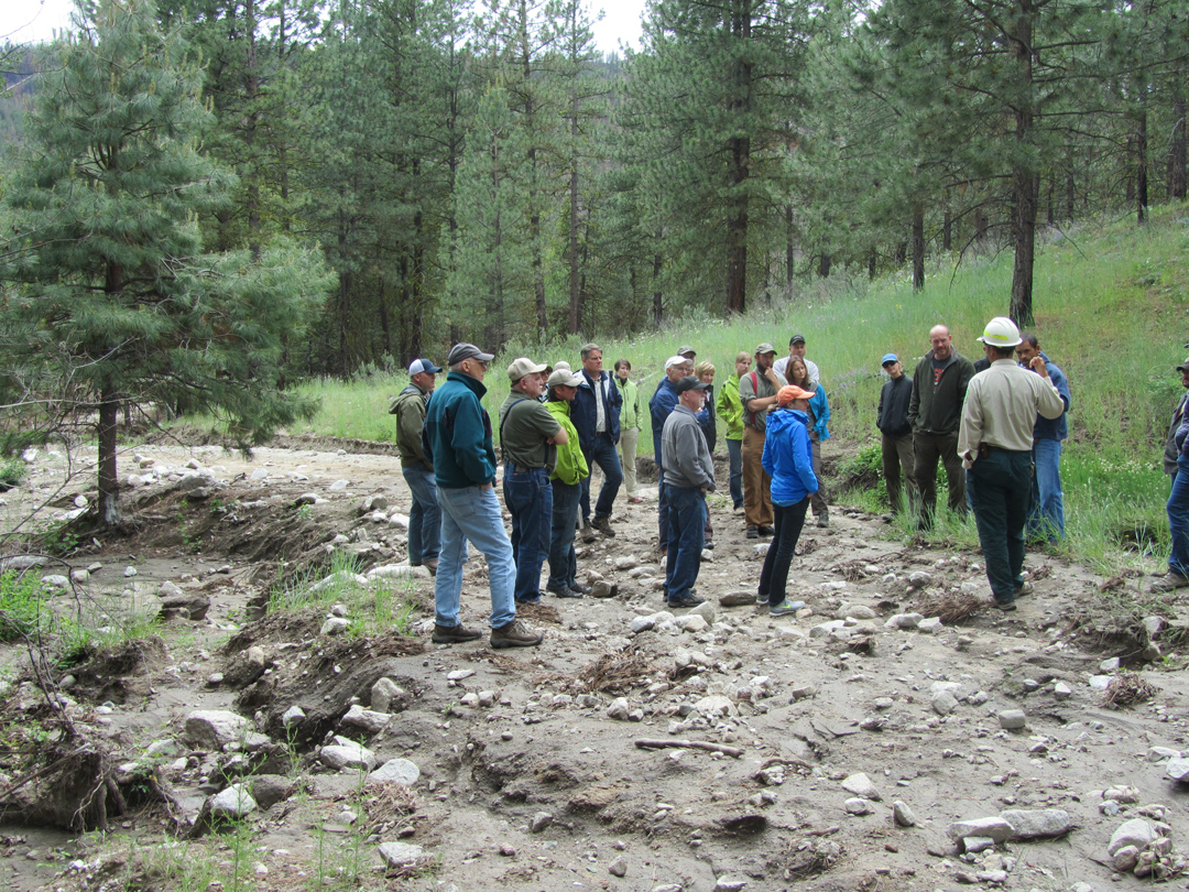

Written & Photographed by Lloyd McGee, Eastern Washington Forests Program Manager
Last week, we toured “the donut hole,” a 6,000 acre area of forestland the Carlton Complex burn surrounds. The tour participants were the North Central WA Forest Health Collaborative (NCWFHC) and the Methow Valley Ranger District of the Okanogan-Wenatchee National Forest (OWNF).
To support the OWNF in the aftermath of the worst fire in Washington’s history – the 250,000 acre Carlton Complex fire – the NCWFHC has been actively working on post-fire restoration in partnership with the OWNF staff by re-packaging the South Summit Restoration Project in which 70% of the landscape was burned just two weeks prior to the implementation of the project.
The quick response by the NCWFHC and OWNF to this drastically altered landscape was remarkable. The NCWFHC kept the forest service on schedule by taking the lead role in planning the 50,000 acre Mission Restoration Project on the western perimeter of the Carlton Complex fire.
It was incredible to see the areas which the fire by-passed because of previous forest treatments.