Seven years later, and over $200 million dollars spent in Floodplains by Design alone, we are seeing a new level of resilience, creativity and impact in our floodplains across the state.

Earth Day was born out of a movement to improve the lives of people and nature, inspiring sweeping legislative action and investments. Today, federal infrastructure funding and WA Climate Commitment Act are a continuation of this movement, investments making a tangible impact locally. As an example, Washington’s historic funding of the Floodplains by Design program is contributing to nature-based floodplain management across the state to reduce flood risk, protect communities and protect salmon habitat. These state and federal dollars are just the start of local climate action that will improve the daily lives and the future of all Washingtonians.
Meet DeAnne Hamilton: Learn how the general manager of Tacoma’s KBTC Public Television and TNC in Washington trustee, uses the power of storytelling to engage people in conservation and create a better future for the next generation.
Nestled in the cliffs in Moses Coulee is an import desert water sources that every springs attracts thousands of Pacific Tree frogs. I came to Whisper Lake for a night concert. It was anything but quiet. The chorus of frogs was soothing, calming—the quintessential sound of spring.
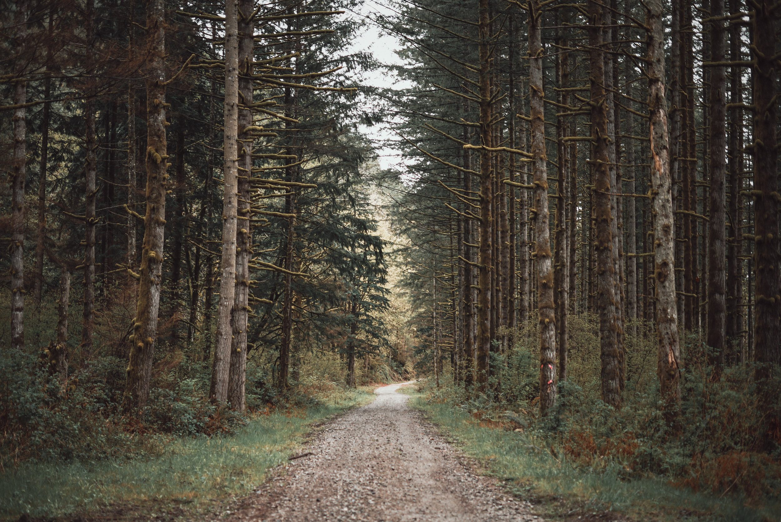
The Cle Elum Wildlife Project is improving our understanding of how wildlife use and move through protected forest landscapes, providing us with an opportunity to test how forest management practices impact wildlife and building an evidence base for permanent protection.
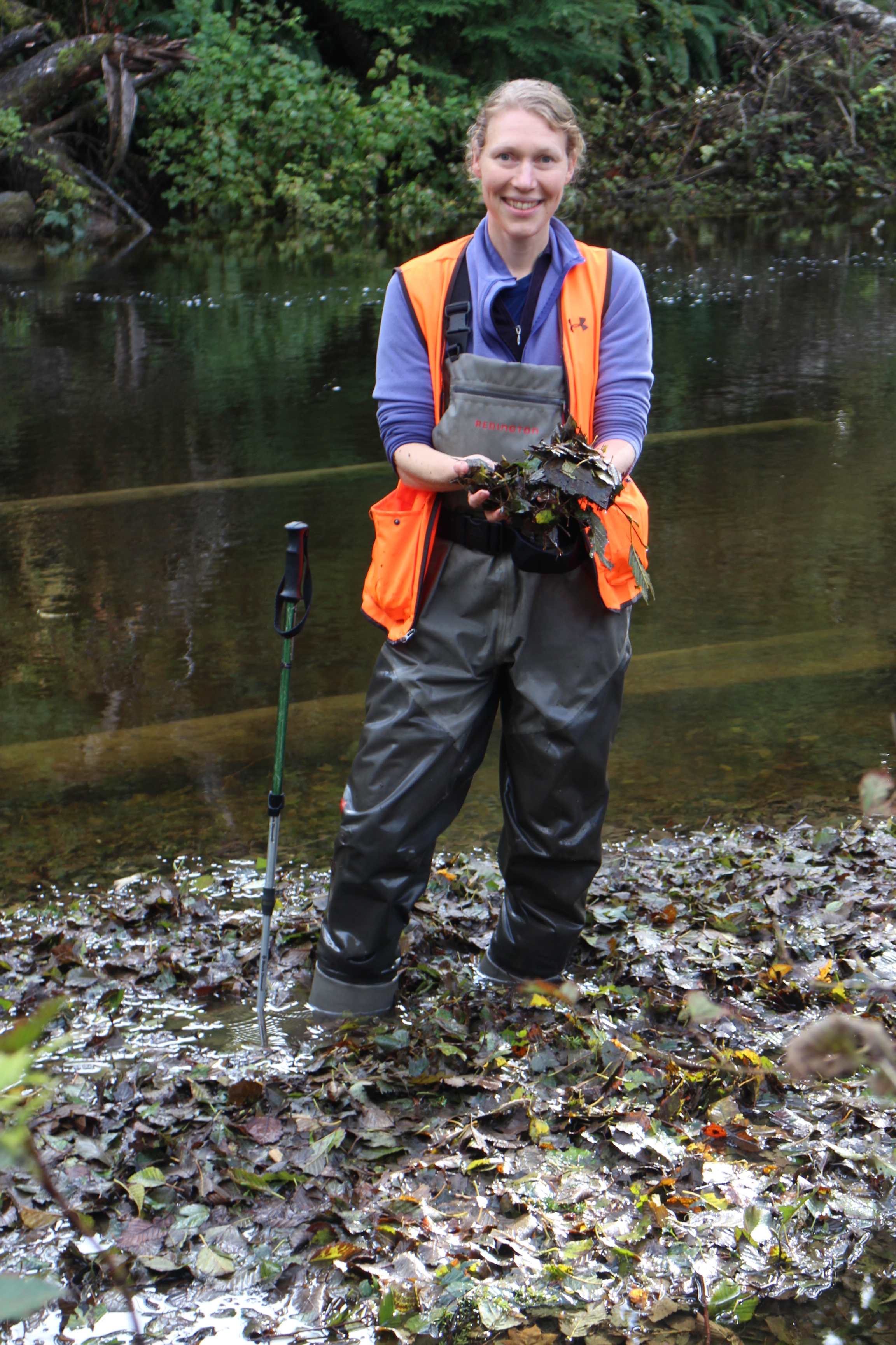
Written and Photographed by Emily Howe, Conservancy Aquatic Ecologist
The trouble with field biology is that every once in a while, your best laid experimental designs are obliterated by a typhoon.
Such was the case last week, when Typhoon Songda blasted across the Pacific and slammed into the Washington coast. Puget Sound was spared the brunt of the winds, as the storm was compact and tracked 60 miles further northwest than expected. The coast, however, was spared nothing in terms of rain and wind, clocking in 78 mph gusts and 3" of rain in a 24 hr period.
Now, I'd carefully planned to retrieve all my stream temperature loggers from Hurst and Shale creeks on Thursday and Friday, October 13th and 14th. By Tuesday, we knew of a weather system coming for the end of the week. By Wednesday, Cliff Mass was forecasting a mega-storm. We watched the storm track, the rain forecasts, and wind forecasts. We watched the low pressure depression, and the storm size. We translated wind speed to tree strengths. And we tried to translate rainfall to river height. That's tricky for a system that doesn't have a gauge on it.
In the end, we cancelled.
We crossed our fingers that the loggers would hold through the storm, waited a few days for a break in the weather, and headed west to the Clearwater Basin near Kalaloch.
I took my sister as my intrepid volunteer. She worked in the ONP for years revegetating high alpine meadows and living out of her tent in the drenching rain. She's a well vetted bushwhacker with the highest of credentials.
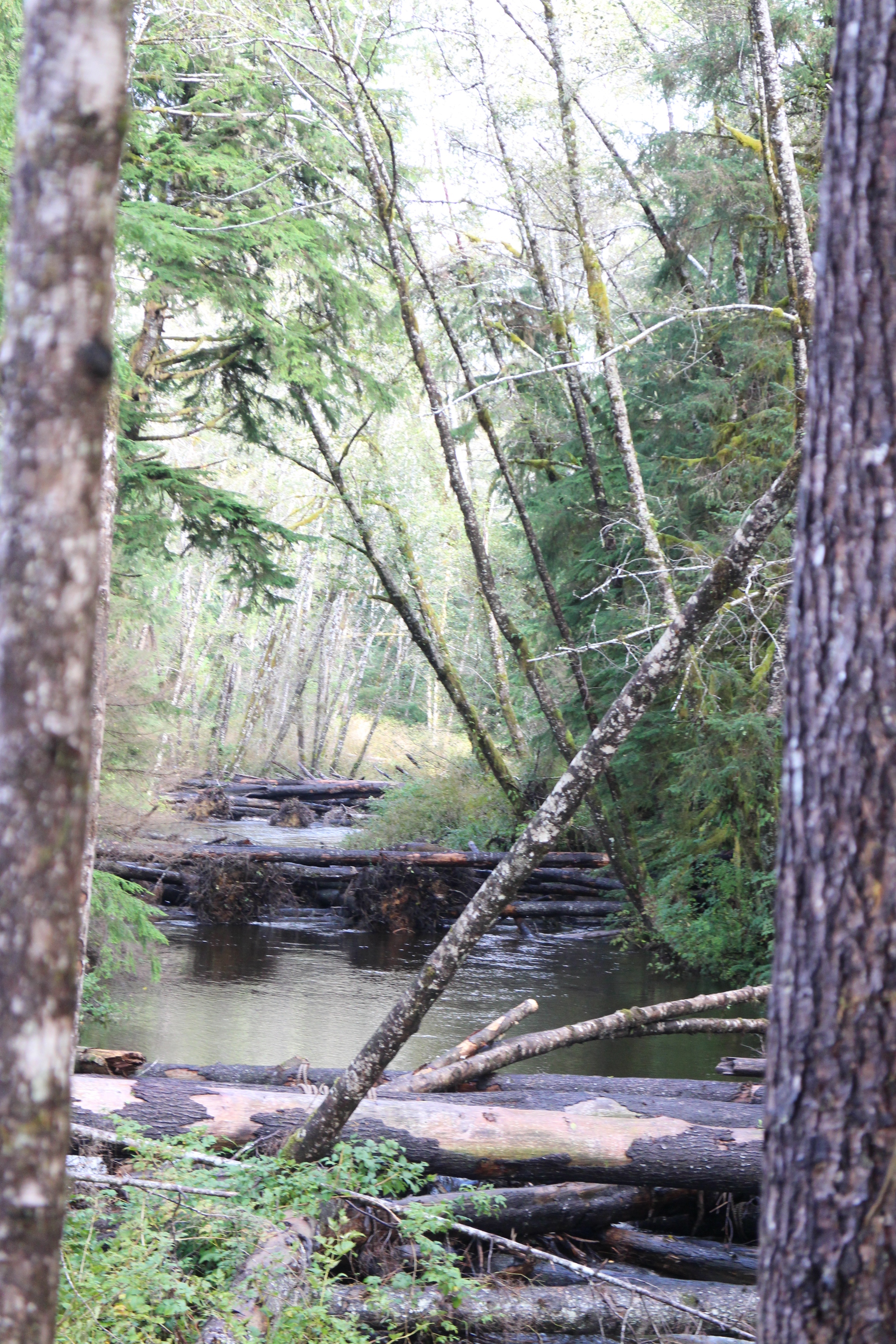
We arrived at Hurst Creek to find the downstream reach below our 6 log jams roaring. The river was only knee-deep, but was so swift that I could barely stand. That first logger was long gone, probably taking temps in the Pacific Ocean by now.
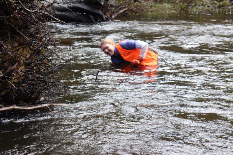
The river stretches between the log jams were deep, slow moving pools. I could safely wade out to my ribcage without losing my footing. The only problem was that my loggers were anchored to the creek bed and my arms are not 4 feet long. But, I'm a water person, and getting wet is par for the course. If I laid my face on the water, and submerged my neck and shoulder, I could just barely reach the loggers.
The upper jam on Hurst is an incredible sight. We knew last summer that it was doing its job to trap sediment and rebuild the stream bed in an intensely downcut section of the creek, but what we didn't see last summer was the immense collection of leaf litter that it also traps. Right now, there are literally two islands in the creek built entirely of leaves and twigs. They are about 20 ft long, 5 feet wide, and 3 ft thick. If you stand on them, you sink up to your knees in leaves. This is nutrient storage in action. This is how streams hang on to energy at the base of the food web. This is how productivity is conserved in flowing waters.
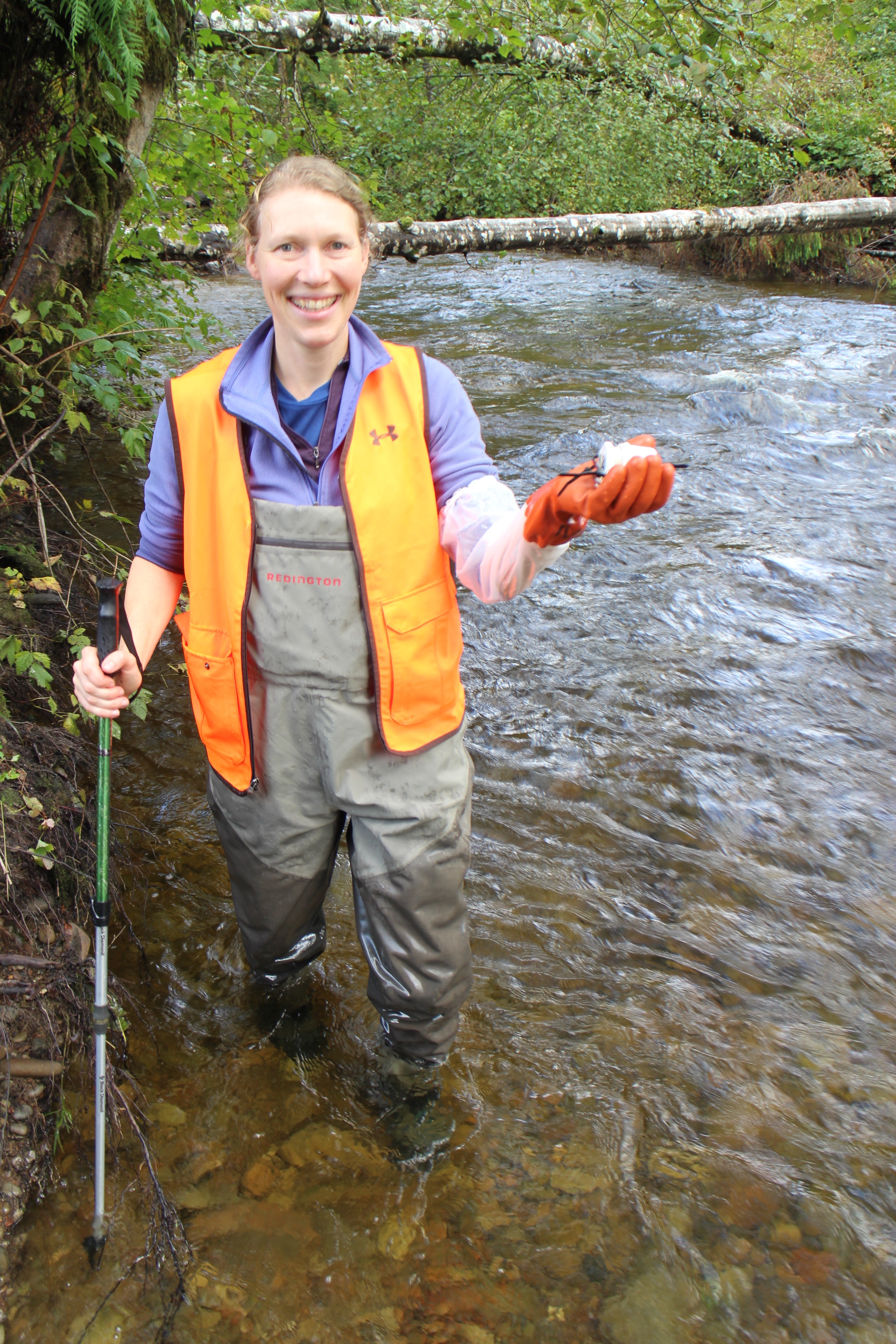
In the end, we retrieved 6 of 11 loggers on Hurst, and only 1 of 4 on Shale. The storm beat me by a day, but the fish welcomed the pulse of freshwater. Indeed, we watched the first scouts nose their way up Shale, easily passing through a tangle of natural log jams on their way.
Video produced by Caravan Lab
Our river and floodplain ecosystems are an essential part of life. These systems are home to protected fish and wildlife. They are the places we go to enjoy natural beauty and outdoor recreation. But did you know flooding is becoming more frequent and severe, putting communities, wildlife, and livelihoods at risk. Watch the video above to learn more about the importance of our river systems and why restoring these regions is vital for people and nature.

Written by John Lombard, Lombard Consulting
In the ten years since my book, Saving Puget Sound, came out, Floodplains by Design is the most impressive regional initiative that I have seen for Puget Sound conservation. Focusing on floodplain restoration, it is tackling one of the most important parts of the landscape for conserving Puget Sound as an ecosystem, serving as a model for how we might address other key issues, such as the Puget Sound shoreline and stormwater management. Even more impressive, while starting in Puget Sound, Floodplains by Design has quickly grown into a statewide initiative.
Taking a multi-benefit approach, Floodplains by Design recognizes that virtually by definition any major action in floodplains affects multiple interests—agriculture, salmon recovery, flood hazards (locally, downstream, and even sometimes upstream), and often a significant amount of development and infrastructure. We have traditionally funded actions in the floodplain from different pots focused on these different interests, which tends to lead to partial solutions, conflicts with the other interests, and insufficient resources to take a more holistic view—even when that holistic approach is cheapest and better for everyone in the long run.
Floodplains by Design is a model for how to approach these types of issues more effectively. It is a perfect example of a role that The Nature Conservancy can fit extremely well—facilitating a partnership that takes a creative approach to a common problem across the region and state, and attracting legislative and funding support because it offers real solutions and brings communities together.
John Lombard is the owner and principal of Lombard Consulting. He is the author of the book Saving Puget Sound which won the Haig-Brown Award for environmental writing from the North Pacific International Chapter of the American Fisheries Society.

Written by Bob Carey, Strategic Partnership Director
Agencies and tribes recognized for their leadership in improving river management to improve flood protection, restore salmon habitats, improve water quality, and enhance outdoor recreation. More than 150 people came together to celebrate the Floodplains by Design Partnership and honor seven floodplain champions and project partnerships at a dinner Monday, September 12, in Seattle.
The Floodplains by Design Partnership, led by the Washington Department of Ecology, The Nature Conservancy, and the Puget Sound Partnership, identify and support large-scale projects that are built from the ground up by local governments, tribes and community stakeholders. Collectively the partnership is pursuing a vision of collaborative, integrated management delivering results to help Washington’s communities and ecosystems thrive.
In four short years, with the support of $80M in new state funding, the Floodplains by Design partnership has reduced flood risks to hundreds of families in 25 communities while restoring habitat along 10 miles of salmon-producing rivers, protecting 500 acres of farmland and creating new river access and trails.
“Floodplains by Design is not just a grant program, it’s a movement!” Bob Carey from The Nature Conservancy told the celebrants. “It’s a movement to put our shoulders together to make our communities safer from flooding, to make our salmon runs stronger, and to ensure future generations have local food, clean water, and recreational opportunities.”
Three locally-driven river management partnerships were recognized as 2016 Floodplain Luminaries, for their steadfast pursuit of an integrated, resilient river management program and delivering results in support of a prosperous community and healthy environment:
· The Yakima River Floodplain Project
· The Dungeness River Floodplain Partnership
· Puyallup Floodplains for the Future Partnership
Four organizations were honored as 2016 Floodplain Champions for their steadfast support of integrated, resilient river management programs that deliver results for a prosperous community and healthy environment, include:
· Washington State Department of Ecology
· US Environmental Protection Agency
· Tulalip Tribes
· Puget Sound Conservation Districts
Award presenters included Washington Sen. Karen Keiser, D-Kent, Rep. Richard DeBolt, R-Chehalis, Rep. Steve Tharinger, D-Dungeness, King County Executive Dow Constantine, NOAA Fisheries Regional Administrator Will Stelle, Puget Sound Partnership Executive Director Sheida Sahandy, and Washington Department of Ecology Program Manager Gordon White.
Presenting sponsors for the Floodplains by Design conference were Anchor QEA, ESA, HDR Inc. and Northwest Hydraulic Consultants. Dinner sponsors were Watershed Science & Engineering, Northwest Regional Floodplain Management Association and WEST Consultants. Funding for the Conservancy’s engagement in Floodplains by Design has been provided in part by the Boeing Company and The Russell Family Foundation.
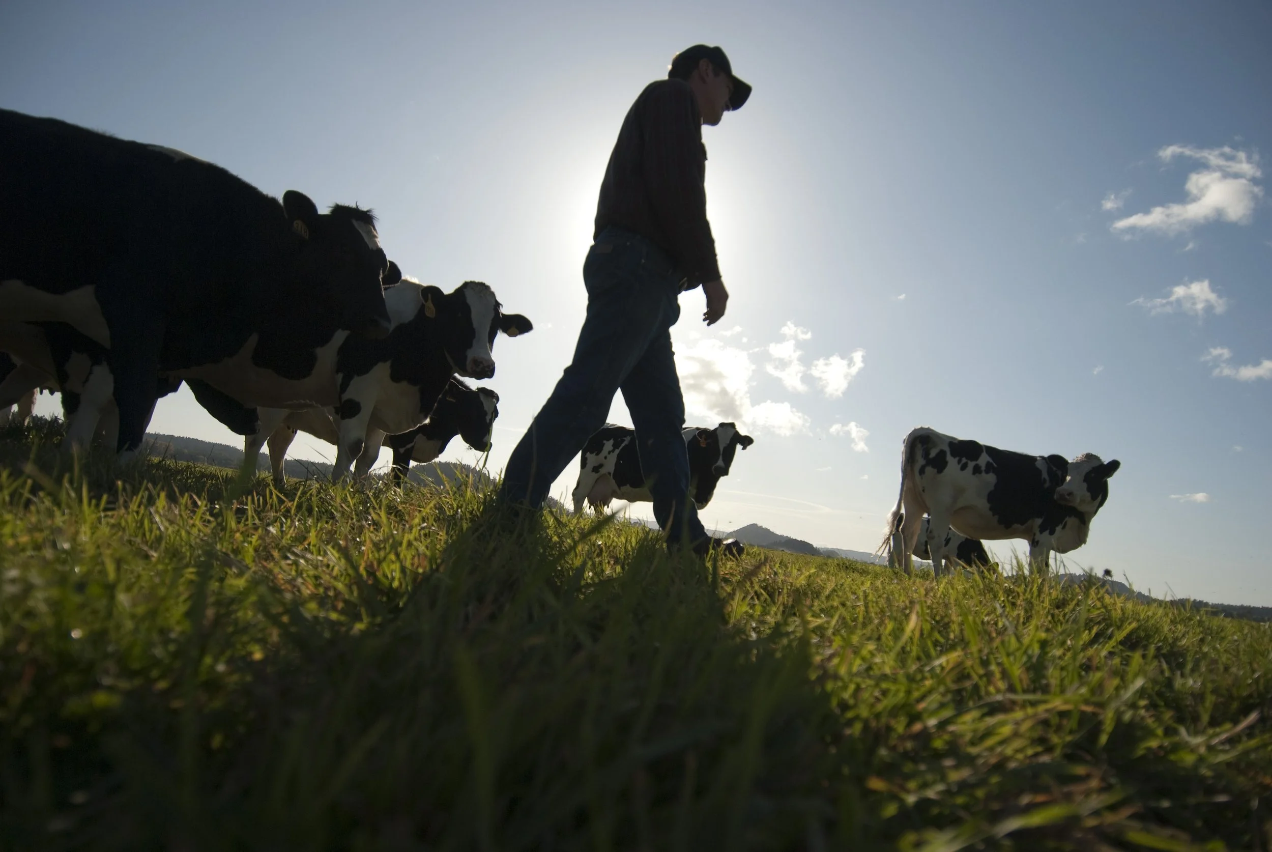
Investments that recognize the role farmers have in restoring our lands will provide an all encompassing approach to reaching our climate and habitat goals.
Seven years later, and over $200 million dollars spent in Floodplains by Design alone, we are seeing a new level of resilience, creativity and impact in our floodplains across the state.
Read about how Floodplains by Design pivoted to virtual workshops and the lessons they learned.
Did you know that rivers are constantly changing, carving new paths over the years? Come along and take a trip to the Nooksack River, where you'll learn that the only constant is change
Washington state lawmakers approved groundbreaking policy and budget priorities this session, positioning our state for a more resilient future.
We caught up with Cindy Dittbrenner, Natural Resource Program Manager for the Snohomish Conservation District, to discuss why data and webmaps are so important for farmers in Snohomish County.
Imagine you’re a third-generation farmer in the Puget Sound. You’re witnessing more rain and wetter fields. How can you make decisions about the future? A new tool will help.
Explore maps that show how fluid rivers in Washington state have been over time.
The loss of another orca is a stark reminder of how sick our Puget Sound really is and the importance of river health, salmon recovery, climate change and the impacts of a fast-growing Puget Sound.
Climate change is bringing greater precipitation to Washington, with more frequent and severe storms. Healthy floodplains are a key natural solution: They absorb heavy flows, reduce flooding and temper storm surges.
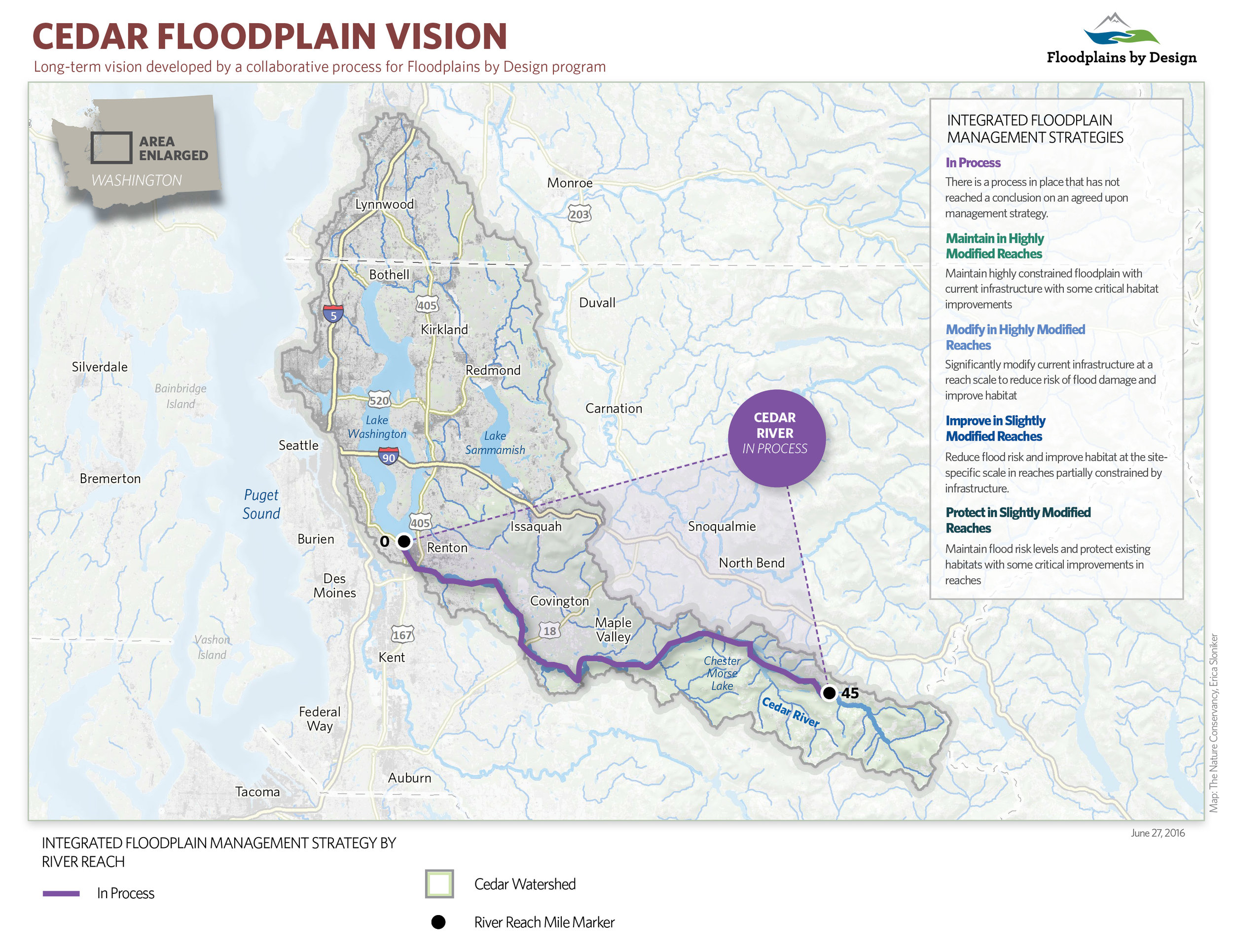
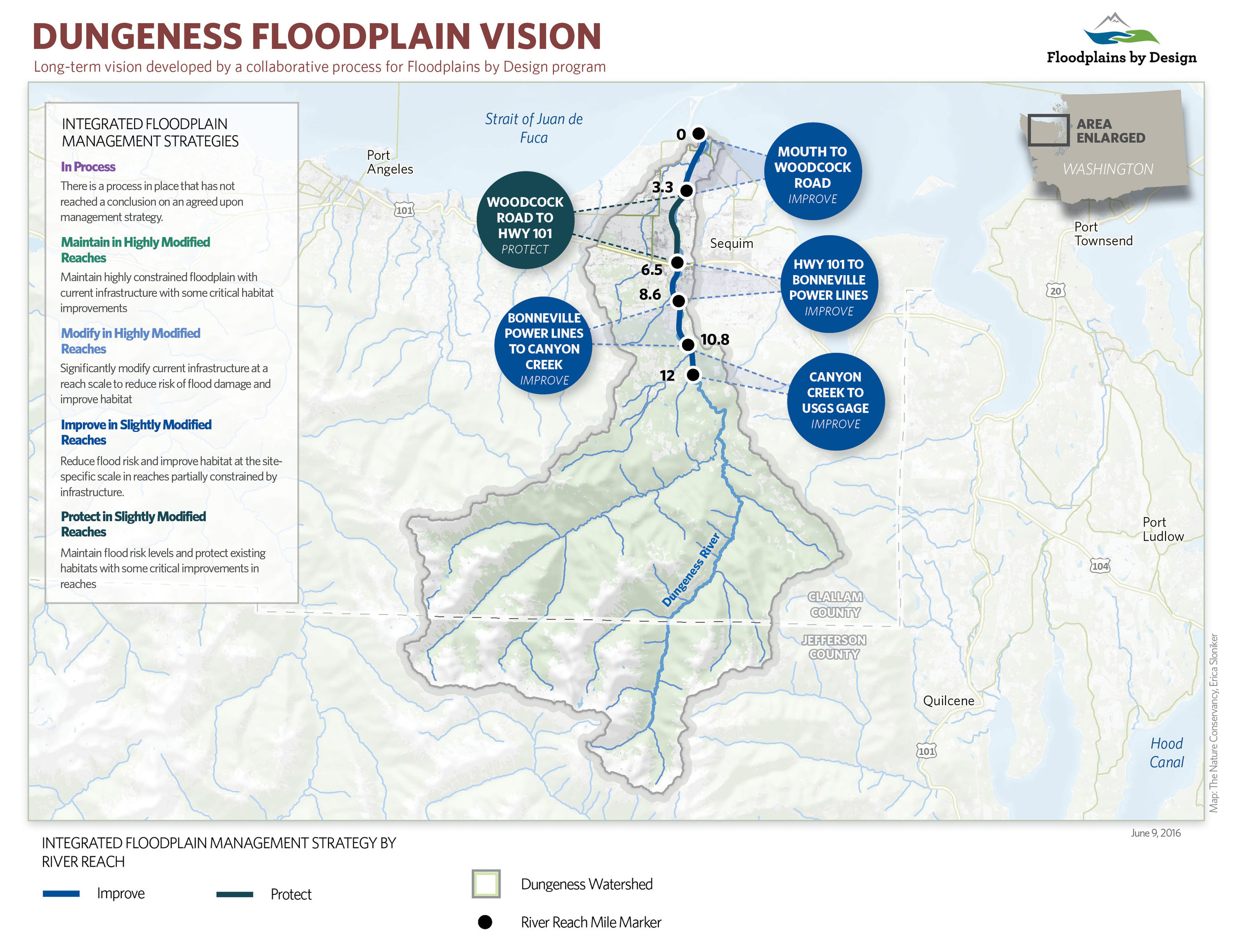
Written by: Bob Carey
Maps by: Erica Simek Sloniker
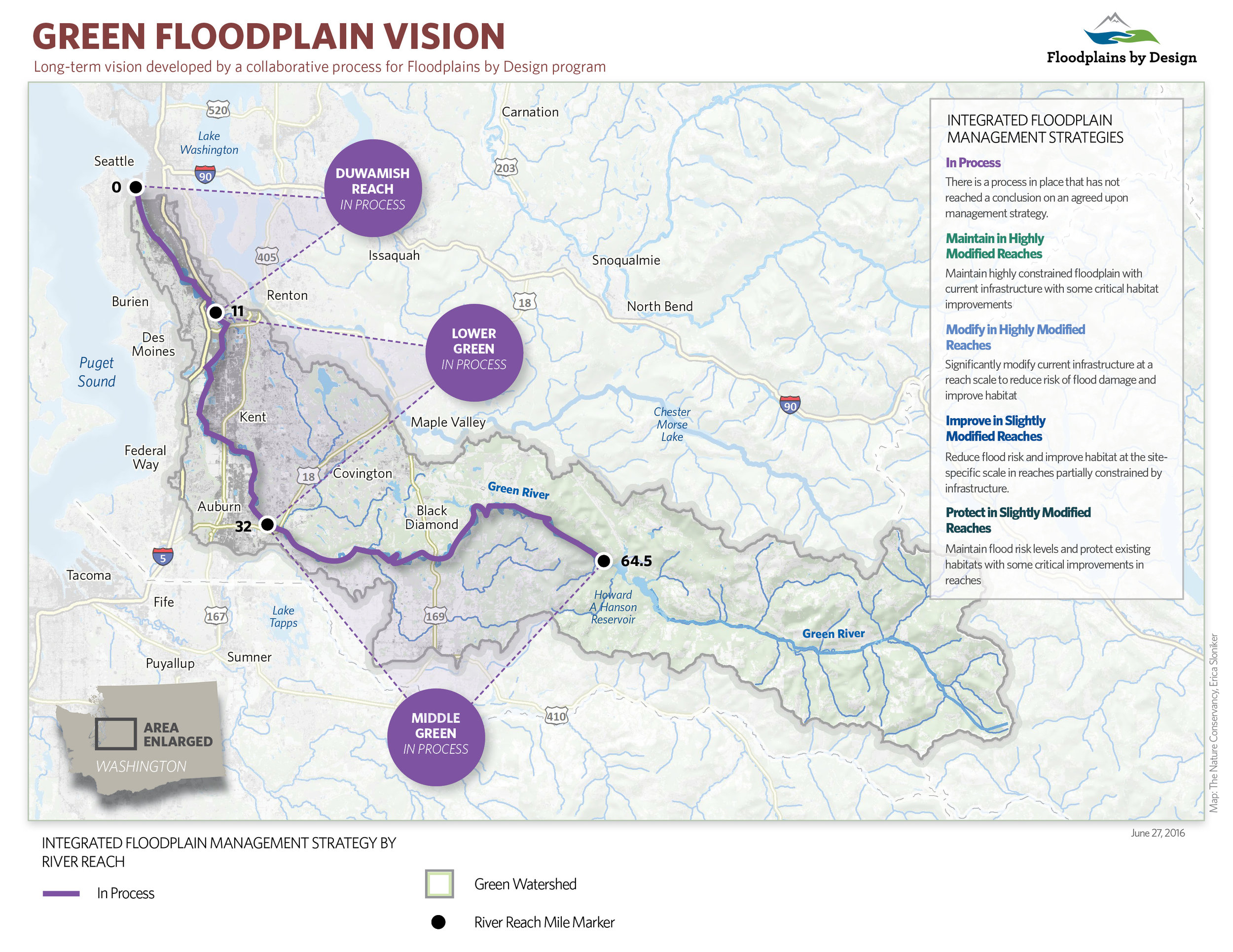
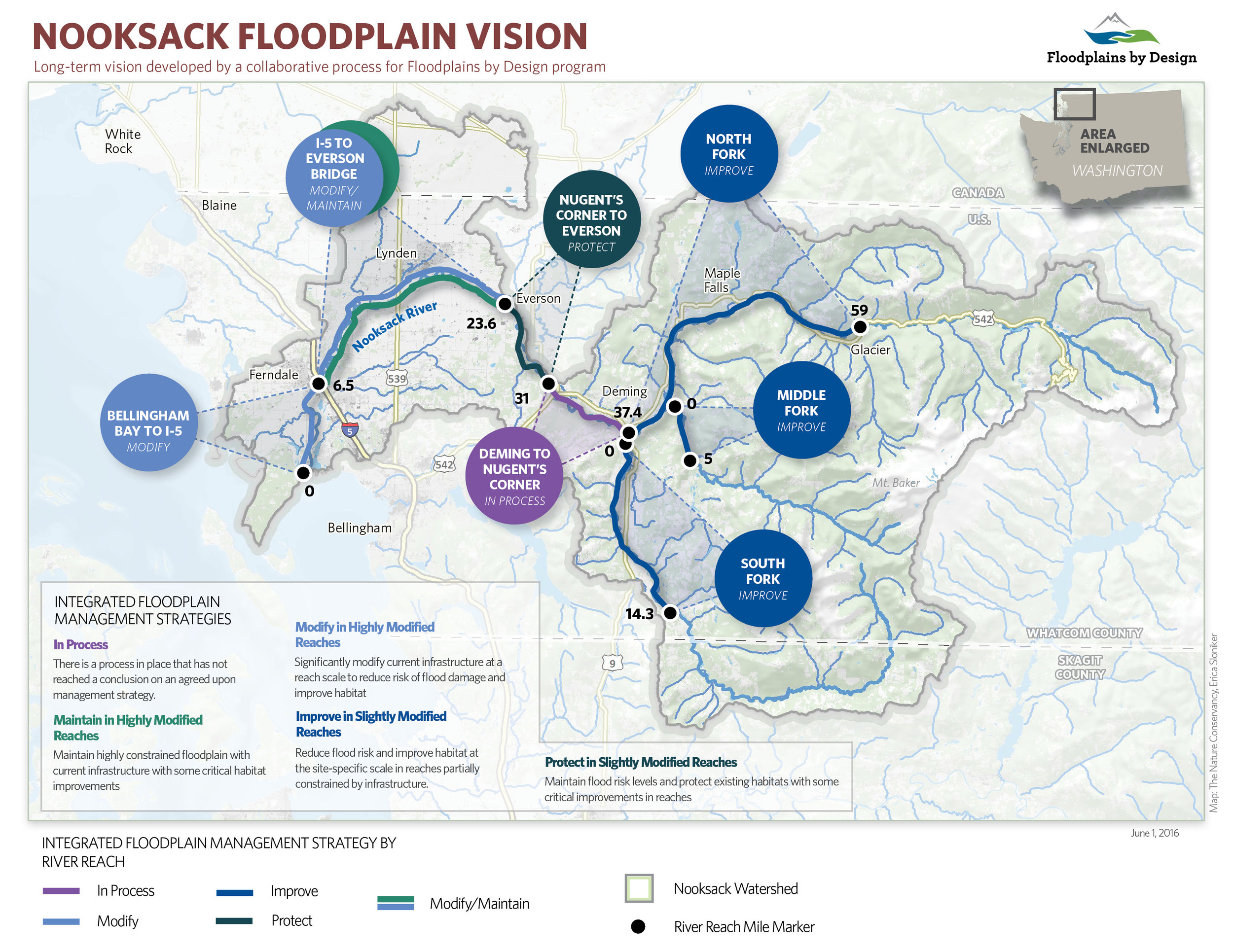
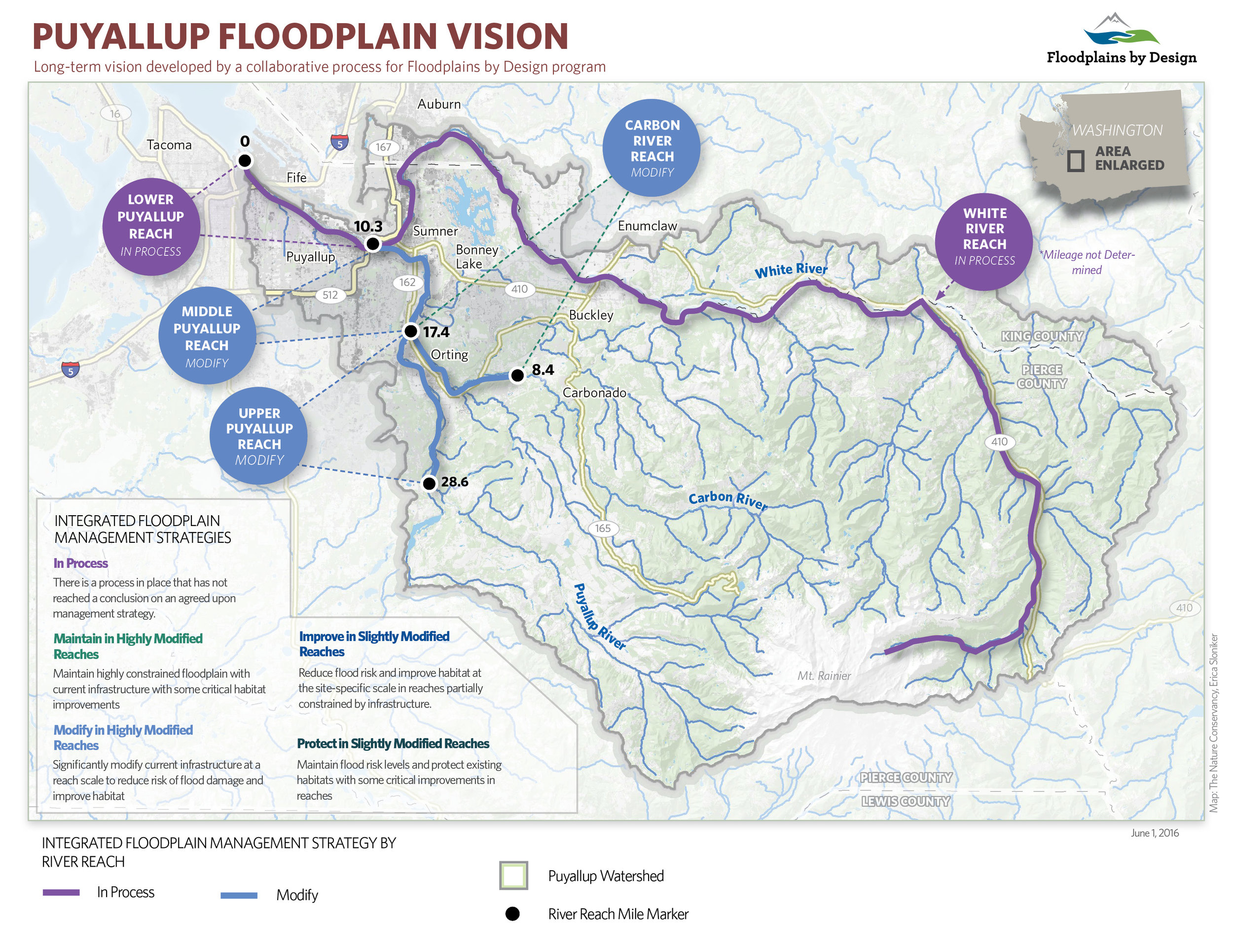
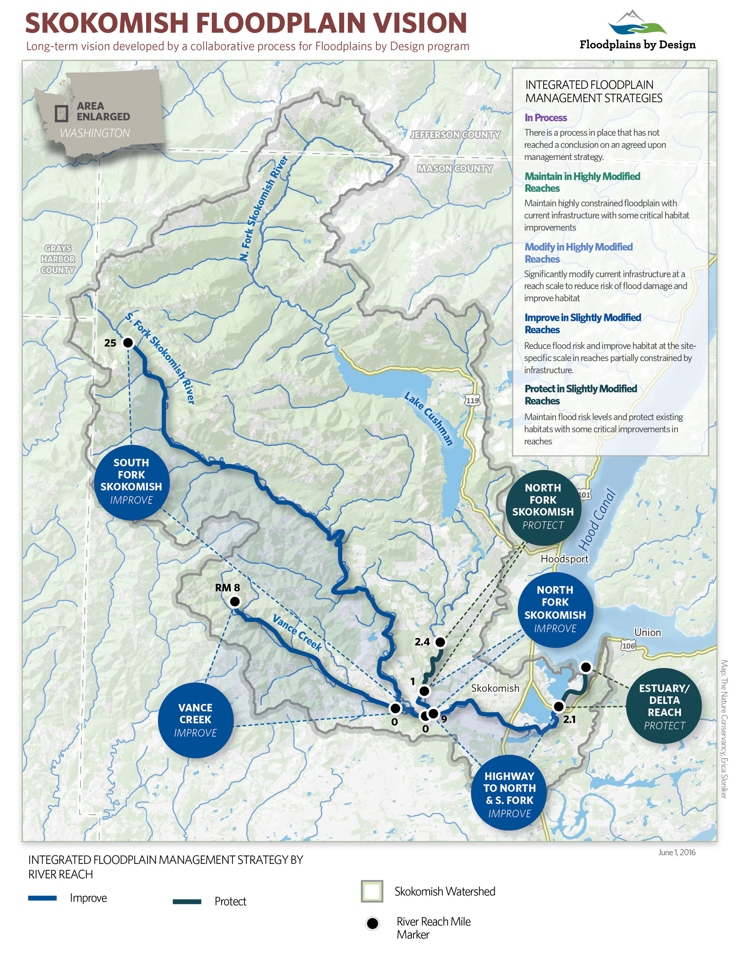
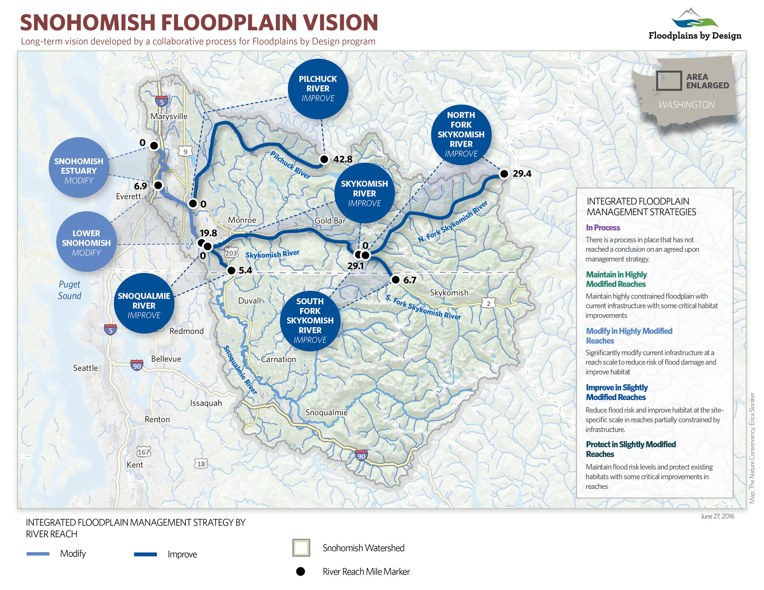
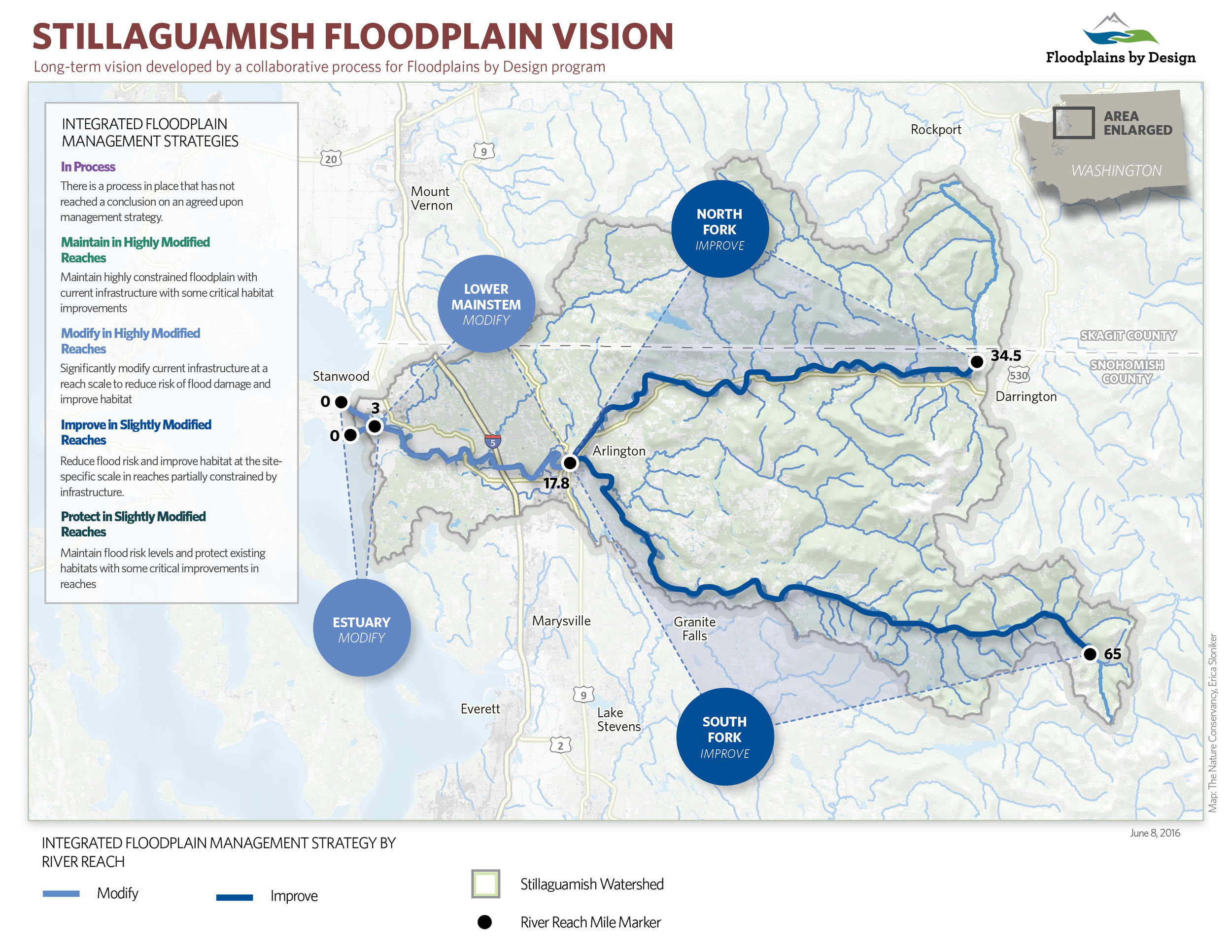
Rivers and their associated floodplains are amongst the more productive ecosystems on the planet in terms of the goods and services they provide people: fisheries, rich alluvial soils, places for floodwaters to spread out and slow down, and that thing upon which all life and all economies depend – fresh WATER. Unfortunately management responsibilities and activities are parsed out through myriad competing and siloed programs and the result is less than stellar. Flood damages are on a troubling upward trend even as we look forward to a future of more severe storms. Salmon runs have declined precipitously. Water pollution persists.
The Floodplains by Design effort is looking to reverse these troubling trends by institutionalizing an integrated approach to river management – one in which interest groups work collaboratively to better understand how these systems work and to unleash the power of collective action to manage them in ways that increase health and resilience of both communities and nature. The first step in this process is for communities to develop a new, integrated vision of what they want to achieve and the actions they need to take to achieve those goals – watershed by watershed. Leaders in the majority of Puget Sound’s largest watersheds have begun this process. The results are a snapshot of current aspirations for river management in the region and provide a sense of the scale of potential on-the-ground actions.
It is clear that local leaders and partners in many watersheds have significant aspirations for improving the conditions of their floodplains for people and nature. There is an interest to significantly improve reaches of major rivers in over 40 percent of the 800 miles of floodplain in Puget Sound as well as protect the areas that are currently functioning naturally. While more work is needed for communities to come to collective agreement on their priorities in other river corridors, there is a process in place to create a unifying, broadly-supported vision and action plan to transform their floodplains. Erica Simek Sloniker, Cartographer and Visual Communications Specialist for The Nature Conservancy, has produced a map series to accompany these watershed visions.
Investments that recognize the role farmers have in restoring our lands will provide an all encompassing approach to reaching our climate and habitat goals.
Seven years later, and over $200 million dollars spent in Floodplains by Design alone, we are seeing a new level of resilience, creativity and impact in our floodplains across the state.
Read about how Floodplains by Design pivoted to virtual workshops and the lessons they learned.
Did you know that rivers are constantly changing, carving new paths over the years? Come along and take a trip to the Nooksack River, where you'll learn that the only constant is change
Washington state lawmakers approved groundbreaking policy and budget priorities this session, positioning our state for a more resilient future.
We caught up with Cindy Dittbrenner, Natural Resource Program Manager for the Snohomish Conservation District, to discuss why data and webmaps are so important for farmers in Snohomish County.
Imagine you’re a third-generation farmer in the Puget Sound. You’re witnessing more rain and wetter fields. How can you make decisions about the future? A new tool will help.
Explore maps that show how fluid rivers in Washington state have been over time.
The loss of another orca is a stark reminder of how sick our Puget Sound really is and the importance of river health, salmon recovery, climate change and the impacts of a fast-growing Puget Sound.
Climate change is bringing greater precipitation to Washington, with more frequent and severe storms. Healthy floodplains are a key natural solution: They absorb heavy flows, reduce flooding and temper storm surges.
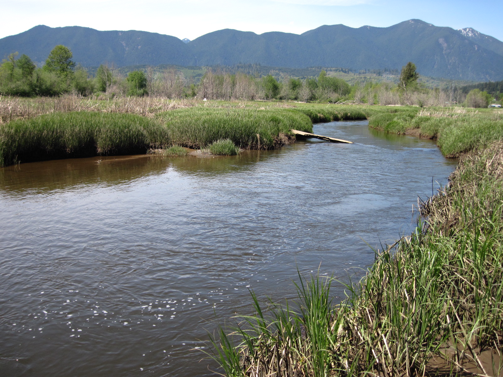
Meandering channels provide important places for young salmon to feed and grow on their way to Puget Sound. (photo credit: Hood Canal Coordinating Council)
The project will provide benefits that are important to the local community. (photo credit: Linda Herzog)
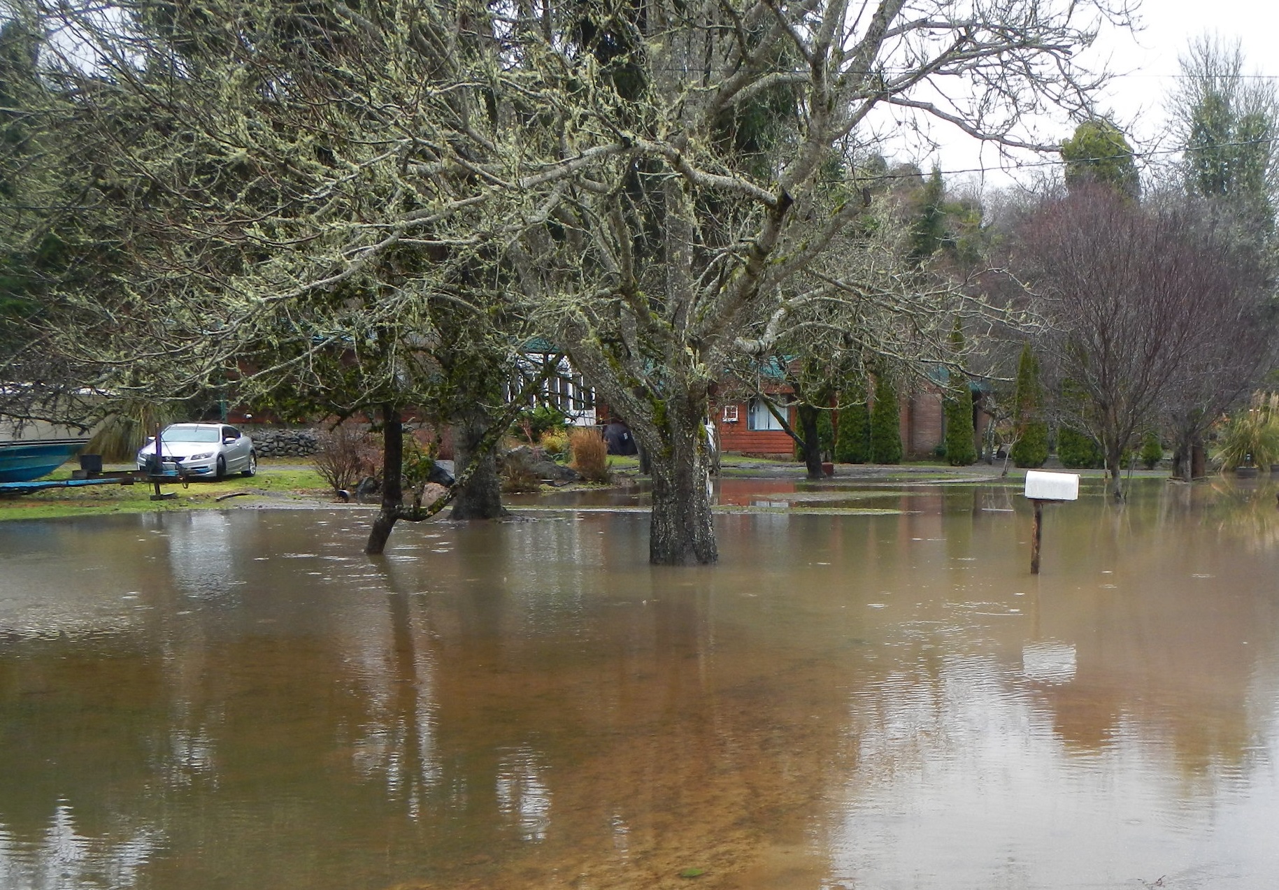
Floods damage roads and homes. (photo credit: Pat McCullough)
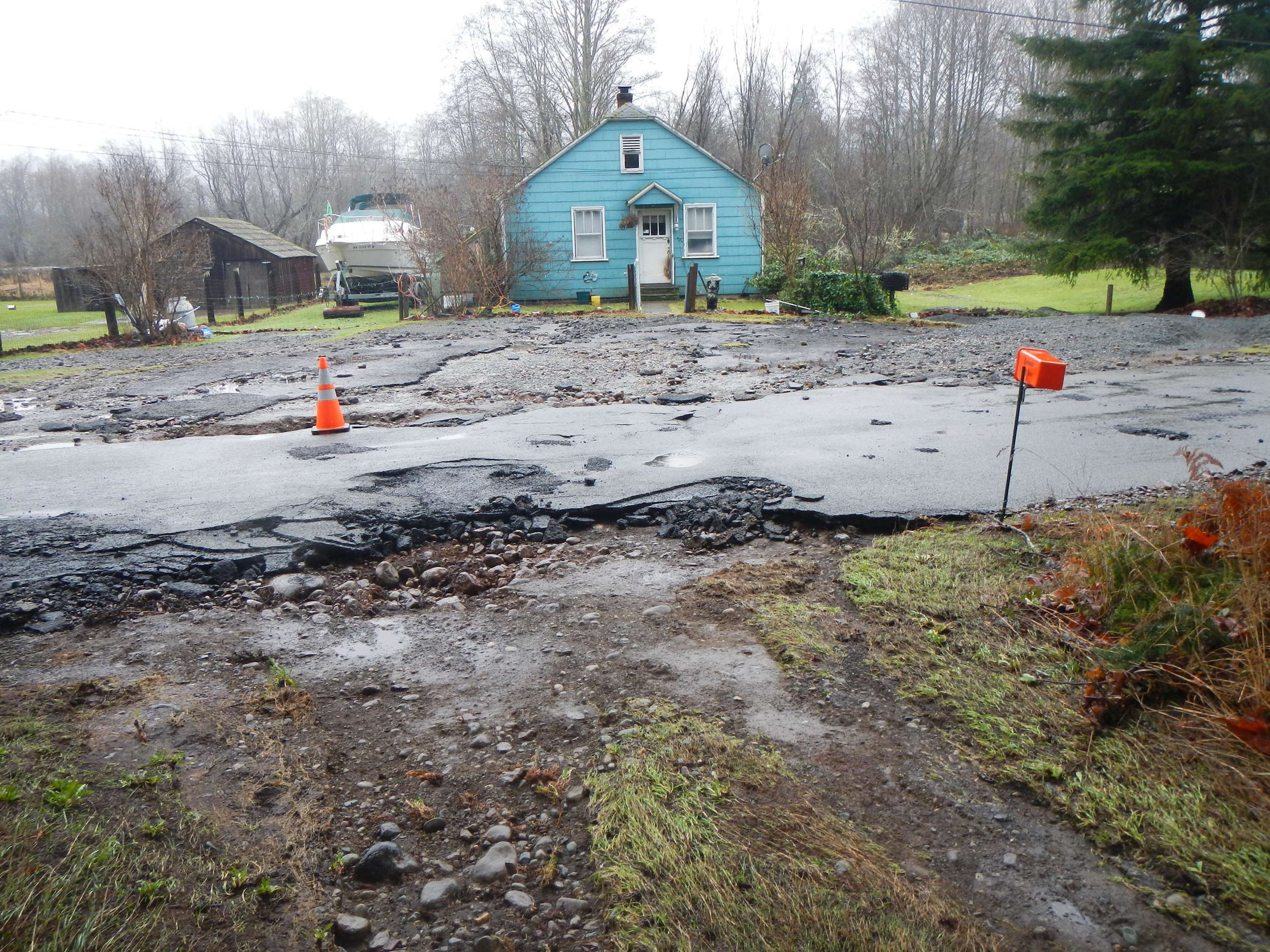
Floods damage roads and homes. (photo credit: Pat McCullough)
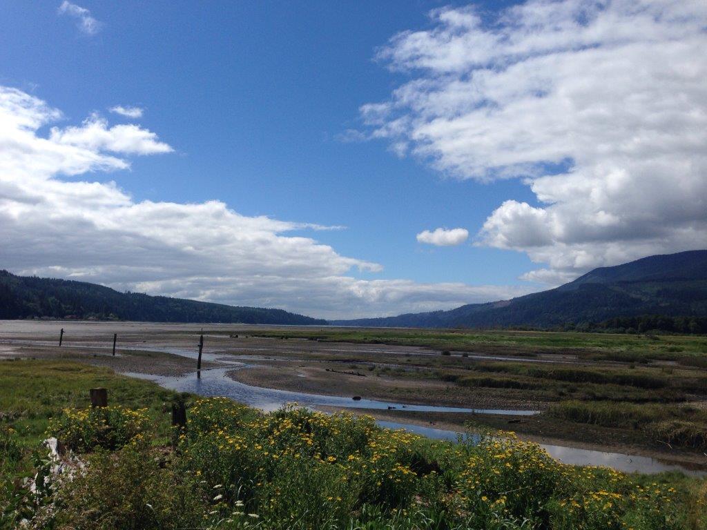
The Big Quilcene estuary is important for salmon, shellfish and people. (photo credit: TNC)
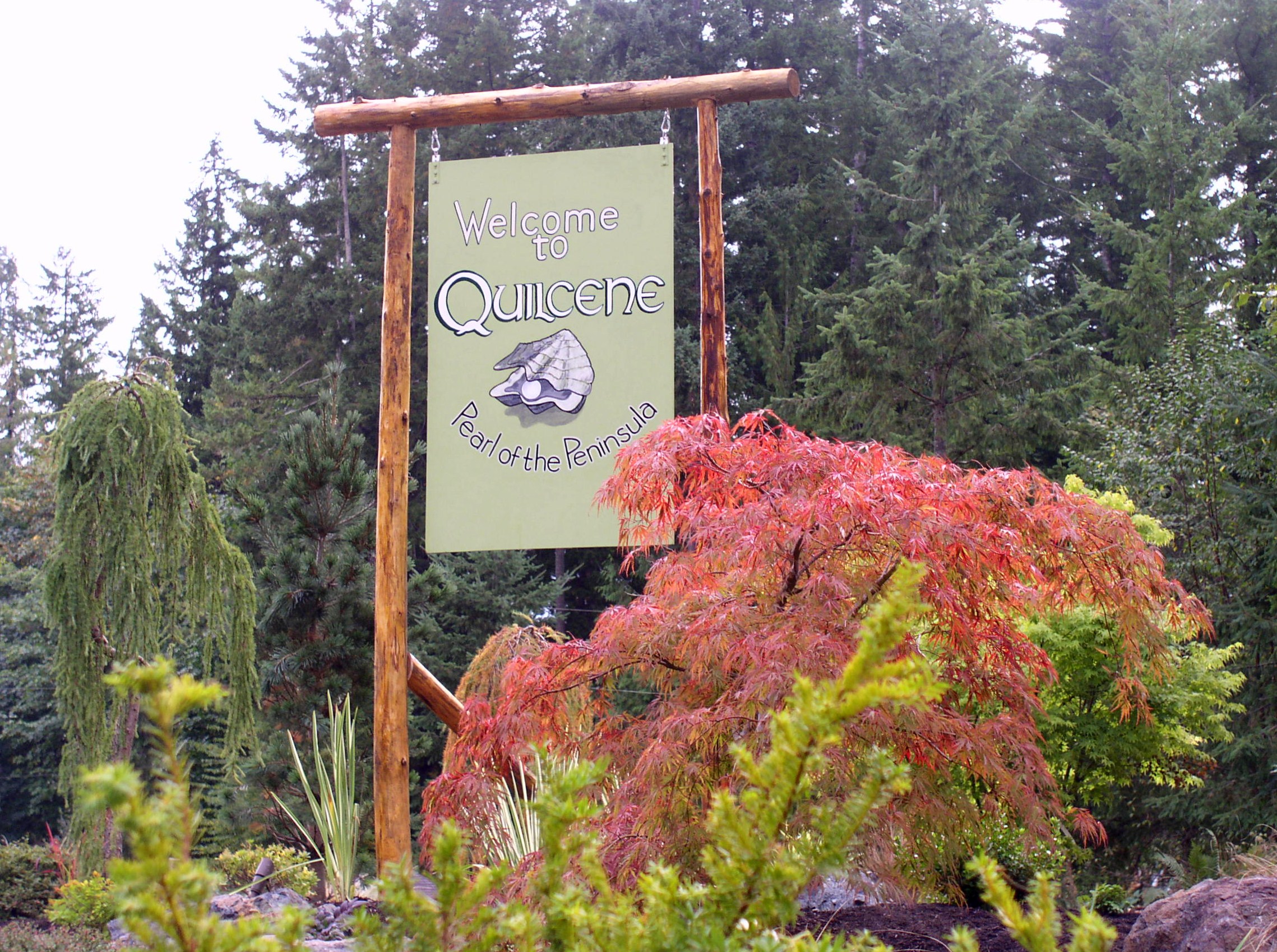
Written by Beth Geiger
The residents of Quilcene, Washington are used to living close to nature. Logging and shellfish production have long been the core of this small Olympic peninsula town’s economy.
But for some of those residents who live along the Big Quilcene River, flooding may seem a little too natural. At least once every year or two the river rises, swamping about 30 homes. “The flooding is getting more frequent,” says Tami Pokorny with Jefferson County Public Health. “The houses are moldy. People are tired of rescuing muddy kid’s toys from the yard.”
The Big Quilcene also floods sweetly-named Linger Longer Road, which crosses the river. Linger Longer Road is the only access to 70 homes as well as the town’s largest employer, Coast Seafoods Shellfish Hatchery. The hatchery is the world’s largest supplier of juvenile oysters. It operates 24 hours per day so when access is cut off, it’s high impact.
What’s more, the levees extend into the marshy tide flats in the Big Quilcene’s estuary. Removing them may alleviate flooding, but less predictability about where the river channel might go afterwards concerns shellfish producers, whose beds have been successfully cultivated and harvested with the dikes where they are. Meanwhile, habitat for chum salmon in the estuary is also of critical concern. Dikes cut off channels and water flow that link the bay and river and provide important habitat for juvenile salmon.
Community, business, nature: Is there one solution here for all?
An essential element of the lower Big Quilcene project is engaging community and other stakeholders. The Conservancy, in support of the project lead, Hood Canal Salmon Enhancement Group, and partner Jefferson County, is working closely with key stakeholders in the community to plan the project. Community input has been important in developing the project’s six goals (flood risk reduction, habitat restoration, compatibility with shellfish, educational opportunities, recreational access and economic vitality) and in developing three alternative project concepts. “The thing that stands out about this project is that it’s presenting ideas to the communities and saying “what do you want to do?” says Jared Keefer, Director of Environmental Health and Water Quality for Jefferson County.
The lower Big Quilcene project gives the Conservancy the opportunity to bring skills and knowledge to the table in a strategic, rather than a managing role. The Conservancy provides key support and knowledge to local project sponsors to advance community-supported, multi-benefit projects around Puget Sound. “This is a newer direction for the Conservancy,” says Jenny Baker, restoration manager for the Conservancy. “By playing more of a strategic role, we can have a bigger impact over a larger area.”
Written and Photographed by Chris Liedle, Northwest Photographer
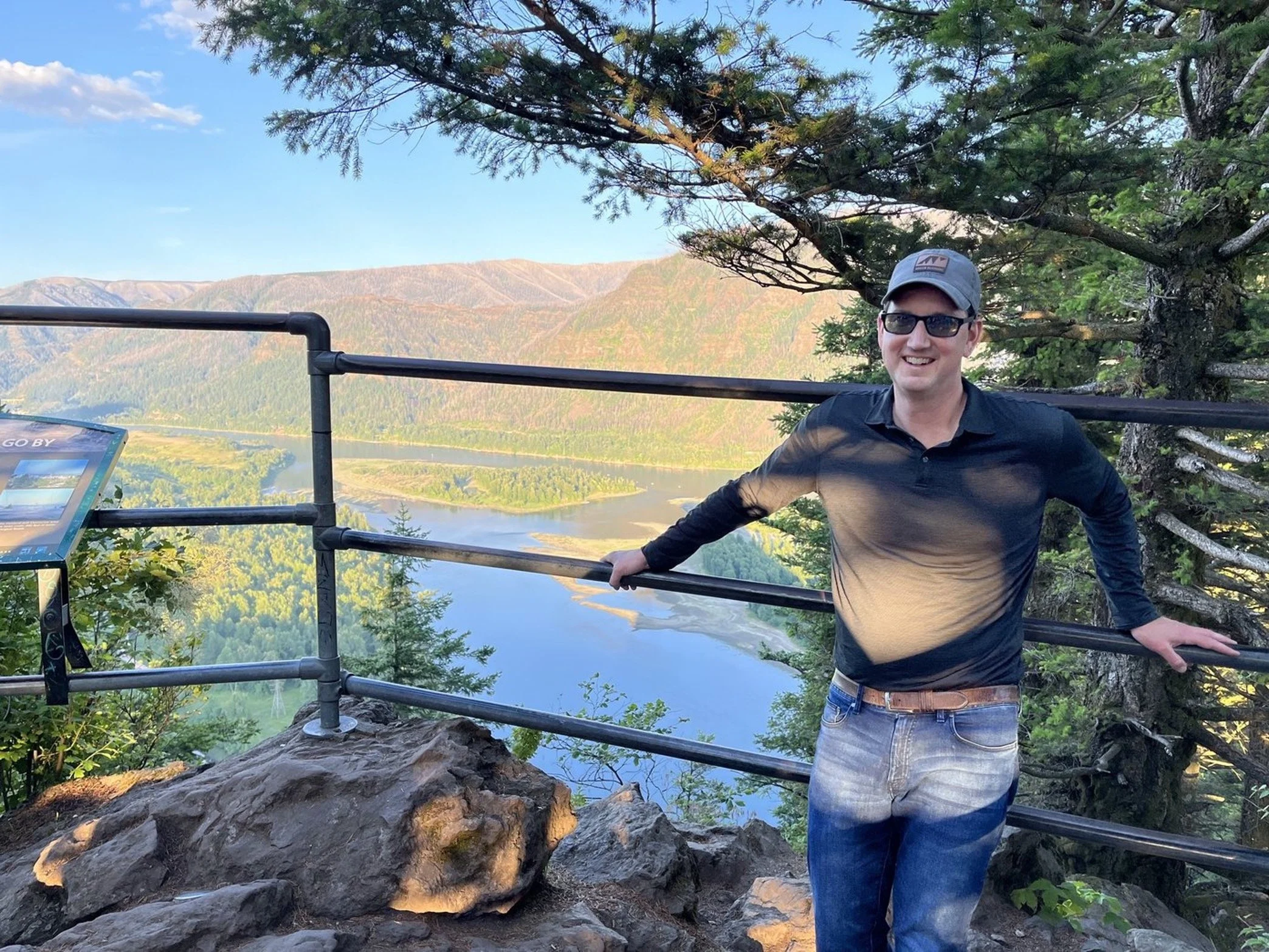
What's the familiar saying? Sometimes the best adventures are the ones you didn't plan for. That's what you could say happened here. My friend Matt and I packed our hiking gear and grabbed our cameras, and then took off for the Columbia River Gorge. Where should we go, what should we see? Oneonta Gorge, yes. Gorton Creek Falls, maybe. What about Spirit Falls? We checked our GPS. It added nearly an hour of driving time. We quickly began passing freeway exit after freeway exit, then missed our turn off to Oneonta. I guess, Spirit Falls it is!
We left Oregon and crossed into Washington, winding our way up to the trailhead. And by trailhead, I mean, goat trail. It's a steep, half-mile scramble on loose rock to the falls, but the trail is used just enough. Swollen from recent rains, Spirit Falls thundered through the canyon. We were there for only a few minutes, when I saw a kayaker in all red, scouting the drop. When I saw him reach for a camera, I knew someone was coming. No time to change lenses. The kayaker plunged, disappeared, then dodged a fallen tree. We cheered him on as he paddled below.
I shot a series of photos, hoping at least one picture turned out. I was stunned. The image was beautiful. The true colors of the Little White Salmon River came to life in the sunlight. Thick fir trees towered above. The paddling kayaker, frozen in time. Luck, probably, but I'm always amazed at what nature has in store. There's an enchanting view at every turn, whether it's a strenuous hike downhill to a waterfall or up the side of a mountain. The wilderness is a humbling place, a place where you can leave worry behind and enjoy what's in front of you. The wilderness, to me, is grounding. It's inspiring. It's home.
I learned the kayaker is Aniol Serrasolses, a professional whitewater kayaker from Spain. Welcome to the Pacific Northwest!
Originally from San Diego, Chris moved to the Pacific Northwest several years ago and is a television reporter in Portland. You'll find him in the chilly water surfing off the Oregon Coast or on the trail backpacking in the Cascades. Follow him on Instagram @ChrisLiedle or visit his website.
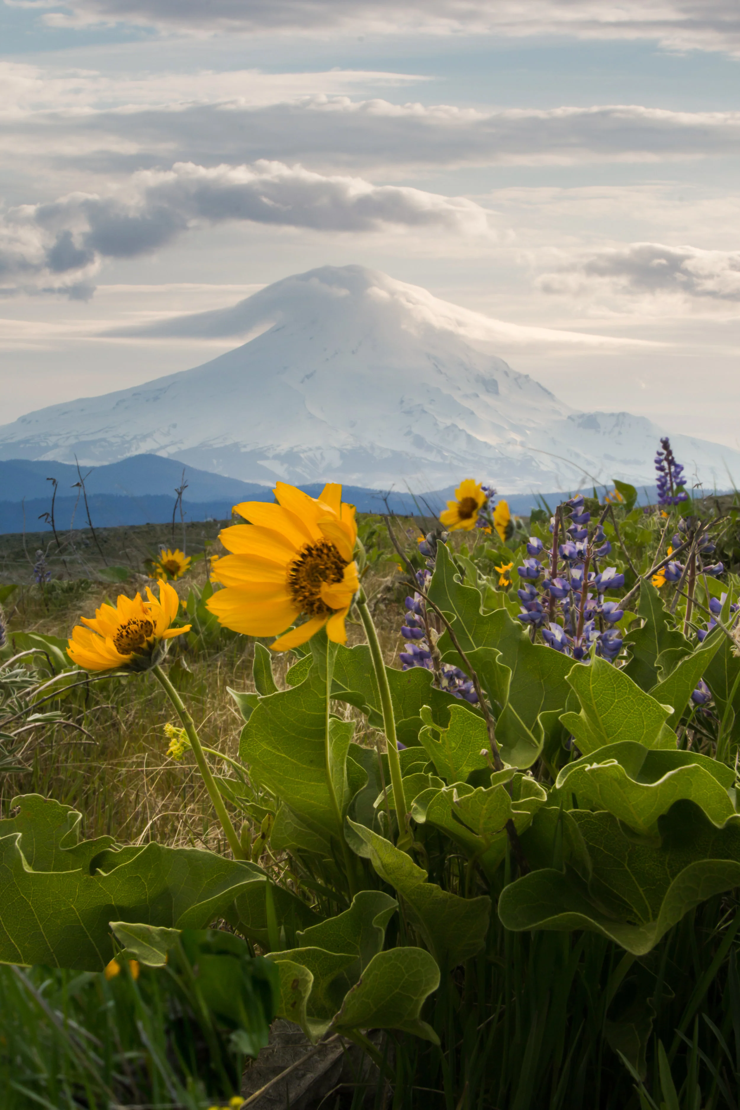
Not every outdoors adventure leads to your destination or the perfect photo. Often, lots of persistence and patience is required.
Landscape photography is a pursuit that gets Jake Gosline out into nature and helps to keep him grounded.
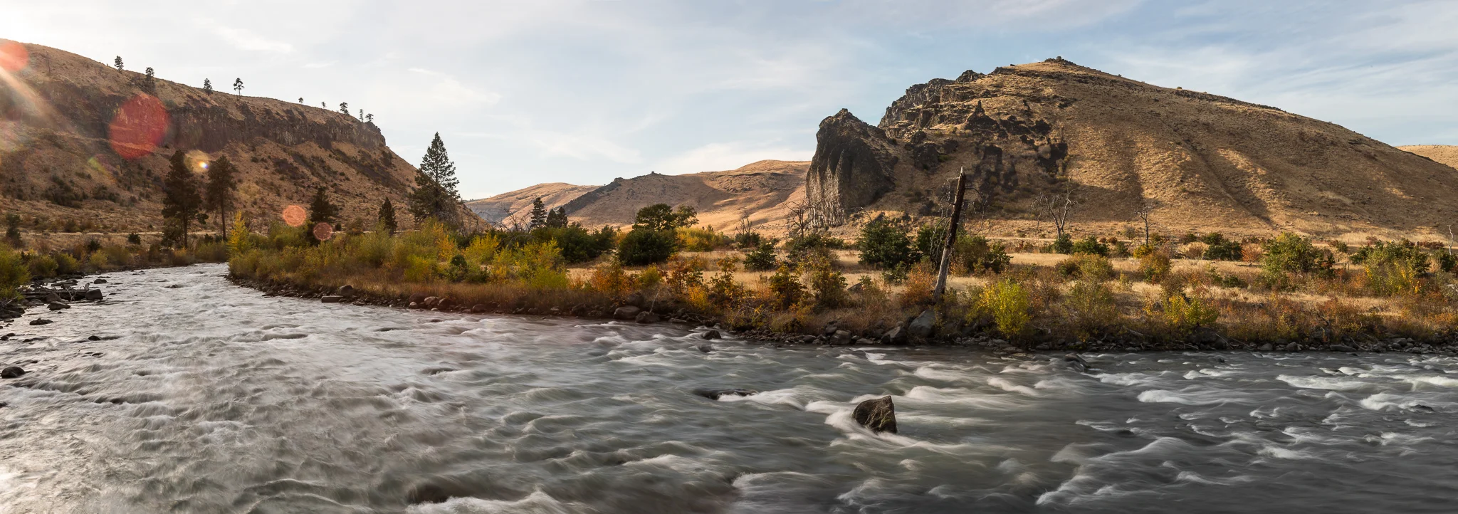
This month’s featured photo captures the pivot from summer to fall in the Tieton Canyon.
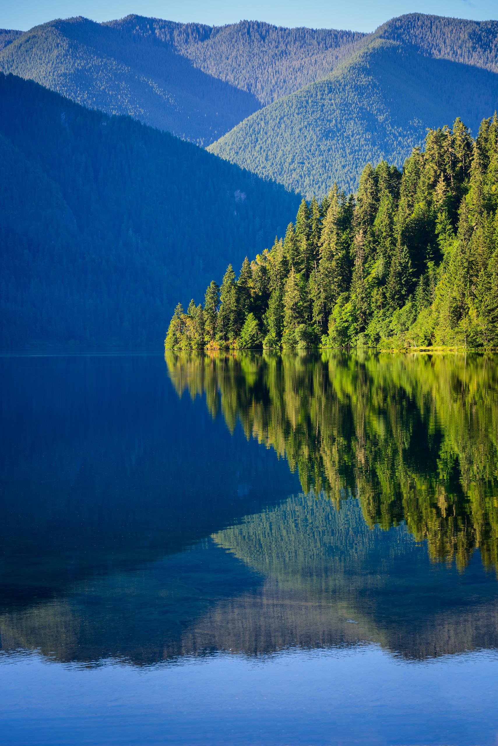
At Park Lake, the waves were no longer moving water — they were but stands of a hair on a bow, moving across the reeds, like the strings of a violin.
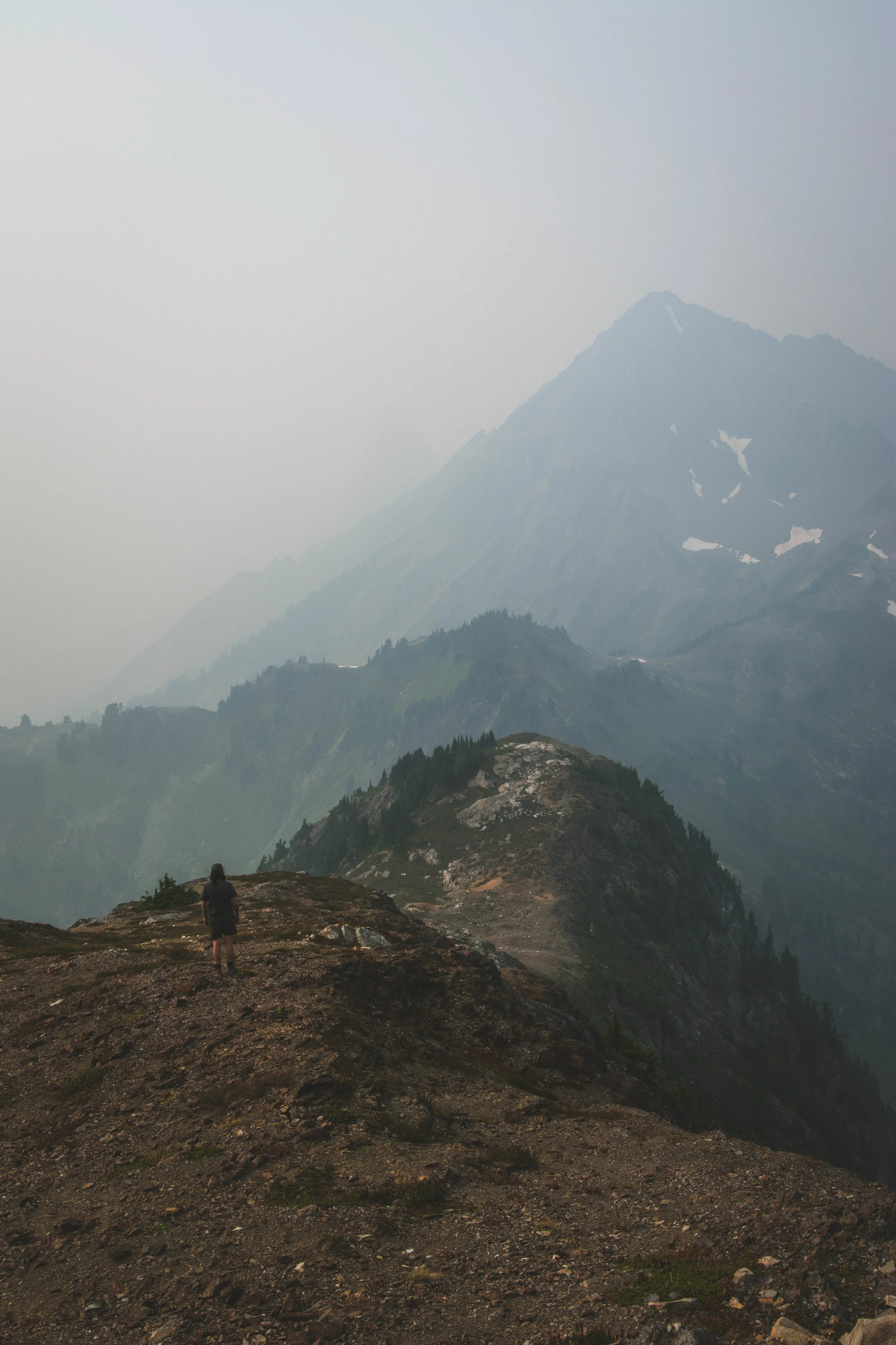
Photographer Cory Zanker revisits a favorite hiking destination, only to find the view obscured by smoke from Western wildfires. He made the most of the situation and found the silver lining.
For Jerad Armijo, photography is soothing, surreal and a fantastic way for him to cope with depression while creating beauty for others to enjoy.
For this photographer of the month, photography is a way to more fully experience life. He doesn’t think of it as hiding behind a lens, removed from life.
We have all been there. It’s easy to feel overwhelmed and not recognize the crucial need for fresh air. A minimal escape can reset your mentality in a crucial way.
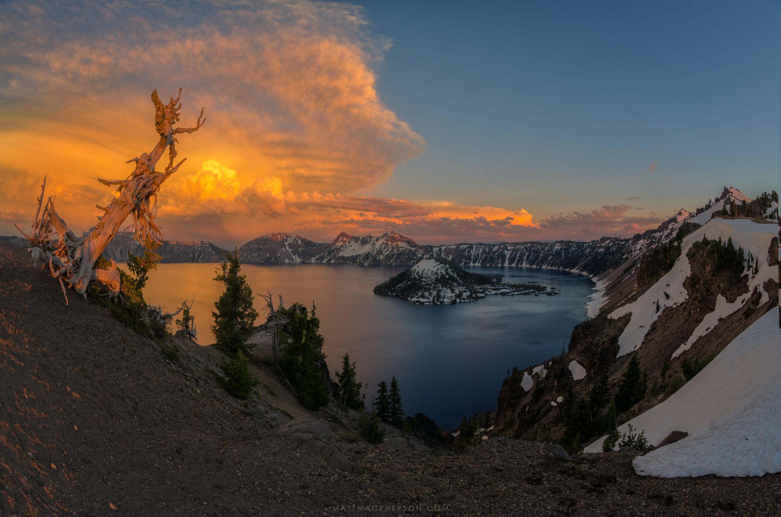
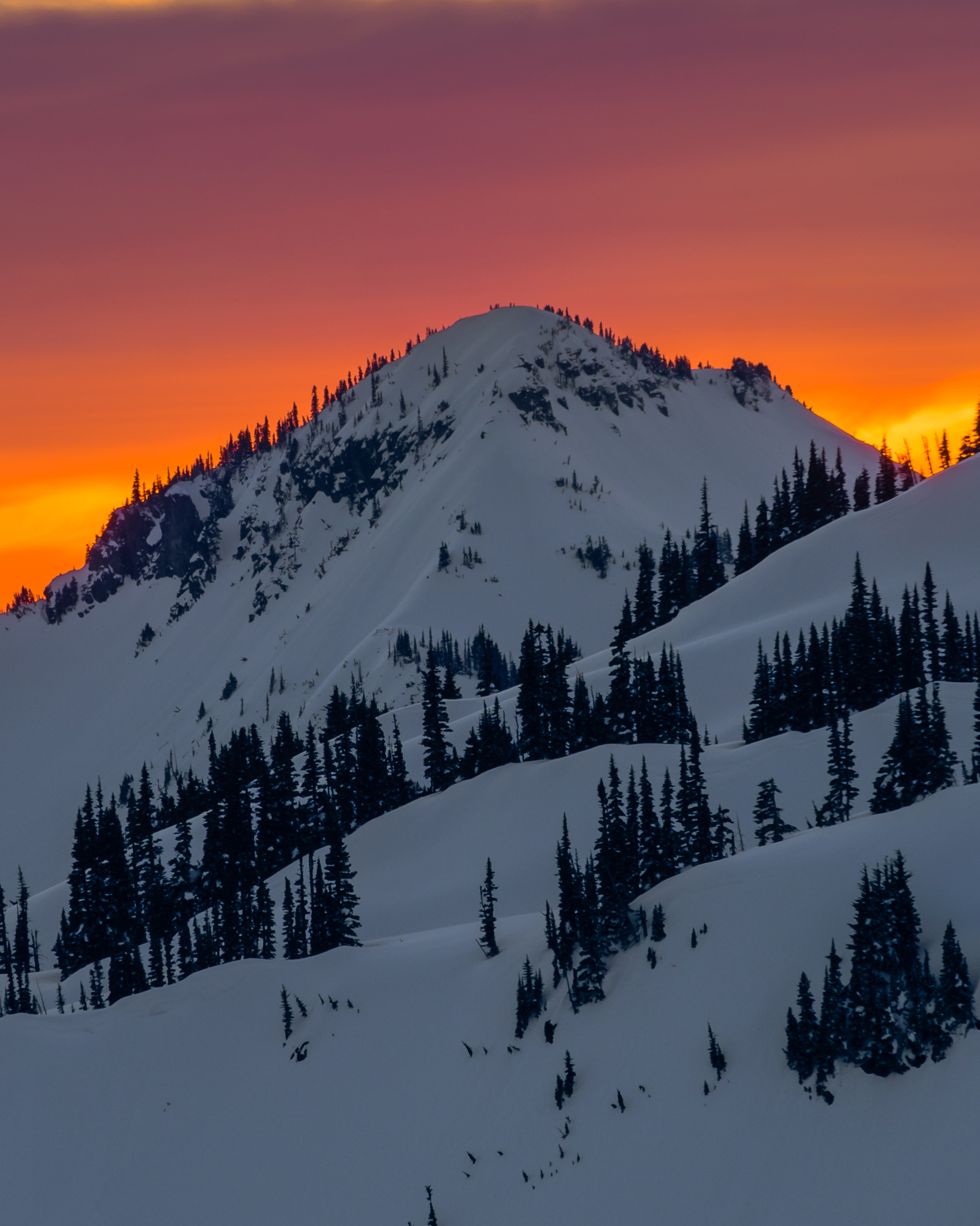
Not only does Matt MacPherson find the light of sunsets and sunrises beautiful and exciting, but he likes spending the time in between doing grueling day hikes without having to get his camera gear out.
During backcountry trips, Alex Spaeth is inspired by landscapes both big and small that make him pause and think how fortunate he is to be there to appreciate fleeting, yet lasting, moments.


Photograph by Bridget Besaw
WASHINGTON COAST – The Nature Conservancy has sold 1,720 acres of forestlands above the Queets River to the state Department of Natural Resources for management within the Olympic Experimental State Forest as wildlife habitat and working forest.
“This sale assures our conservation goals for this property, and supports the Conservancy’s long-term goals of a sustainable Olympic rainforest that supports wildlife and the local economy,” said David Rolph, Washington’s Director of Forest Conservation and Management for the Conservancy.
The property was part of 2,321 acres the Conservancy purchased from Rayonier in 2014. Conservancy analysis showed that the 600 acres closest to the river is most important for salmon and the health of the river system. The remaining 1,720 acres, while important upland habitat, could be managed in ways that includes sustainable forestry and some logging.
By selling to the Department of Natural Resources, the Conservancy is ensuring good long term management of the land, Rolph said. DNR owns most of the surrounding land, and their management in the Experimental Forest is governed by a 70-year federal conservation plan. It ensures strong protection of wetlands and the development of older stands of trees in the forest rotation. It also allows for continued public access and recreation, and revenue to the state school trust
“Analysis from our scientists confirms that DNR’s management under their federal conservation plan can be a good match in supporting the Conservancy’s habitat restoration goals along the Queets River system,” Rolph said.
“We’re grateful for the partnership with The Nature Conservancy in purchasing this land,” said Commissioner of Public Lands Peter Goldmark, who chairs the Board of Natural Resources, which authorized the purchase. “It will benefit future trust beneficiaries and DNR’s conservation commitments on the Olympic Peninsula.”
The sales agreement was announced in April, when the Board of Natural Resources authorized the $5.2 million purchase. The sale closed June 12. The Conservancy will use the money generated by the sale, for further forest conservation work.
The Queets is one of four major rivers flowing from the summit of the mountains in Olympic National Park to the Olympic National Marine Sanctuary in the Pacific Ocean. The Conservancy has also purchased and is restoring forest lands on the Clearwater, a tributary to the Queets, and on the Hoh River farther north. The Conservancy is also working with the Quinault Indian Nation for restoration of forests on the Quinault River.
Together with the acquisitions on the Clearwater and Hoh rivers, the Conservancy is now managing 9,410 acres of forest lands in Jefferson County. Conservancy foresters and ecologists have developed long-term plans that include planting trees, restoring important salmon and wildlife habitat, and sustainable long-rotation timber harvest where it makes sense.


Written by Robin Stanton, Media Relations Manager
Photographed by (1-5) Robin Stanton; and (6-7) King County
Opportunities don’t come along very often to reconnect a river to dozens of acres of floodplain and dramatically restore fish and wildlife habitat, while maintaining flood protection for nearby homes and roads.
King County’s Upper Carlson Floodplain Restoration project along the Snoqualmie River near Fall City is just such an opportunity – and a broad coalition of local, state, tribal and federal governments and organizations came together this week to celebrate completion of this complex, multi-year effort.
The work was done on King County’s Fall City Natural Area – a 50-acre forested floodplain that historically contained the Snoqualmie River’s main stem. The project included removing roughly 1,600 linear feet of aging levee that constrained the river to an unnaturally narrow channel.
With the old levee gone, wintertime flooding brought fresh flows across much of the newly reconnected floodplain, and widened the river channel by approximately 40 feet. As these natural processes are restored, gravel bars and log jams will form, providing additional salmon habitat.
To maintain protection for nearby homes, roads and fertile farmland, project managers designed and installed log structures and a new 850-foot-long rock structure at the lower end of the site to provide additional protection where the river is most likely to migrate.
King County acquired the Fall City Natural Area with funding from the Conservation Futures Levy and Salmon Recovery Funding Board, for preserving and restoring critical salmon habitat.
The site restoration work included invasive vegetation removal, and planting acres of native trees, to improve habitat for the birds, mammals, reptiles and other wildlife.
The $3.5 million project was funded by grants from:
For more information, visit the project website, or contact Mary Maier at 206-477-4762 or mary.maier@kingcounty.gov.

Written by Cathy Baker, Federal Director of Government Relations
Photograph by John Marshall
On the eve of Earth day, the White House recognized Puget Sound as a model for climate change adaptation, making it one of four places in the U.S. where increased cooperation will aid in preparation for the impacts of climate change –including sea level rise, drought, flooding and wildfires.
The Puget Sound region was showcased in the Resilient Lands and Waters Initiative for outstanding efforts in local, state, federal and tribal partnerships around Puget Sound recovery. The release highlights recent successes and builds momentum for efforts to restore floodplains, preserve farmland and reduce flood risk through the innovative Floodplains by Design program and Snohomish County’s Sustainable Land Strategy.
Read the Seattle Times story for more coverage.
“We are living with the evidence of a changing climate,” said Mike Stevens, Washington State director for The Nature Conservancy. “Longer and more intense winter flooding, low river flows in the summer, and rising seas are affecting both cities and farmlands in the Puget Sound region. “
In Snohomish County, local leaders have developed the Snohomish Sustainable Lands Strategy which brings together Tulalip and Stillaguamish Tribes, government agencies, and local agriculture, and other interests to tackle these issues together.
“Thanks to Sustainable Lands Strategy partners, leadership by Snohomish County Surface Water Management, and the support of the Floodplains by Design program, the county has an assessment of risk and a plan to make the river valleys more resilient in the face of those risks, to the benefit of both people and nature,” Stevens said.
“We are trying to prepare for the future under changing climate conditions,” said Terry Williams of the Tulalip Tribes, a key partner in collaborative efforts underway in Snohomish County. “In the Snohomish River Delta we are getting 500-year-floods more frequently, early spring flooding, early drought. Eighty percent of the delta was diked 100 years ago, and we lost a lot of fish habitat. Mix that with land use that includes forestry, agriculture and urban development—all of that affects the landscape.”
“We’re figuring out how to address these landscapes, these changing conditions, and capitalize on them so we become stronger, rather than weaker,” he said.
“This designation speaks volumes about what we’ve accomplished,” said Tristan Klesick, of Klesick Family Farms. “It’s not easy work, but it’s valuable and important. We have to be stewards of the environment and the economy – we have to have a place for salmon and salamanders, corn, broccoli and milk, homes, schools and hospitals.“
“We look forward to engaging in this opportunity to build upon our efforts to bring government and our communities together to address the natural resource challenges we face,” said Snohomish County Council Chair Dave Somers.
The Nature Conservancy has contributed both science and leadership to this work.


More than 3,000 acres will increase the protected area along the Hoh River
Written by Megan Sheehan, Senior Editorial Manager, Digital
Photography by Bridget Besaw
They say fish have short memories, but the salmon in Washington State will remember the newly protected 3,000+ acres in Washington State for a long time. 3,184 acres along the Hoh River – extending from Olympic National Park to the Olympic Coast National Marine Sanctuary – are now protected for people and nature.
This new protected area creates a 32-mile corridor of critical and protected habitat for a variety of species, especially the trees and salmon, which in Washington grow faster than anywhere else in the world. This work builds on what the Hoh River Trust has been doing to ensure these lands, waters and creatures can thrive and grow for future generations.
All the Conservancy’s land on the Washington Coast continues to be open to public and tribal use for hunting, fishing, traditional gathering of plants and medicines, boating, birding, hiking, and other coastal outdoor activities.
Saves like this bring us hope for the future, and show that when we all work together, we can accomplish things greater than ourselves. Read more details about the Hoh River acquisition.

Welcome to Flood Season
Written by Julie Morse, Regional Ecologist, The Nature Conservancy in Washington
Photogrpah by Andy Porter, Northwest Photographer
It’s flood season here in Western Washington. That’s nothing new of course. Puget Sound rivers have reached flood stage over 1400 times in the last 20 years. It’s just part of life here.
Albeit, a very stressful part of life. Especially for floodplain managers whose jobs it is to minimize the damage caused by swelling rivers that naturally want and need to jump their banks – wreaking havoc on people’s homes and businesses, undermining transportation corridors, and putting lives and our economy at risk.
Ken Wolfe has one of those unenviable floodplain manager jobs. He is responsible for safety of the City of Orting which sits on the Puyallup River -one of the most flood prone rivers in the State. So it’s strange to see him walking around with a big smile on his face this time of year.
Last week a “pineapple express” or what the weathermen call an “atmospheric river” moved through our region bringing heavy rains. These storms are common here and can result in flooding, especially in the fall when there’s little snowpack in the mountains to absorb all that rain or when it warms rapidly after snowfall so rain and snow melt create a double whammy. The Puyallup River was raging and peaked at over 16,000 cubic feet per second.
The last time the river got that high was in January 2009, when it broke through the levee and caused 26,000 people to be evacuated in the Puyallup River Valley, in and around the City of Orting It resulted in one of largest urban evacuations in the State’s history. Despite the fact that it was the 4th highest flow ever recorded on the Puyallup, this year only a handful of residents voluntarily evacuated.
And instead of overseeing the chaos of filling 17,000 sandbags as he did in 2009, Ken Wolfe is smiling.
Just last month major phases of the Calistoga Reach Floodplains by Design Project was completed.
In Orting, the City moved 1.5 miles of the levee back to expand the width of the river corridor by up to 4 times - giving the river more room to spread out and slow down. Clearly, it worked, and has helped dramatically reduce the flood risk for this community.
Meanwhile, just downstream, this summer Pierce County completed an effort to reconnect about 150 acres of floodplain and carve a new side channel to the river. During last week’s high flow, this new channel took about 30% of the flow out of the mainstem Puyallup, dramatically reducing pressure on riverbank levees that protect a large subdivision.
The project in Orting is one of the first Floodplains by Design projects to be completed, and the first to stand the test of a big flood. What’s more, in addition to the dramatically reduced flood risks in this area, these projects are also providing other important community benefits. The side channels and reconnected floodplains provide critical salmon spawning and refuge habitat. And when the waters recede, city and county residents are left with about 2 miles of scenic riverfront open space.
The City of Orting and Pierce County deserve kudos for working together on a large stretch of river to implement projects that combined, reduce flood risk, restore critical habitat for salmon and improve the quality of life for residents of the area. This is exactly what Floodplains by Design program is all about – working together to implement big projects that produce big results.
Related Blog Posts

SAVING PUGET SOUND
Puget Sound is where Washington lives. It is the cultural, economic and natural heart of Washington. Most of its people live, work and play here – with more on the way. And more species of animals and plants live in and around the Sound than anywhere else in the state.
As more of us are experiencing every day, Puget Sound is slowly dying from toxic runoff, changes in the quality and quantity of fresh water, continued loss of natural shorelines and the effects of rising sea levels.
With your support, we can clean up Puget Sound once and for all, by:
Let’s make sure the people of Puget Sound enjoy plenty of clean water, healthy farms providing local food, wildlife in our forests and ample fish in our waters.