Written by: Bob Carey
Maps by: Erica Simek Sloniker
Rivers and their associated floodplains are amongst the more productive ecosystems on the planet in terms of the goods and services they provide people: fisheries, rich alluvial soils, places for floodwaters to spread out and slow down, and that thing upon which all life and all economies depend – fresh WATER. Unfortunately management responsibilities and activities are parsed out through myriad competing and siloed programs and the result is less than stellar. Flood damages are on a troubling upward trend even as we look forward to a future of more severe storms. Salmon runs have declined precipitously. Water pollution persists.
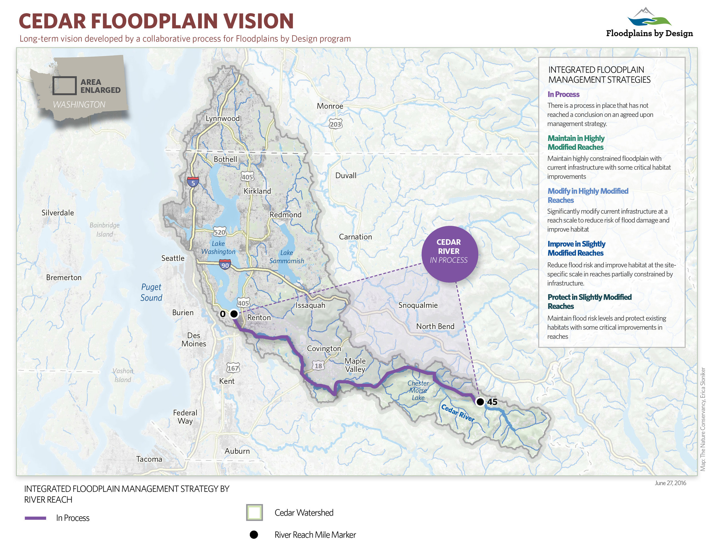
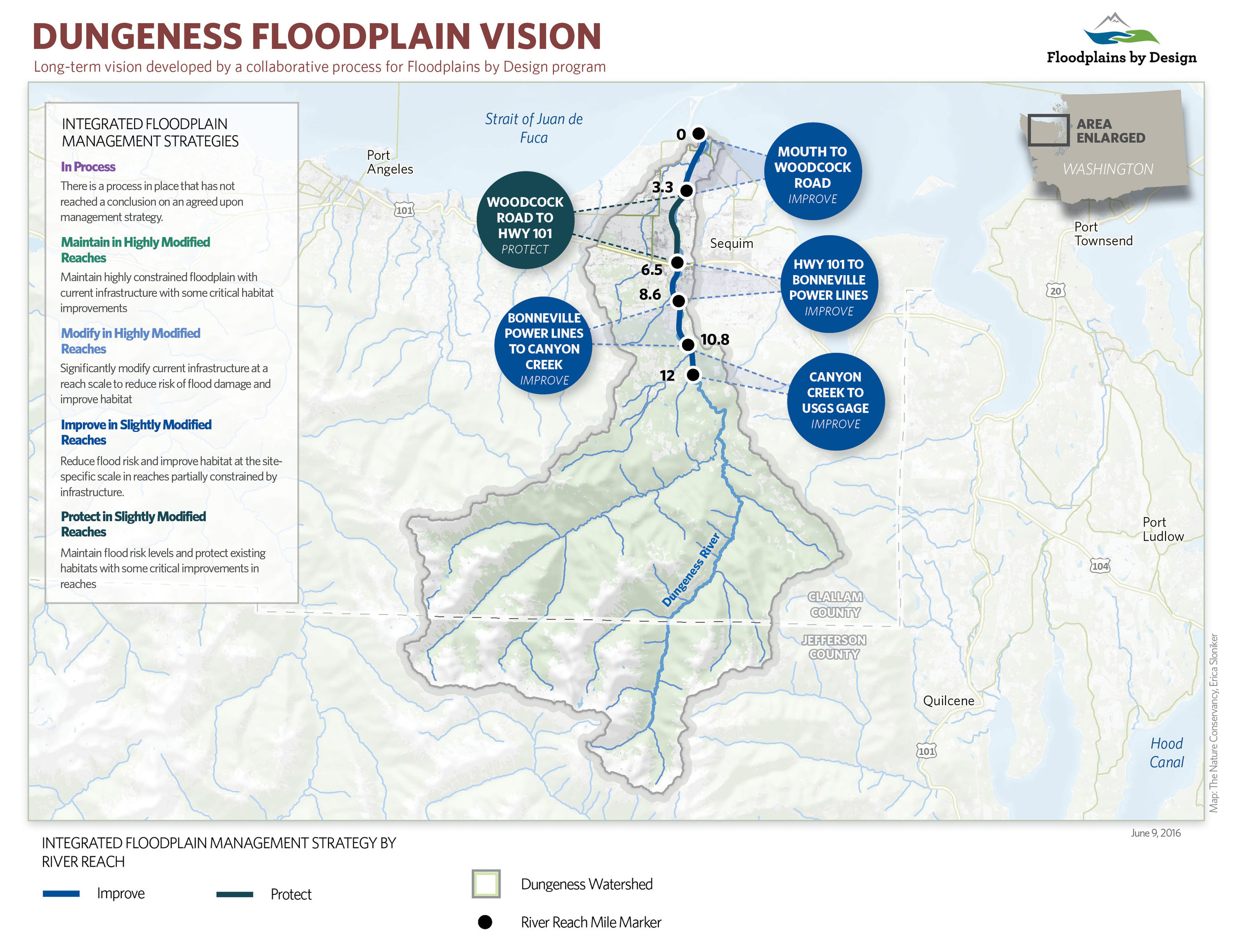
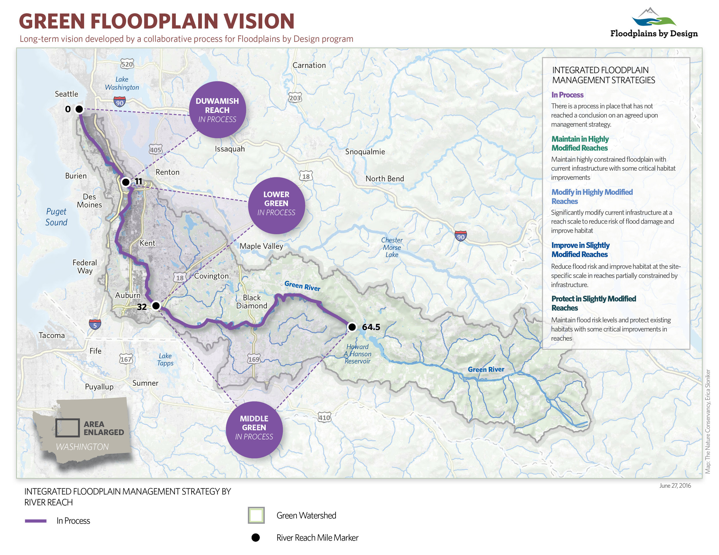
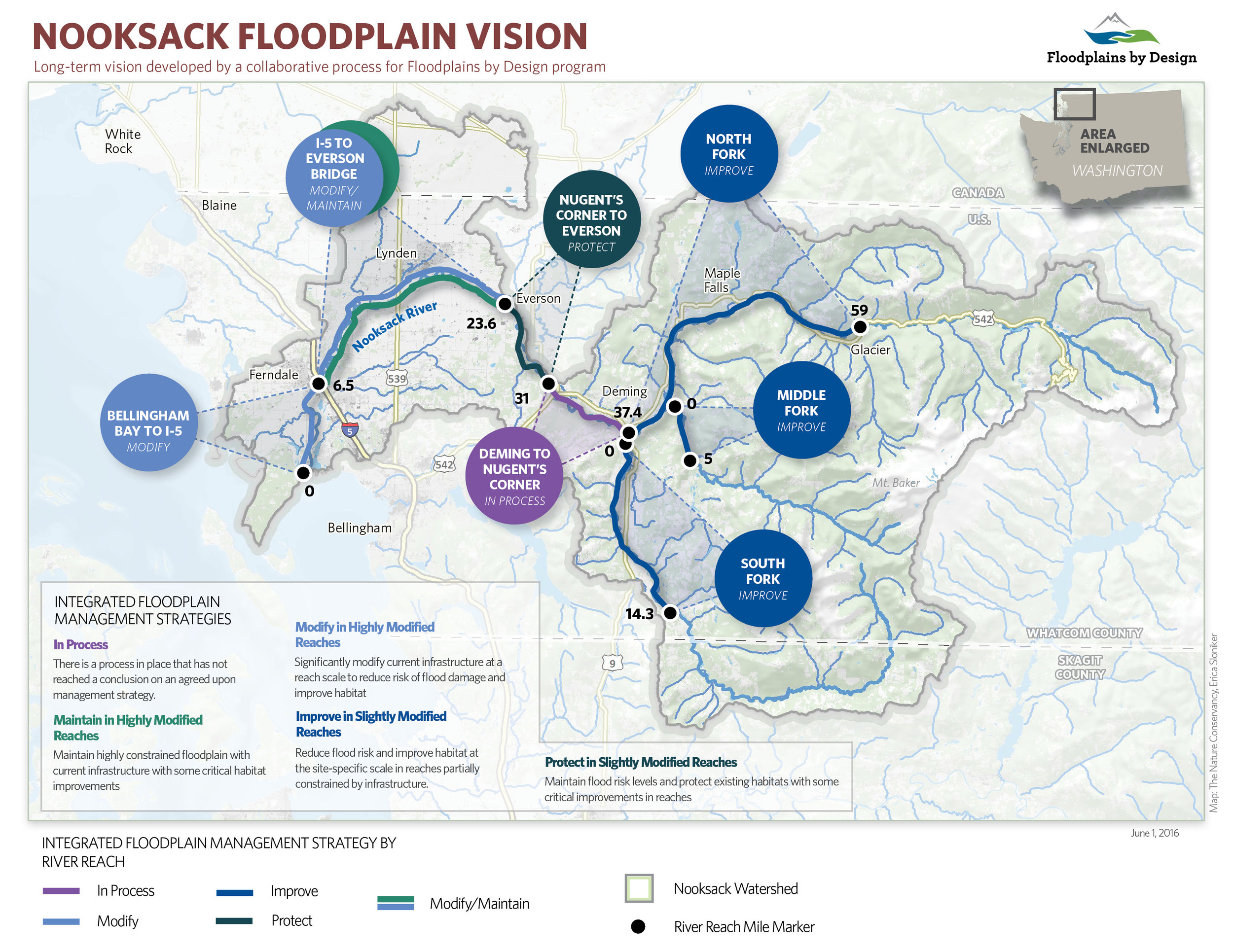
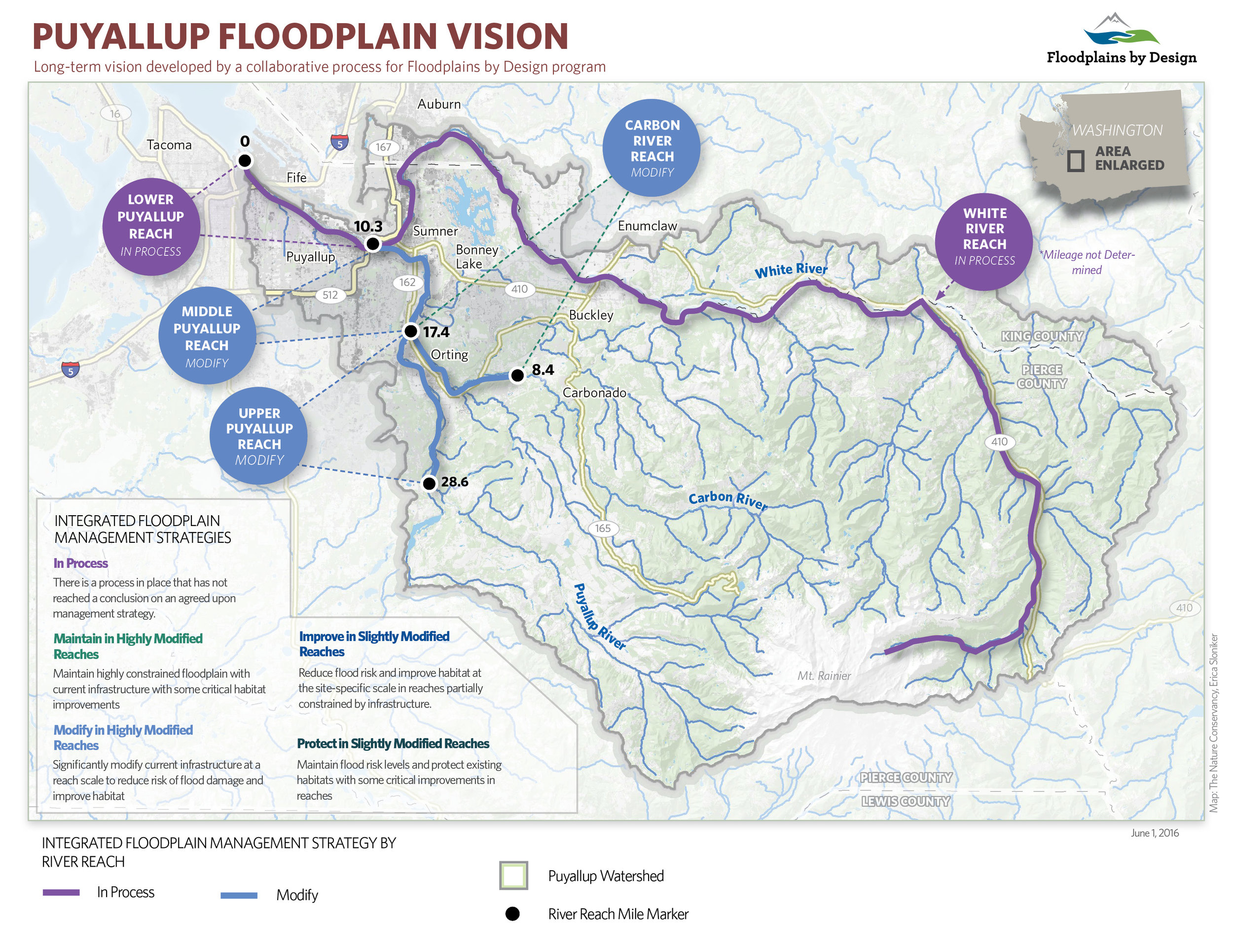
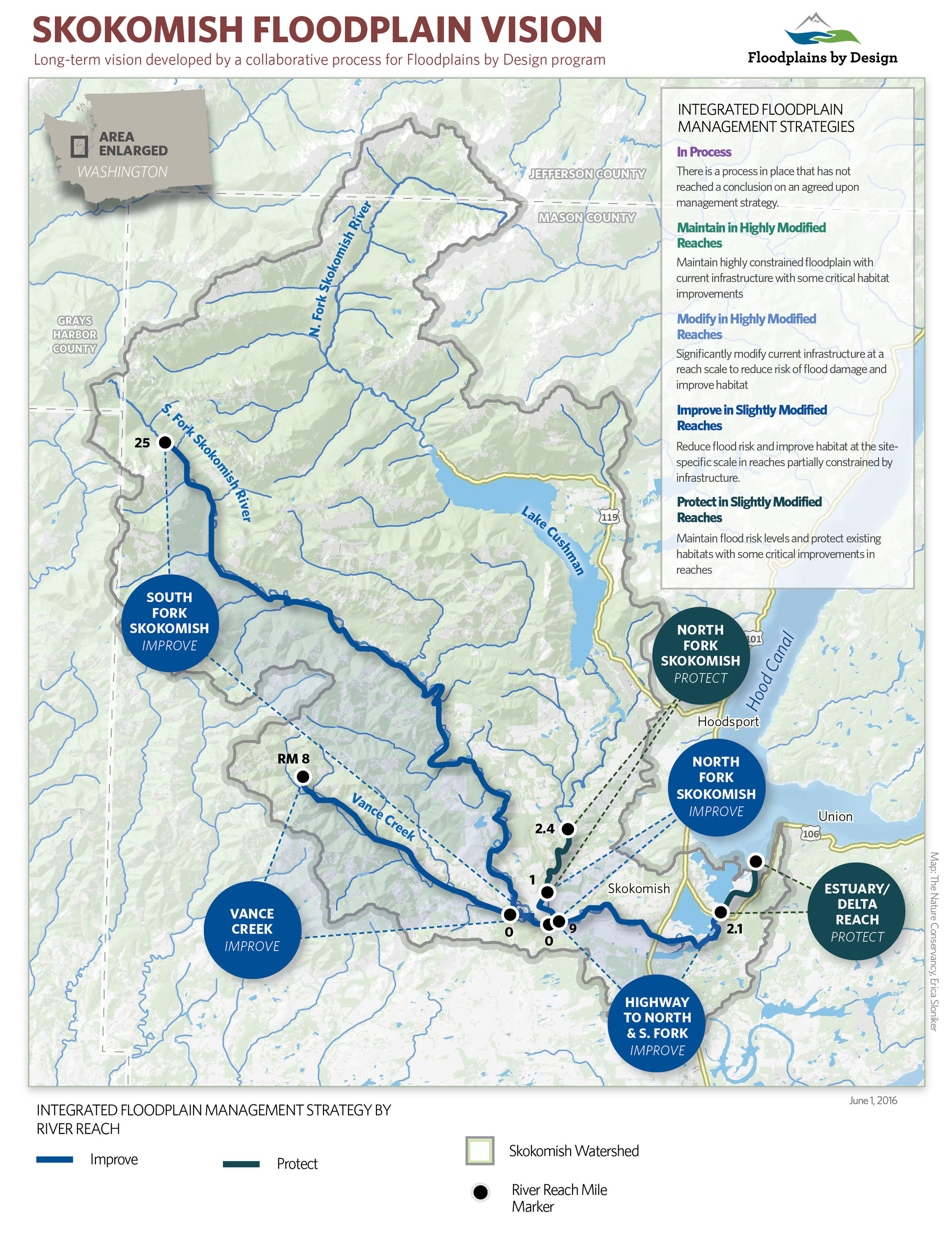
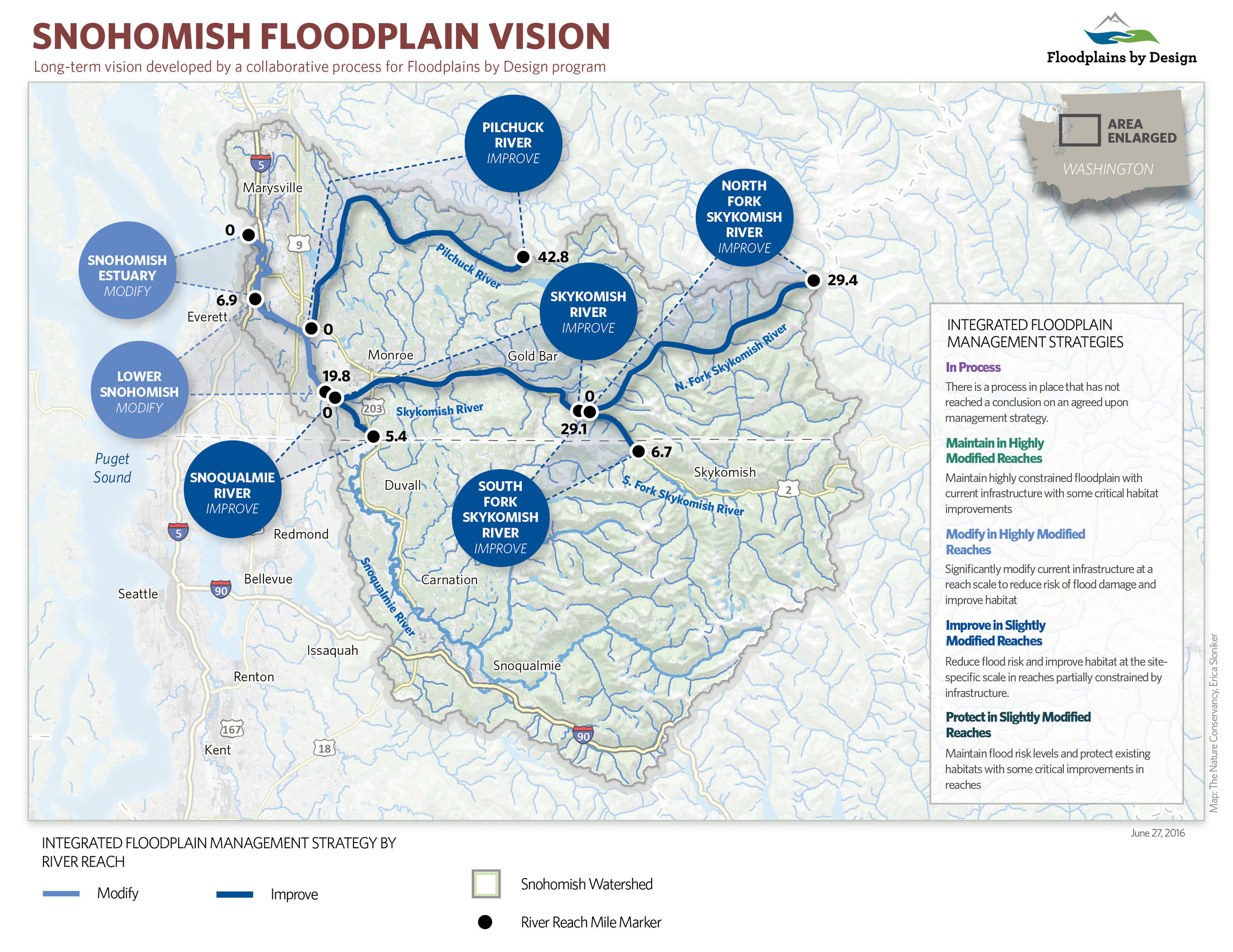
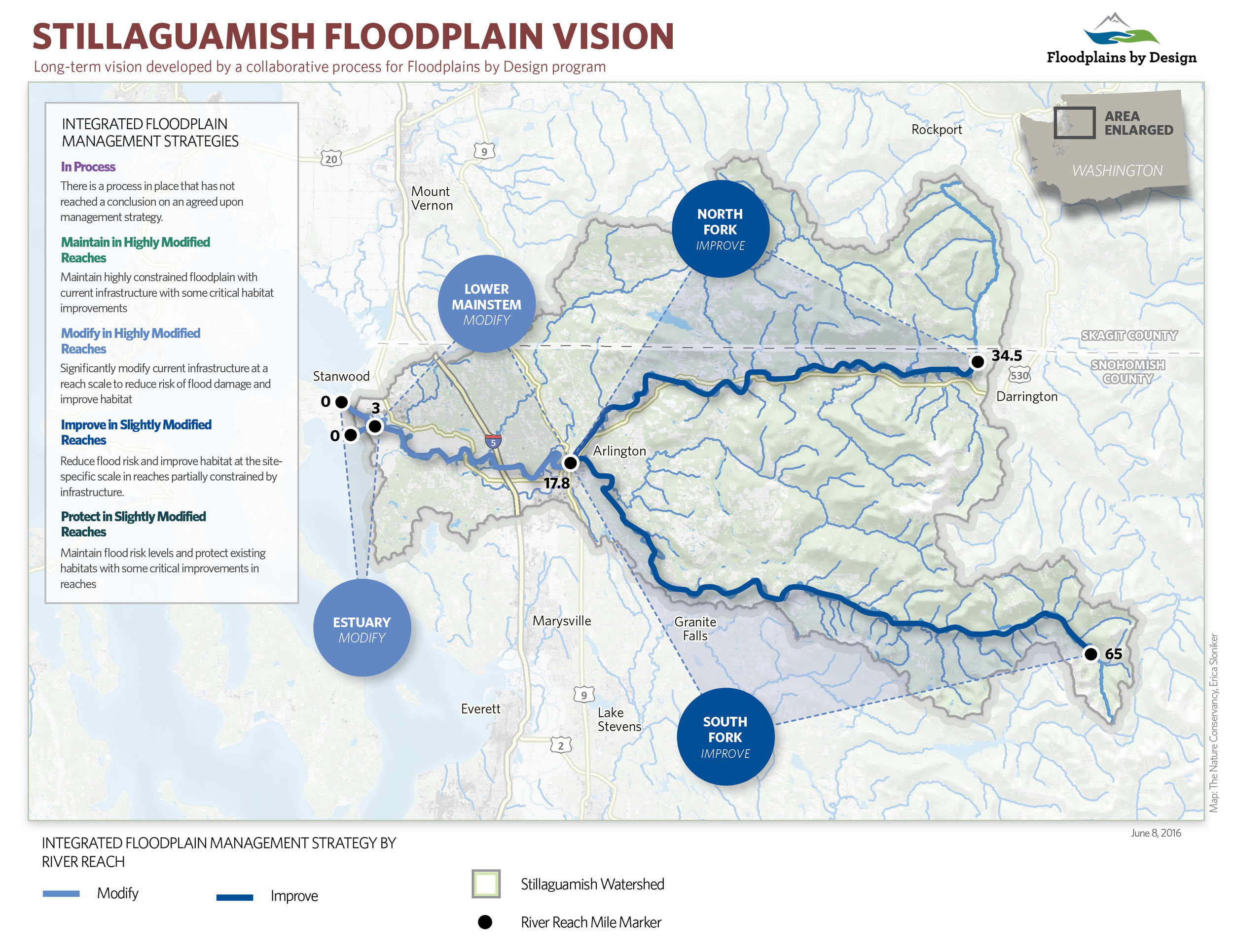
The Floodplains by Design effort is looking to reverse these troubling trends by institutionalizing an integrated approach to river management – one in which interest groups work collaboratively to better understand how these systems work and to unleash the power of collective action to manage them in ways that increase health and resilience of both communities and nature. The first step in this process is for communities to develop a new, integrated vision of what they want to achieve and the actions they need to take to achieve those goals – watershed by watershed. Leaders in the majority of Puget Sound’s largest watersheds have begun this process. The results are a snapshot of current aspirations for river management in the region and provide a sense of the scale of potential on-the-ground actions.
It is clear that local leaders and partners in many watersheds have significant aspirations for improving the conditions of their floodplains for people and nature. There is an interest to significantly improve reaches of major rivers in over 40 percent of the 800 miles of floodplain in Puget Sound as well as protect the areas that are currently functioning naturally. While more work is needed for communities to come to collective agreement on their priorities in other river corridors, there is a process in place to create a unifying, broadly-supported vision and action plan to transform their floodplains. Erica Simek Sloniker, Cartographer and Visual Communications Specialist for The Nature Conservancy, has produced a map series to accompany these watershed visions.